

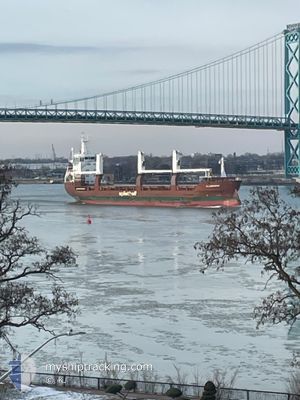
FLEVOGRACHT
General Cargo

Current Trip
| Time Travelled | 6 days |
|---|---|
| Remaining Time | --- |
| Distance Travelled | 1890.81 nm |
| Remaining Distance | --- |
| AVG Speed | 12.9 Knots |
| MAX Speed | 17.6 Knots |
| AVG Wind | 12.6 knots |
| MAX Wind | 22.4 knots |
| MIN Temp | 21°C / 69.8°F |
| MAX Temp | 31.5°C / 88.7°F |
| Draught | 5.6 m |
| Position Received | 2 d ago |
Current Position
| Longitude | -79.50511° |
|---|---|
| Latitude | 27.54701° |
| Status | Under way using engine |
| Speed | 15.2 Knots |
| Course | 28.4° |
| Area | North Atlantic Ocean |
| Station | T-AIS |
| Position Received | 2 d ago |
Information
The current position of FLEVOGRACHT is in North Atlantic Ocean with coordinates 27.54701° / -79.50511° as reported on 2025-05-30 12:46 by AIS to our vessel tracker app. The vessel's current speed is 15.2 Knots and is heading at the port of SEPT-ILES. The estimated time of arrival as calculated by MyShipTracking vessel tracking app is 2025-06-05 18:00 LT
The vessel FLEVOGRACHT (IMO: 9509956, MMSI: 246620000) is a General Cargo that was built in 2011 ( 14 years old ). It's sailing under the flag of [NL] Netherlands.
In this page you can find informations about the vessels current position, last detected port calls, and current voyage information. If the vessels is not in coverage by AIS you will find the latest position.
The current position of FLEVOGRACHT is detected by our AIS receivers and we are not responsible for the reliability of the data. The last position was recorded while the vessel was in Coverage by the Ais receivers of our vessel tracking app.
The current draught of FLEVOGRACHT as reported by AIS is 5.6 meters
Weather
| Temperature | 21.3°C / 70.34°F |
|---|---|
| Wind Speed | 5 knots |
| Direction | 40° NE |
| Pressure | 1016.3 hPa |
| Humidity | 65.4 % |
| Cloud Coverage | 42 % |


Featured Company
Last Port Calls
| Port | Arrival | Departure | Time In Port |
|---|---|---|---|
| 2025-05-24 07:52 | 2025-05-26 16:20 | 2 d | |
| 2025-05-04 17:32 | 2025-05-04 18:48 | 1 h | |
| 2025-05-04 14:17 | 2025-05-04 15:00 | 42 m | |
| 2025-05-03 08:06 | 2025-05-03 08:43 | 37 m | |
| 2025-05-01 05:36 | 2025-05-01 06:28 | 52 m | |
| 2025-04-26 10:29 | 2025-04-29 15:49 | 3 d | |
| 2025-04-25 10:07 | 2025-04-25 11:24 | 1 h | |
| 2025-04-23 02:51 | 2025-04-23 03:55 | 1 h | |
| 2025-04-20 22:14 | 2025-04-21 19:22 | 21 h | |
| 2025-04-04 04:28 |
Most Visited Ports (Last year)
| Port | Arrivals | |
|---|---|---|
| 6 | ||
| 6 | ||
| 4 | ||
| 2 | ||
| 2 | ||
| 2 |
Last Trips
| Origin | Departure | Destination | Arrival | Distance | |
|---|---|---|---|---|---|
| 2025-05-04 18:48 | 2025-05-24 07:52 | 3409.85 nm | |||
| 2025-05-04 15:00 | 2025-05-04 17:32 | 5.69 nm | |||
| 2025-05-03 08:43 | 2025-05-04 14:17 | 287.81 nm | |||
| 2025-05-01 06:28 | 2025-05-03 08:06 | 524.17 nm | |||
| 2025-04-29 15:49 | 2025-05-01 05:36 | 347.01 nm | |||
| 2025-04-25 11:24 | 2025-04-26 10:29 | 324.49 nm | |||
| 2025-04-23 03:55 | 2025-04-25 10:07 | 522.33 nm | |||
| 2025-04-21 19:22 | 2025-04-23 02:51 | 295.61 nm | |||
| 2025-04-04 04:28 | 2025-04-20 22:14 | 5035.75 nm |
Events
| Time | Event | Details | Position / Dest | Info |
|---|---|---|---|---|
| 2025-05-30 13:29 | Status Changed | Default Under way using engine |
27.68409 / -79.37040
CASEI
|
Speed: 15.2 kn Course: 28.4° |
| 2025-05-30 12:46 | OUT of Coverage |
27.54701 / -79.50511
North Atlantic Ocean
CASEI
|
Speed: 15.2 kn Course: 28.4° |
|
| 2025-05-30 12:33 | Change Sea Area | Bahamas part of the North Atlantic Ocean United States part of the North Atlantic Ocean |
27.49170 / -79.51773
North Atlantic Ocean
CASEI
|
Speed: 16.3 kn Course: 10.8° |
| 2025-05-30 12:17 | Detected in Sea | United States part of the North Atlantic Ocean |
27.41991 / -79.53324
North Atlantic Ocean
CASEI
|
Speed: 16.5 kn Course: 11.2° |
| 2025-05-30 11:33 | Detected in Sea | Bahamas part of the North Atlantic Ocean |
27.22070 / -79.57384
North Atlantic Ocean
CASEI
|
Speed: 16 kn Course: 9.7° |
| 2025-05-30 11:33 | Status Changed | Under way using engine Default |
27.22070 / -79.57384
CASEI
|
Speed: 16.1 kn Course: 10° |
| 2025-05-30 11:13 | Status Changed | Default Under way using engine |
27.13287 / -79.58989
CASEI
|
Speed: 16 kn Course: 8.7° |
| 2025-05-30 11:01 | Status Changed | Under way using engine Default |
27.07974 / -79.59897
CASEI
|
Speed: 16 kn Course: 9° |
| 2025-05-30 11:01 | IN Coverage |
27.07974 / -79.59897
North Atlantic Ocean
CASEI
|
Speed: 16.1 kn Course: 8.4° |
|
| 2025-05-30 09:09 | OUT of Coverage |
26.58875 / -79.68779
North Atlantic Ocean
CASEI
|
Speed: 17.7 kn Course: 7.3° |