

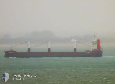
FLORIJNGRACHT
General Cargo
Current Trip
| Time Travelled | 14 days |
|---|---|
| Remaining Time | --- |
| Distance Travelled | 4556.50 nm |
| Remaining Distance | --- |
| AVG Speed | 13.5 Knots |
| MAX Speed | 15 Knots |
| AVG Wind | 12.3 knots |
| MAX Wind | 24.5 knots |
| MIN Temp | 14.6°C / 58.28°F |
| MAX Temp | 22.3°C / 72.14°F |
| Draught | 5.8 m |
| Position Received | 9 h, 32 m ago |
Current Position
| Longitude | -78.26817° |
|---|---|
| Latitude | 33.78350° |
| Status | At anchor |
| Speed | 0.2 Knots |
| Course | 130° |
| Area | North Atlantic Ocean |
| Station | T-AIS |
| Position Received | 9 h, 32 m ago |
Information
The current position of FLORIJNGRACHT is in North Atlantic Ocean with coordinates 33.78350° / -78.26817° as reported on 2025-04-25 18:19 by AIS to our vessel tracker app. The vessel's current speed is 0.2 Knots and is heading at the port of SUNNY POINT. The estimated time of arrival as calculated by MyShipTracking vessel tracking app is 2025-04-25 11:00 LT
The vessel FLORIJNGRACHT (IMO: 9428413, MMSI: 246592000) is a General Cargo that was built in 2010 ( 15 years old ). It's sailing under the flag of [NL] Netherlands.
In this page you can find informations about the vessels current position, last detected port calls, and current voyage information. If the vessels is not in coverage by AIS you will find the latest position.
The current position of FLORIJNGRACHT is detected by our AIS receivers and we are not responsible for the reliability of the data. The last position was recorded while the vessel was in Coverage by the Ais receivers of our vessel tracking app.
The current draught of FLORIJNGRACHT as reported by AIS is 5.8 meters
Weather
| Temperature | 21.8°C / 71.24°F |
|---|---|
| Wind Speed | 9 knots |
| Direction | 181° S |
| Pressure | 1019.8 hPa |
| Humidity | 85.7 % |
| Cloud Coverage | 60 % |
Featured Company
Last Port Calls
| Port | Arrival | Departure | Time In Port |
|---|---|---|---|
| 2025-04-10 06:01 | 2025-04-11 18:48 | 1 d | |
| 2025-04-01 11:49 | 2025-04-03 05:43 | 1 d | |
| 2025-03-30 09:49 | 2025-03-31 16:49 | 1 d | |
| 2025-03-27 15:27 | 2025-03-28 18:22 | 1 d | |
| 2025-03-21 12:06 | 2025-03-24 14:30 | 3 d | |
| 2025-02-24 16:24 | 2025-02-26 19:40 | 2 d | |
| 2025-02-04 13:47 | 2025-02-09 16:20 | 5 d |
Last Trips
| Origin | Departure | Destination | Arrival | Distance | |
|---|---|---|---|---|---|
| 2025-04-03 05:43 | 2025-04-10 06:01 | 2187.11 nm | |||
| 2025-03-31 16:49 | 2025-04-01 11:49 | 249.84 nm | |||
| 2025-03-28 18:22 | 2025-03-30 09:49 | 481.32 nm | |||
| 2025-03-24 14:30 | 2025-03-27 15:27 | 852.67 nm | |||
| 2025-02-26 19:40 | 2025-03-21 12:06 | 6723.65 nm | |||
| 2025-02-09 16:20 | 2025-02-24 16:24 | 2271.21 nm | |||
| 2024-12-06 11:31 | 2025-02-04 13:47 | 8497.56 nm |
Events
| Time | Event | Details | Position / Dest | Info |
|---|---|---|---|---|
| 2025-04-25 18:28 | Status Changed | Default At anchor |
33.78384 / -78.26727
SUNNY POINT,U.S.A.
|
Speed: 0.2 kn Course: 130° |
| 2025-04-25 18:19 | Status Changed | At anchor Default |
33.78350 / -78.26817
SUNNY POINT,U.S.A.
|
Speed: 0.7 kn Course: 98° |
| 2025-04-25 18:19 | STOP Moving | 15.21 nm, South West of SOUTHPORT |
33.78350 / -78.26817
SUNNY POINT,U.S.A.
|
Speed: 0.2 kn Course: 130° |
| 2025-04-25 18:19 | OUT of Coverage |
33.78350 / -78.26817
North Atlantic Ocean
SUNNY POINT,U.S.A.
|
Speed: 0.2 kn Course: 79.4° |
|
| 2025-04-25 18:11 | Status Changed | Default Under way using engine |
33.78249 / -78.26801
SUNNY POINT,U.S.A.
|
Speed: 0.5 kn Course: 123° |
| 2025-04-25 17:53 | Status Changed | Under way using engine Default |
33.77509 / -78.27187
SUNNY POINT,U.S.A.
|
Speed: 3 kn Course: 40° |
| 2025-04-25 17:17 | Status Changed | Default Under way using engine |
33.72837 / -78.29324
SUNNY POINT,U.S.A.
|
Speed: 8.9 kn Course: 17.4° |
| 2025-04-25 17:04 | Status Changed | Under way using engine Default |
33.69745 / -78.30581
SUNNY POINT,U.S.A.
|
Speed: 9.4 kn Course: 22° |
| 2025-04-25 16:36 | Status Changed | Default Under way using engine |
33.62933 / -78.33515
SUNNY POINT,U.S.A.
|
Speed: 8.7 kn Course: 18.2° |
| 2025-04-25 16:35 | Status Changed | Under way using engine Default |
33.62575 / -78.33649
SUNNY POINT,U.S.A.
|
Speed: 8.7 kn Course: 18° |