
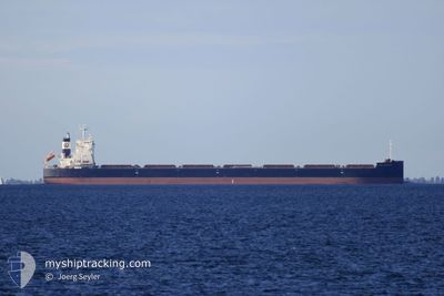
GCL LEADER
Cargo
Current Trip
| Time Travelled | 14 days |
|---|---|
| Remaining Time | --- |
| Distance Travelled | 3241.18 nm |
| Remaining Distance | --- |
| AVG Speed | 10.7 Knots |
| MAX Speed | 15.1 Knots |
| AVG Wind | 12.7 knots |
| MAX Wind | 28.8 knots |
| MIN Temp | 5.6°C / 42.08°F |
| MAX Temp | 18.6°C / 65.48°F |
| Draught | 7.7 m |
| Position Received | 6 d ago |
Current Position
| Longitude | -44.56118° |
|---|---|
| Latitude | 42.28161° |
| Status | Under way using engine |
| Speed | 9.5 Knots |
| Course | 240.6° |
| Area | North Atlantic Ocean |
| Station | T-AIS |
| Position Received | 6 d ago |
Information
The current position of GCL LEADER is in North Atlantic Ocean with coordinates 42.28161° / -44.56118° as reported on 2025-05-24 23:12 by AIS to our vessel tracker app. The vessel's current speed is 9.5 Knots
The vessel GCL LEADER (IMO: 9902550, MMSI: 636020450) is a Cargo It's sailing under the flag of [LR] Liberia.
In this page you can find informations about the vessels current position, last detected port calls, and current voyage information. If the vessels is not in coverage by AIS you will find the latest position.
The current position of GCL LEADER is detected by our AIS receivers and we are not responsible for the reliability of the data. The last position was recorded while the vessel was in Coverage by the Ais receivers of our vessel tracking app.
The current draught of GCL LEADER as reported by AIS is 7.7 meters
Weather
| Temperature | 9.6°C / 49.28°F |
|---|---|
| Wind Speed | 9 knots |
| Direction | 53° NE |
| Pressure | 998.4 hPa |
| Humidity | 91.6 % |
| Cloud Coverage | 100 % |
Featured Company
Last Port Calls
| Port | Arrival | Departure | Time In Port |
|---|---|---|---|
| 2025-05-13 12:49 | 2025-05-16 23:19 | 3 d | |
| 2025-03-15 07:54 | 2025-03-16 04:13 | 20 h |
Most Visited Ports (Last year)
| Port | Arrivals | |
|---|---|---|
| 3 | ||
| 2 | ||
| 2 | ||
| 1 | ||
| 1 | ||
| 1 |
Last Trips
| Origin | Departure | Destination | Arrival | Distance | |
|---|---|---|---|---|---|
| 2025-03-16 04:13 | 2025-05-13 12:49 | 9913.56 nm | |||
| 2025-02-10 05:41 | 2025-03-15 07:54 | 4350.88 nm |
Events
| Time | Event | Details | Position / Dest | Info |
|---|---|---|---|---|
| 2025-05-29 13:20 | STOP Moving | 1.85 nm, South East of PORT CARTIER |
50.00306 / -66.75567
CA PCA
|
Speed: Course: 290° |
| 2025-05-24 23:20 | Status Changed | Default Under way using engine |
42.27129 / -44.58530
CA PCA
|
Speed: 9.5 kn Course: 240.6° |
| 2025-05-24 23:12 | Status Changed | Under way using engine Default |
42.28161 / -44.56118
CA PCA
|
Speed: 9.6 kn Course: 241° |
| 2025-05-24 23:12 | OUT of Coverage |
42.28161 / -44.56118
North Atlantic Ocean
CA PCA
|
Speed: 9.5 kn Course: 240.6° |
|
| 2025-05-24 22:57 | Status Changed | Default Under way using engine |
42.30185 / -44.51487
CA PCA
|
Speed: 9.4 kn Course: 239.5° |
| 2025-05-24 22:55 | Status Changed | Under way using engine Default |
42.30545 / -44.50666
CA PCA
|
Speed: 9.5 kn Course: 240° |
| 2025-05-24 22:26 | Status Changed | Default Under way using engine |
42.34446 / -44.41917
CA PCA
|
Speed: 9 kn Course: 241.6° |
| 2025-05-24 22:03 | Status Changed | Under way using engine Default |
42.37443 / -44.34872
CA PCA
|
Speed: 8.8 kn Course: 241° |
| 2025-05-24 21:40 | Status Changed | Default Under way using engine |
42.40048 / -44.27919
CA PCA
|
Speed: 8.7 kn Course: 246.6° |
| 2025-05-24 21:32 | Status Changed | Under way using engine Default |
42.40778 / -44.25727
CA PCA
|
Speed: 8.7 kn Course: 244° |