
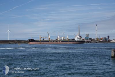
GDYNIA
Bulk Carrier
Current Trip
| Time Travelled | 23 days |
|---|---|
| Remaining Time | --- |
| Distance Travelled | 4613.76 nm |
| Remaining Distance | --- |
| AVG Speed | 9.4 Knots |
| MAX Speed | 15.1 Knots |
| AVG Wind | 14 knots |
| MAX Wind | 41 knots |
| MIN Temp | -1.4°C / 29.48°F |
| MAX Temp | 17.2°C / 62.96°F |
| Draught | 10 m |
| Position Received | 2 d ago |
Current Position
| Longitude | 35.85240° |
|---|---|
| Latitude | 36.49792° |
| Status | Under way using engine |
| Speed | 10.8 Knots |
| Course | 51.6° |
| Area | Mediterranean Sea - Eastern Basin |
| Station | T-AIS |
| Position Received | 2 d ago |
Info
Information
The current position of GDYNIA is in Mediterranean Sea - Eastern Basin with coordinates 36.49792° / 35.85240° as reported on 2026-01-02 21:44 by AIS to our vessel tracker app. The vessel's current speed is 10.8 Knots
The vessel GDYNIA (IMO: 9594248, MMSI: 311055200) is a Bulk Carrier that was built in 2012 ( 14 years old ). It's sailing under the flag of [BS] Bahamas.
In this page you can find informations about the vessels current position, last detected port calls, and current voyage information. If the vessels is not in coverage by AIS you will find the latest position.
The current position of GDYNIA is detected by our AIS receivers and we are not responsible for the reliability of the data. The last position was recorded while the vessel was in Coverage by the Ais receivers of our vessel tracking app.
The current draught of GDYNIA as reported by AIS is 10 meters
Weather
| Temperature | 1°C / 33.8°F |
|---|---|
| Wind Speed | 7 knots |
| Direction | 131° SE |
| Pressure | 1030.1 hPa |
| Humidity | 88.2 % |
| Cloud Coverage | 100 % |
Featured Company
Last Port Calls
| Port | Arrival | Departure | Time In Port |
|---|---|---|---|
| 2025-12-07 16:17 | 2025-12-12 09:53 | 4 d | |
| 2025-12-01 10:07 | 2025-12-03 19:45 | 2 d | |
| 2025-11-15 22:34 | 2025-11-20 23:46 | 5 d |
Last Trips
| Origin | Departure | Destination | Arrival | Distance | |
|---|---|---|---|---|---|
| 2025-12-03 19:45 | 2025-12-07 16:17 | 386.85 nm | |||
| 2025-11-20 23:46 | 2025-12-01 10:07 | 2630.12 nm | |||
| 2025-10-27 04:10 | 2025-11-15 22:34 | 2638.60 nm |
Events
| Time | Event | Details | Position / Dest | Info |
|---|---|---|---|---|
| 2026-01-03 00:00 | STOP Moving | 1.68 nm, West of ISKENDERUN |
36.61546 / 36.14088
TRISK
|
Speed: 0.3 kn Course: 188° |
| 2026-01-02 21:51 | Status Changed | Default Under way using engine |
36.51041 / 35.87198
TRISK
|
Speed: 10.8 kn Course: 51.6° |
| 2026-01-02 21:44 | OUT of Coverage |
36.49792 / 35.85240
Mediterranean Sea - Eastern Basin
TRISK
|
Speed: 10.8 kn Course: 51.6° |
|
| 2026-01-02 20:58 | ETA Changed | 2026/01/02 22:30 2026/01/02 23:00 |
36.40304 / 35.71148
TRISK
|
Speed: 10.9 kn Course: 49.4° |
| 2026-01-02 19:12 | ETA Changed | 2026/01/02 23:00 2026/01/02 12:00 |
36.28815 / 35.34692
TRISK
|
Speed: 10.7 kn Course: 70.9° |
| 2026-01-02 18:17 | Change Sea Area | Turkish part of the Mediterranean Sea - Eastern Basin Spanish part of the Alboran Sea |
36.24507 / 35.15992
Mediterranean Sea - Eastern Basin
|
Speed: 10.8 kn Course: 71.2° |
| 2026-01-02 18:17 | Status Changed | Under way using engine Default |
36.24507 / 35.15992
TRISK
|
Speed: 10.8 kn Course: 70° |
| 2026-01-02 18:17 | IN Coverage |
36.24507 / 35.15992
Mediterranean Sea - Eastern Basin
|
Speed: 10.8 kn Course: 71.2° |
|
| 2025-12-26 04:22 | Status Changed | Default Under way using engine |
36.08691 / -4.47685
TRISK
|
Speed: 11.2 kn Course: 84.1° |
| 2025-12-26 04:20 | OUT of Coverage |
36.08650 / -4.48323
Alboran Sea
TRISK
|
Speed: 11.2 kn Course: 84.1° |