

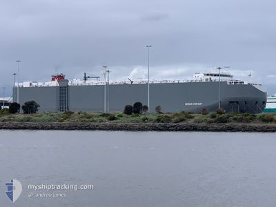
GENIUS HIGHWAY
Vehicles Carrier

Current Trip
BB BGI
| Time Travelled | 1 day |
|---|---|
| Remaining Time | --- |
| Distance Travelled | 118.47 nm |
| Remaining Distance | --- |
| AVG Speed | 9.9 Knots |
| MAX Speed | 16.5 Knots |
| AVG Wind | 11.3 knots |
| MAX Wind | 16 knots |
| MIN Temp | 25.7°C / 78.26°F |
| MAX Temp | 27.7°C / 81.86°F |
| Draught | 8.9 m |
| Position Received | 14 h, 47 m ago |
Current Position
| Longitude | -61.22506° |
|---|---|
| Latitude | 13.14817° |
| Status | Moored |
| Speed | |
| Course | 64° |
| Area | Caribbean Sea |
| Station | T-AIS |
| Position Received | 14 h, 47 m ago |
Information
The current position of GENIUS HIGHWAY is in Caribbean Sea with coordinates 13.14817° / -61.22506° as reported on 2025-06-07 18:53 by AIS to our vessel tracker app. The vessel's current speed is 0 Knots
The vessel GENIUS HIGHWAY (IMO: 9672416, MMSI: 311000102) is a Vehicles Carrier that was built in 2014 ( 11 years old ). It's sailing under the flag of [BS] Bahamas.
In this page you can find informations about the vessels current position, last detected port calls, and current voyage information. If the vessels is not in coverage by AIS you will find the latest position.
The current position of GENIUS HIGHWAY is detected by our AIS receivers and we are not responsible for the reliability of the data. The last position was recorded while the vessel was in Coverage by the Ais receivers of our vessel tracking app.
The current draught of GENIUS HIGHWAY as reported by AIS is 8.9 meters
Weather
| Temperature | 26.3°C / 79.34°F |
|---|---|
| Wind Speed | 10 knots |
| Direction | 97° E |
| Pressure | 1014.6 hPa |
| Humidity | 77.9 % |
| Cloud Coverage | 53 % |


Featured Company
Last Port Calls
| Port | Arrival | Departure | Time In Port |
|---|---|---|---|
| 2025-06-06 09:25 | 2025-06-06 17:11 | 7 h | |
| 2025-06-05 03:51 | 2025-06-05 18:08 | 14 h | |
| 2025-06-03 06:49 | 2025-06-03 19:17 | 12 h | |
| 2025-06-01 21:54 | 2025-06-02 14:53 | 16 h | |
| 2025-05-30 08:14 | 2025-05-30 20:38 | 12 h | |
| 2025-05-27 22:24 | 2025-05-28 19:20 | 20 h | |
| 2025-05-22 14:36 | 2025-05-23 07:16 | 16 h | |
| 2025-04-30 16:46 | 2025-05-01 01:16 | 8 h | |
| 2025-04-30 09:33 | 2025-04-30 16:33 | 7 h | |
| 2025-04-29 06:31 | 2025-04-29 18:02 | 11 h |
Last Trips
| Origin | Departure | Destination | Arrival | Distance | |
|---|---|---|---|---|---|
| 2025-06-05 18:08 | 2025-06-06 09:25 | 213.78 nm | |||
| 2025-06-03 19:17 | 2025-06-05 03:51 | 431.51 nm | |||
| 2025-06-02 14:53 | 2025-06-03 06:49 | 149.54 nm | |||
| 2025-05-30 20:38 | 2025-06-01 21:54 | 476.01 nm | |||
| 2025-05-28 19:20 | 2025-05-30 08:14 | 438.80 nm | |||
| 2025-05-23 07:16 | 2025-05-27 22:24 | 607.27 nm | |||
| 2025-05-01 01:16 | 2025-05-22 14:36 | 7796.16 nm | |||
| 2025-04-30 16:33 | 2025-04-30 16:46 | 4.44 nm | |||
| 2025-04-29 18:02 | 2025-04-30 09:33 | 218.61 nm | |||
| 2025-04-26 18:18 | 2025-04-29 06:31 | 275.36 nm |
Events
| Time | Event | Details | Position / Dest | Info |
|---|---|---|---|---|
| 2025-06-07 18:53 | OUT of Coverage |
13.14817 / -61.22506
Caribbean Sea
|
Speed: Course: 88.1° |
|
| 2025-06-07 18:53 | Status Changed | Moored Default |
13.14817 / -61.22506
BB BGI
|
Speed: Course: 64° |
| 2025-06-07 18:53 | IN Coverage |
13.14817 / -61.22506
Caribbean Sea
|
Speed: Course: 88.1° |
|
| 2025-06-07 16:47 | OUT of Coverage |
13.14818 / -61.22507
Caribbean Sea
|
Speed: Course: 88.1° |
|
| 2025-06-07 15:08 | Status Changed | Moored Default |
13.14817 / -61.22509
BB BGI
|
Speed: Course: 64° |
| 2025-06-07 15:00 | IN Coverage |
13.14817 / -61.22509
Caribbean Sea
|
Speed: Course: 88.1° |
|
| 2025-06-07 10:20 | STOP Moving | 8.25 nm, North of BEQUIA |
13.14799 / -61.22551
BB BGI
|
Speed: 0.3 kn Course: 62° |
| 2025-06-07 10:14 | Status Changed | Default Under way using engine |
13.14707 / -61.22734
BB BGI
|
Speed: 3.1 kn Course: 70° |
| 2025-06-07 10:09 | OUT of Coverage |
13.14599 / -61.23095
Caribbean Sea
|
Speed: 3.1 kn Course: 75.3° |
|
| 2025-06-07 09:49 | START Moving | 7.67 nm, North of BEQUIA |
13.13820 / -61.25313
BB BGI
|
Speed: 3.2 kn Course: 38° |