
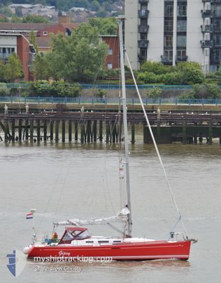
GIPSY
Pleasure Craft
Current Trip
| Trip Time | 4 h, 10 mins |
|---|---|
| Trip Distance | 21.81 nm |
| AVG Speed | 6 Knots |
| MAX Speed | 8.3 Knots |
| Draught | 2.1 m |
| AVG Wind | 14.9 knots |
| MAX Wind | 17.9 knots |
| MIN Temp | 10.5°C / 50.9°F |
| MAX Temp | 11.1°C / 51.98°F |
| Position Received | 7 h, 50 m ago |
Current Position
| Longitude | 3.71891° |
|---|---|
| Latitude | 51.59241° |
| Status | Default |
| Speed | 0.1 Knots |
| Course | --- |
| Area | North Sea |
| Station | T-AIS |
| Position Received | 7 h, 50 m ago |
Information
The current position of GIPSY is in North Sea with coordinates 51.59241° / 3.71891° as reported on 2025-05-07 22:29 by AIS to our vessel tracker app. The vessel's current speed is 0.1 Knots and is currently inside the port of ROOMPOT MARINA.
The vessel GIPSY (MMSI: 244110015) is a Pleasure Craft It's sailing under the flag of [NL] Netherlands.
In this page you can find informations about the vessels current position, last detected port calls, and current voyage information. If the vessels is not in coverage by AIS you will find the latest position.
The current position of GIPSY is detected by our AIS receivers and we are not responsible for the reliability of the data. The last position was recorded while the vessel was in Coverage by the Ais receivers of our vessel tracking app.
The current draught of GIPSY as reported by AIS is 2.1 meters
Weather
| Temperature | 9.9°C / 49.82°F |
|---|---|
| Wind Speed | 9 knots |
| Direction | 25° NNE |
| Pressure | 1020.1 hPa |
| Humidity | 78.9 % |
| Cloud Coverage | 100 % |
Featured Company
Last Port Calls
| Port | Arrival | Departure | Time In Port |
|---|---|---|---|
| 2025-05-07 20:29 | |||
| 2025-05-07 20:29 | |||
| 2025-05-07 17:35 | |||
| 2025-05-06 11:58 | 2025-05-07 13:25 | 1 d | |
| 2025-05-04 13:55 | 2025-05-06 06:42 | 1 d | |
| 2025-04-27 17:20 | 2025-05-03 11:30 | 5 d | |
| 2025-04-26 16:22 | 2025-04-27 07:45 | 15 h | |
| 2025-04-24 14:58 | 2025-04-25 11:07 | 20 h | |
| 2025-04-22 16:45 | 2025-04-24 06:41 | 1 d | |
| 2025-04-21 10:18 |
Most Visited Ports (Last year)
| Port | Arrivals | |
|---|---|---|
| 5 | ||
| 4 | ||
| 3 | ||
| 3 | ||
| 3 | ||
| 2 |
Last Trips
| Origin | Departure | Destination | Arrival | Distance | |
|---|---|---|---|---|---|
| 2025-05-07 15:25 | 2025-05-07 22:29 | 21.81 nm | |||
| 2025-05-07 15:25 | 2025-05-07 19:35 | 17.44 nm | |||
| 2025-05-06 08:42 | 2025-05-06 13:58 | 28.94 nm | |||
| 2025-05-03 13:30 | 2025-05-04 15:55 | 69.42 nm | |||
| 2025-04-27 09:45 | 2025-04-27 19:20 | 46.39 nm | |||
| 2025-04-25 12:07 | 2025-04-26 18:22 | 90.42 nm | |||
| 2025-04-24 08:41 | 2025-04-24 15:58 | 56.75 nm | |||
| 2025-04-21 12:18 | 2025-04-22 18:45 | 56.69 nm |
Events
| Time | Event | Details | Position / Dest | Info |
|---|---|---|---|---|
| 2025-05-07 22:29 | OUT of Coverage |
51.59241 / 3.71891
North Sea
[NL] ROOMPOT MARINA
|
Speed: 0.1 kn Course: 91° |
|
| 2025-05-07 22:29 | IN Coverage |
51.59241 / 3.71891
North Sea
[NL] ROOMPOT MARINA
|
Speed: 0.1 kn Course: 91° |
|
| 2025-05-07 20:29 | OUT of Coverage |
51.59239 / 3.71890
North Sea
[NL] ROOMPOT MARINA
|
Speed: Course: 97.8° |
|
| 2025-05-07 20:29 | IN Coverage |
51.59239 / 3.71890
North Sea
[NL] ROOMPOT MARINA
|
Speed: Course: 97.8° |
|
| 2025-05-07 20:29 | PORT DEPARTURE |
|
51.59239 / 3.71890
|
Speed: 1.1 kn Course: 511° |
| 2025-05-07 20:29 | PORT ARRIVAL |
|
51.59239 / 3.71890
[NL] ROOMPOT MARINA
|
Speed: 1.1 kn Course: 511° |
| 2025-05-07 17:46 | OUT of Coverage |
51.61923 / 3.67948
North Sea
[NL] NEELTJE JANS
|
Speed: 1.1 kn Course: 20.1° |
|
| 2025-05-07 17:35 | PORT ARRIVAL |
|
51.61923 / 3.67948
[NL] NEELTJE JANS
|
Speed: 7.9 kn Course: 71.7° |
| 2025-05-07 17:06 | IN Coverage |
51.60156 / 3.58176
North Sea
|
Speed: 7.9 kn Course: 71.7° |
|
| 2025-05-07 14:19 | OUT of Coverage |
51.46972 / 3.51035
North Sea
|
Speed: 6.7 kn Course: 318.7° |