
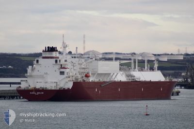
GLOBAL SEALINE
Tanker
Current Trip
| Time Travelled | 57 days |
|---|---|
| Remaining Time | 3 days |
| Distance Travelled | 14914.34 nm |
| Remaining Distance | 1733.12 nm |
| AVG Speed | 14.9 Knots |
| MAX Speed | 19.8 Knots |
| AVG Wind | 13 knots |
| MAX Wind | 27 knots |
| MIN Temp | 16.8°C / 62.24°F |
| MAX Temp | 28.5°C / 83.3°F |
| Draught | 11.7 m |
| Position Received | 4 d ago |
Current Position
| Longitude | 104.38943° |
|---|---|
| Latitude | 1.33008° |
| Status | Under way using engine |
| Speed | 15.9 Knots |
| Course | 47° |
| Area | South China Sea |
| Station | T-AIS |
| Position Received | 4 d ago |
Info
Information
The current position of GLOBAL SEALINE is in South China Sea with coordinates 1.33008° / 104.38943° as reported on 2025-12-11 14:59 by AIS to our vessel tracker app. The vessel's current speed is 15.9 Knots and is heading at the port of TOKYO. The estimated time of arrival as calculated by MyShipTracking vessel tracking app is 2025-12-19 08:22 LT
The vessel GLOBAL SEALINE (IMO: 9880477, MMSI: 538009406) is a Tanker It's sailing under the flag of [MH] Marshall Is.
In this page you can find informations about the vessels current position, last detected port calls, and current voyage information. If the vessels is not in coverage by AIS you will find the latest position.
The current position of GLOBAL SEALINE is detected by our AIS receivers and we are not responsible for the reliability of the data. The last position was recorded while the vessel was in Coverage by the Ais receivers of our vessel tracking app.
The current draught of GLOBAL SEALINE as reported by AIS is 11.7 meters
Weather
| Temperature | 24.2°C / 75.56°F |
|---|---|
| Wind Speed | 25 knots |
| Direction | 64° ENE |
| Pressure | 1016.2 hPa |
| Humidity | 79.5 % |
| Cloud Coverage | 100 % |
Featured Company
Last Port Calls
| Port | Arrival | Departure | Time In Port |
|---|---|---|---|
| 2025-10-18 03:50 | 2025-10-19 05:24 | 1 d |
Most Visited Ports (Last year)
| Port | Arrivals | |
|---|---|---|
| 4 | ||
| 1 | ||
| 1 | ||
| 1 | ||
| 1 | ||
| 1 |
Last Trips
| Origin | Departure | Destination | Arrival | Distance | |
|---|---|---|---|---|---|
| 2025-07-26 06:03 | 2025-10-18 11:50 | 12360.10 nm |
Events
| Time | Event | Details | Position / Dest | Info |
|---|---|---|---|---|
| 2025-12-11 15:05 | Status Changed | Default Under way using engine |
1.34799 / 104.40751
JAPAN
|
Speed: 15.9 kn Course: 47° |
| 2025-12-11 14:59 | OUT of Coverage |
1.33008 / 104.38943
South China Sea
JAPAN
|
Speed: 15.9 kn Course: 47° |
|
| 2025-12-11 14:52 | Change Sea Area | Malaysian part of the South China Sea Malaysian part of the Singapore Strait |
1.30746 / 104.36274
South China Sea
JAPAN
|
Speed: 16 kn Course: 50° |
| 2025-12-11 14:13 | Change Sea Area | Malaysian part of the Singapore Strait Indonesian part of the Singapore Strait |
1.25683 / 104.19824
Singapore Strait
JAPAN
|
Speed: 16.3 kn Course: 83.5° |
| 2025-12-11 11:25 | Status Changed | Under way using engine Default |
1.09640 / 103.57492
JAPAN
|
Speed: 14.5 kn Course: 120° |
| 2025-12-11 11:17 | Status Changed | Default Under way using engine |
1.11323 / 103.54599
JAPAN
|
Speed: 13.9 kn Course: 120.3° |
| 2025-12-11 11:02 | Status Changed | Under way using engine Default |
1.14164 / 103.49647
JAPAN
|
Speed: 13.3 kn Course: 118° |
| 2025-12-11 11:01 | Status Changed | Default Under way using engine |
1.14401 / 103.49197
JAPAN
|
Speed: 13.3 kn Course: 117.7° |
| 2025-12-11 11:01 | Change Sea Area | Indonesian part of the Singapore Strait Malaysian part of the Malacca Strait |
1.14457 / 103.49092
Singapore Strait
JAPAN
|
Speed: 13.3 kn Course: 117.7° |
| 2025-12-11 10:45 | Status Changed | Under way using engine Default |
1.16769 / 103.44278
JAPAN
|
Speed: 11.6 kn Course: 124° |