
GLOBAL UNITY
Cargo
Current Trip
| Time Travelled | 6 days |
|---|---|
| Remaining Time | 2 h, 59 mins |
| Distance Travelled | 990.68 nm |
| Remaining Distance | 35.44 nm |
| AVG Speed | 10.5 Knots |
| MAX Speed | 12.7 Knots |
| AVG Wind | 6.3 knots |
| MAX Wind | 15.3 knots |
| MIN Temp | 7.5°C / 45.5°F |
| MAX Temp | 18.9°C / 66.02°F |
| Draught | 11.5 m |
| Position Received | 5 m ago |
Current Position
| Longitude | 32.34504° |
|---|---|
| Latitude | 31.39607° |
| Status | Under way using engine |
| Speed | 10.1 Knots |
| Course | 168.7° |
| Area | Mediterranean Sea - Eastern Basin |
| Station | T-AIS |
| Position Received | 5 m ago |
Info
Information
The current position of GLOBAL UNITY is in Mediterranean Sea - Eastern Basin with coordinates 31.39607° / 32.34504° as reported on 2025-12-24 04:48 by AIS to our vessel tracker app. The vessel's current speed is 10.1 Knots and is heading at the port of DAMIETTA. The estimated time of arrival as calculated by MyShipTracking vessel tracking app is 2025-12-24 07:53 LT
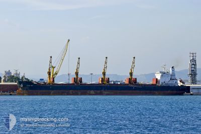
The vessel GLOBAL UNITY (IMO: 9665542, MMSI: 538005566) is a Cargo It's sailing under the flag of [MH] Marshall Is.
In this page you can find informations about the vessels current position, last detected port calls, and current voyage information. If the vessels is not in coverage by AIS you will find the latest position.
The current position of GLOBAL UNITY is detected by our AIS receivers and we are not responsible for the reliability of the data. The last position was recorded while the vessel was in Coverage by the Ais receivers of our vessel tracking app.
The current draught of GLOBAL UNITY as reported by AIS is 11.5 meters
Weather
| Temperature | 17.5°C / 63.5°F |
|---|---|
| Wind Speed | 5 knots |
| Direction | 260° W |
| Pressure | 1019.3 hPa |
| Humidity | 72 % |
| Cloud Coverage | 1 % |
Featured Company
Last Port Calls
| Port | Arrival | Departure | Time In Port |
|---|---|---|---|
| 2025-12-09 20:45 | 2025-12-17 19:03 | 7 d | |
| 2025-11-22 08:25 | 2025-11-29 17:39 | 7 d | |
| 2025-11-20 09:52 | 2025-11-20 19:23 | 9 h | |
| 2025-11-02 22:59 | 2025-11-07 19:28 | 4 d | |
| 2025-10-08 04:48 | 2025-10-08 13:33 | 8 h | |
| 2025-10-02 11:56 |
Most Visited Ports (Last year)
| Port | Arrivals | |
|---|---|---|
| 3 | ||
| 2 | ||
| 2 | ||
| 1 | ||
| 1 | ||
| 1 |
Last Trips
| Origin | Departure | Destination | Arrival | Distance | |
|---|---|---|---|---|---|
| 2025-11-29 20:39 | 2025-12-09 22:45 | 1198.17 nm | |||
| 2025-11-07 22:28 | 2025-11-22 11:25 | 3553.26 nm | |||
| 2025-11-07 22:28 | 2025-11-20 11:52 | 3085.47 nm | |||
| 2025-10-02 14:56 | 2025-11-03 01:59 | 4849.55 nm | |||
| 2025-10-02 14:56 | 2025-10-08 06:48 | 1028.43 nm |
Events
| Time | Event | Details | Position / Dest | Info |
|---|---|---|---|---|
| 2025-12-24 04:48 | Status Changed | Under way using engine Default |
31.39607 / 32.34504
EGDAM
|
Speed: 10.5 kn Course: 169° |
| 2025-12-24 04:42 | Status Changed | Default Under way using engine |
31.41423 / 32.34093
EGDAM
|
Speed: 10.5 kn Course: 170.1° |
| 2025-12-24 04:33 | Status Changed | Under way using engine Default |
31.43942 / 32.33555
EGDAM
|
Speed: 10.3 kn Course: 178° |
| 2025-12-24 04:21 | IN Coverage |
31.43558 / 32.33629
Mediterranean Sea - Eastern Basin
|
Speed: 10.5 kn Course: 170.1° |
|
| 2025-12-24 03:57 | START Moving | 16.65 nm, North of PORT SAID |
31.52922 / 32.32907
EGDAM
|
Speed: 7.3 kn Course: 176° |
| 2025-12-23 09:17 | STOP Moving | 17.56 nm, North of PORT SAID |
31.54376 / 32.34004
EGDAM
|
Speed: Course: 268° |
| 2025-12-23 07:53 | Status Changed | Default Under way using engine |
31.53091 / 32.22838
EGDAM
|
Speed: 8.8 kn Course: 81.8° |
| 2025-12-23 07:51 | OUT of Coverage |
31.53000 / 32.22295
Mediterranean Sea - Eastern Basin
EGDAM
|
Speed: 8.8 kn Course: 81.8° |
|
| 2025-12-23 07:48 | Status Changed | Under way using engine Default |
31.52967 / 32.21419
EGDAM
|
Speed: 9.4 kn Course: 135° |
| 2025-12-23 07:23 | Status Changed | Default Under way using engine |
31.56819 / 32.16371
EGDAM
|
Speed: 7.2 kn Course: 135.3° |