
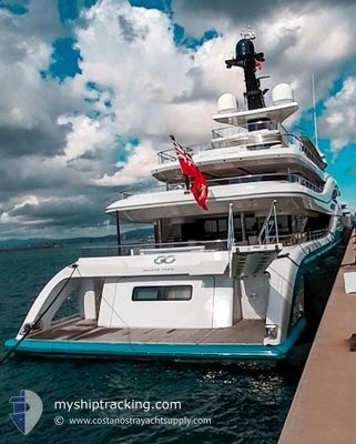
GO
Pleasure Craft
Current Trip
ST BAQLE//H.BAY
| Time Travelled | 3 days |
|---|---|
| Remaining Time | --- |
| Distance Travelled | 23.65 nm |
| Remaining Distance | --- |
| AVG Speed | 9.2 Knots |
| MAX Speed | 14.4 Knots |
| AVG Wind | 6.3 knots |
| MAX Wind | 12 knots |
| MIN Temp | 23.5°C / 74.3°F |
| MAX Temp | 26.4°C / 79.52°F |
| Draught | 4.1 m |
| Position Received | 14 h, 30 m ago |
Current Position
| Longitude | -62.86728° |
|---|---|
| Latitude | 17.90872° |
| Status | At anchor |
| Speed | |
| Course | 80° |
| Area | Caribbean Sea |
| Station | T-AIS |
| Position Received | 14 h, 30 m ago |
Info
Information
The current position of GO is in Caribbean Sea with coordinates 17.90872° / -62.86728° as reported on 2026-01-07 16:00 by AIS to our vessel tracker app. The vessel's current speed is 0 Knots
The vessel GO (IMO: 9774305, MMSI: 319135400) is a Pleasure Craft It's sailing under the flag of [KY] Cayman Is.
In this page you can find informations about the vessels current position, last detected port calls, and current voyage information. If the vessels is not in coverage by AIS you will find the latest position.
The current position of GO is detected by our AIS receivers and we are not responsible for the reliability of the data. The last position was recorded while the vessel was in Coverage by the Ais receivers of our vessel tracking app.
The current draught of GO as reported by AIS is 4.1 meters
Weather
| Temperature | 25°C / 77°F |
|---|---|
| Wind Speed | 7 knots |
| Direction | 61° ENE |
| Pressure | 1016.8 hPa |
| Humidity | 76.9 % |
| Cloud Coverage | 24 % |
Featured Company
Last Port Calls
| Port | Arrival | Departure | Time In Port |
|---|---|---|---|
| 2026-01-04 11:56 | 2026-01-04 18:46 | 6 h | |
| 2025-12-24 09:51 | 2025-12-28 16:17 | 4 d | |
| 2025-12-12 16:15 | 2025-12-14 09:57 | 1 d | |
| 2025-12-09 13:48 | 2025-12-11 07:37 | 1 d |
Last Trips
| Origin | Departure | Destination | Arrival | Distance | |
|---|---|---|---|---|---|
| 2025-12-28 16:17 | 2026-01-04 11:56 | 35.39 nm | |||
| 2025-12-14 09:57 | 2025-12-24 09:51 | 3234.63 nm | |||
| 2025-12-11 07:37 | 2025-12-12 16:15 | 452.30 nm | |||
| 2025-09-18 17:14 | 2025-12-09 13:48 | 16.74 nm |
Events
| Time | Event | Details | Position / Dest | Info |
|---|---|---|---|---|
| 2026-01-07 16:00 | OUT of Coverage |
17.90872 / -62.86728
Caribbean Sea
|
Speed: Course: 319° |
|
| 2026-01-07 15:25 | Status Changed | At anchor Under way using engine |
17.90860 / -62.86685
ST BAQLE//H.BAY
|
Speed: 1.5 kn Course: 82° |
| 2026-01-07 15:03 | Status Changed | Under way using engine At anchor |
17.91012 / -62.87094
ST BAQLE//H.BAY
|
Speed: 1.7 kn Course: 124° |
| 2026-01-05 22:08 | Status Changed | At anchor Under way using engine |
17.91148 / -62.87099
ST BAQLE//H.BAY
|
Speed: 0.3 kn Course: 246° |
| 2026-01-05 21:59 | STOP Moving | 1.09 nm, North West of GUSTAVIA |
17.90979 / -62.86959
ST BAQLE//H.BAY
|
Speed: 0.3 kn Course: 222° |
| 2026-01-05 21:12 | Change Sea Area | Saint-Martin part of the Caribbean Sea Sint-Maarten part of the Caribbean Sea |
17.94870 / -63.00802
Caribbean Sea
ST BAQLE//H.BAY
|
Speed: 14.4 kn Course: 105.7° |
| 2026-01-05 20:42 | Destination Changed | ST BAQLE//H.BAY ST MAARTEN |
18.02118 / -63.09834
ST BAQLE//H.BAY
|
Speed: 10.9 kn Course: 159.6° |
| 2026-01-05 20:42 | ETA Changed | 2026/01/05 20:00 2026/01/04 19:00 |
18.02118 / -63.09834
ST BAQLE//H.BAY
|
Speed: 10.9 kn Course: 159.6° |
| 2026-01-05 20:36 | Status Changed | Under way using engine At anchor |
18.03149 / -63.10891
ST MAARTEN
|
Speed: 5.8 kn Course: 205.5° |
| 2026-01-05 20:35 | START Moving | 0.96 nm, West of ST MAARTEN |
18.03291 / -63.10833
ST MAARTEN
|
Speed: 5.8 kn Course: 217.4° |