
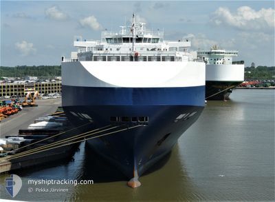
GOLIATH LEADER
Vehicles Carrier
Current Trip
| Trip Time | 2 days |
|---|---|
| Trip Distance | 206.64 nm |
| AVG Speed | 6.5 Knots |
| MAX Speed | 12.8 Knots |
| Draught | 8.7 m |
| AVG Wind | 11.7 knots |
| MAX Wind | 29 knots |
| MIN Temp | 19.9°C / 67.82°F |
| MAX Temp | 23.3°C / 73.94°F |
| Position Received | 4 d ago |
Current Position
| Longitude | 30.91857° |
|---|---|
| Latitude | -30.34945° |
| Status | Under way using engine |
| Speed | 16.7 Knots |
| Course | 200.3° |
| Area | Indian Ocean |
| Station | T-AIS |
| Position Received | 4 d ago |
Info
Information
The current position of GOLIATH LEADER is in Indian Ocean with coordinates -30.34945° / 30.91857° as reported on 2025-02-26 11:22 by AIS to our vessel tracker app. The vessel's current speed is 16.7 Knots and is currently inside the port of PORT ELIZABETH.
The vessel GOLIATH LEADER (IMO: 9357315, MMSI: 308369000) is a Vehicles Carrier that was built in 2008 ( 17 years old ). It's sailing under the flag of [BS] Bahamas.
In this page you can find informations about the vessels current position, last detected port calls, and current voyage information. If the vessels is not in coverage by AIS you will find the latest position.
The current position of GOLIATH LEADER is detected by our AIS receivers and we are not responsible for the reliability of the data. The last position was recorded while the vessel was in Coverage by the Ais receivers of our vessel tracking app.
The current draught of GOLIATH LEADER as reported by AIS is 8.7 meters
Weather
| Temperature | 23.1°C / 73.58°F |
|---|---|
| Wind Speed | 16 knots |
| Direction | 79° E |
| Pressure | 1011.4 hPa |
| Humidity | 81.9 % |
| Cloud Coverage | 23 % |
Featured Company
Last Port Calls
| Port | Arrival | Departure | Time In Port |
|---|---|---|---|
| 2025-03-02 08:57 | |||
| 2025-02-27 04:58 | 2025-02-28 04:57 | 23 h | |
| 2025-02-23 05:37 | 2025-02-26 09:03 | 3 d | |
| 2025-02-18 08:04 | 2025-02-19 00:40 | 16 h | |
| 2025-02-13 05:20 | 2025-02-14 05:16 | 23 h | |
| 2025-02-05 00:45 | 2025-02-05 11:28 | 10 h | |
| 2025-01-31 09:10 | 2025-01-31 17:58 | 8 h | |
| 2025-01-30 18:06 | 2025-01-31 07:50 | 13 h | |
| 2025-01-19 06:24 | 2025-01-22 07:29 | 3 d | |
| 2025-01-17 10:25 | 2025-01-18 07:44 | 21 h |
Most Visited Ports (Last year)
| Port | Arrivals | |
|---|---|---|
| 4 | ||
| 3 | ||
| 3 | ||
| 2 | ||
| 2 | ||
| 2 |
Last Trips
| Origin | Departure | Destination | Arrival | Distance | |
|---|---|---|---|---|---|
| 2025-02-28 06:57 | 2025-03-02 10:57 | 206.64 nm | |||
| 2025-02-26 11:03 | 2025-02-27 06:58 | 267.62 nm | |||
| 2025-02-19 03:40 | 2025-02-23 07:37 | 1617.12 nm | |||
| 2025-02-14 08:16 | 2025-02-18 11:04 | 277.05 nm | |||
| 2025-02-05 16:58 | 2025-02-13 08:20 | 2775.65 nm | |||
| 2025-02-01 01:58 | 2025-02-05 06:15 | 1490.90 nm | |||
| 2025-01-31 15:50 | 2025-01-31 17:10 | 13.13 nm | |||
| 2025-01-22 16:29 | 2025-01-31 02:06 | 2803.63 nm | |||
| 2025-01-18 16:44 | 2025-01-19 15:24 | 257.82 nm | |||
| 2025-01-17 18:17 | 2025-01-17 19:25 | 10.34 nm |
Events
| Time | Event | Details | Position / Dest | Info |
|---|---|---|---|---|
| 2025-03-02 09:13 | STOP Moving |
-33.95972 / 25.63141
[ZA] PORT ELIZABETH
|
Speed: 0.2 kn Course: 265° |
|
| 2025-03-02 08:57 | PORT ARRIVAL |
|
-33.95543 / 25.64165
[ZA] PORT ELIZABETH
|
Speed: 5.9 kn Course: 174° |
| 2025-03-02 05:40 | START Moving | 13.03 nm, East of COEGA |
-33.76379 / 25.94931
ZA ELS
|
Speed: 3.8 kn Course: 176° |
| 2025-03-02 00:37 | STOP Moving | 13.99 nm, East of COEGA |
-33.83218 / 25.97090
ZA ELS
|
Speed: 0.3 kn Course: 158° |
| 2025-03-01 23:41 | START Moving | 14.28 nm, East of COEGA |
-33.76055 / 25.97402
ZA ELS
|
Speed: 6.1 kn Course: 188° |
| 2025-03-01 20:01 | STOP Moving | 14.26 nm, East of COEGA |
-33.82613 / 25.97720
ZA ELS
|
Speed: 0.2 kn Course: 173° |
| 2025-03-01 19:09 | START Moving | 13.47 nm, East of COEGA |
-33.76382 / 25.95825
ZA ELS
|
Speed: 4.5 kn Course: 160° |
| 2025-03-01 17:53 | STOP Moving | 13.44 nm, East of COEGA |
-33.78804 / 25.96123
ZA ELS
|
Speed: 0.3 kn Course: 143° |
| 2025-03-01 08:05 | START Moving | 18.52 nm, East of COEGA |
-33.78878 / 26.06319
ZA ELS
|
Speed: 5.5 kn Course: 165° |
| 2025-03-01 06:01 | STOP Moving | 18.68 nm, East of COEGA |
-33.82898 / 26.06571
ZA ELS
|
Speed: 0.2 kn Course: 174° |