
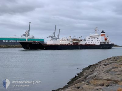
GOLIATH
Cement Carrier
Current Trip
| Time Travelled | 12 h, 20 mins |
|---|---|
| Remaining Time | 6 h, 36 mins |
| Distance Travelled | 149.56 nm |
| Remaining Distance | 88.32 nm |
| AVG Speed | 12.1 Knots |
| MAX Speed | 12.8 Knots |
| AVG Wind | 13.1 knots |
| MAX Wind | 15.5 knots |
| MIN Temp | 12.2°C / 53.96°F |
| MAX Temp | 14.2°C / 57.56°F |
| Draught | 6.7 m |
| Position Received | 8 h, 45 m ago |
Current Position
| Longitude | 144.61847° |
|---|---|
| Latitude | -38.32413° |
| Status | Under way using engine |
| Speed | 11.4 Knots |
| Course | 179.1° |
| Area | Bass Strait |
| Station | T-AIS |
| Position Received | 8 h, 45 m ago |
Info
Information
The current position of GOLIATH is in Bass Strait with coordinates -38.32413° / 144.61847° as reported on 2025-12-15 12:06 by AIS to our vessel tracker app. The vessel's current speed is 11.4 Knots and is heading at the port of DEVONPORT. The estimated time of arrival as calculated by MyShipTracking vessel tracking app is 2025-12-16 14:27 LT
The vessel GOLIATH (IMO: 9036430, MMSI: 503003000) is a Cement Carrier that was built in 1993 ( 32 years old ). It's sailing under the flag of [AU] Australia.
In this page you can find informations about the vessels current position, last detected port calls, and current voyage information. If the vessels is not in coverage by AIS you will find the latest position.
The current position of GOLIATH is detected by our AIS receivers and we are not responsible for the reliability of the data. The last position was recorded while the vessel was in Coverage by the Ais receivers of our vessel tracking app.
The current draught of GOLIATH as reported by AIS is 6.7 meters
Weather
| Temperature | 12.9°C / 55.22°F |
|---|---|
| Wind Speed | 14 knots |
| Direction | 232° SW |
| Pressure | 1022.2 hPa |
| Humidity | 74.7 % |
| Cloud Coverage | 85 % |
Featured Company
Last Port Calls
| Port | Arrival | Departure | Time In Port |
|---|---|---|---|
| 2025-12-14 17:22 | 2025-12-15 19:31 | 1 d | |
| 2025-12-13 04:09 | 2025-12-13 20:30 | 16 h | |
| 2025-12-11 08:29 | 2025-12-12 09:42 | 1 d | |
| 2025-12-09 13:38 | 2025-12-10 14:41 | 1 d | |
| 2025-12-07 19:06 | 2025-12-08 19:09 | 1 d | |
| 2025-12-05 19:37 | 2025-12-06 23:48 | 1 d | |
| 2025-12-04 03:16 | 2025-12-04 23:41 | 20 h | |
| 2025-12-02 15:20 | 2025-12-03 09:24 | 18 h | |
| 2025-11-30 13:56 | 2025-12-01 15:10 | 1 d | |
| 2025-11-28 12:18 | 2025-11-29 19:16 | 1 d |
Last Trips
| Origin | Departure | Destination | Arrival | Distance | |
|---|---|---|---|---|---|
| 2025-12-13 20:30 | 2025-12-14 17:22 | 234.53 nm | |||
| 2025-12-12 09:42 | 2025-12-13 04:09 | 236.10 nm | |||
| 2025-12-10 14:41 | 2025-12-11 08:29 | 234.85 nm | |||
| 2025-12-08 19:09 | 2025-12-09 13:38 | 233.87 nm | |||
| 2025-12-06 23:48 | 2025-12-07 19:06 | 231.93 nm | |||
| 2025-12-04 23:41 | 2025-12-05 19:37 | 234.31 nm | |||
| 2025-12-03 09:24 | 2025-12-04 03:16 | 234.21 nm | |||
| 2025-12-01 15:10 | 2025-12-02 15:20 | 244.01 nm | |||
| 2025-11-29 19:16 | 2025-11-30 13:56 | 232.66 nm | |||
| 2025-11-27 16:05 | 2025-11-28 12:18 | 235.38 nm |
Events
| Time | Event | Details | Position / Dest | Info |
|---|---|---|---|---|
| 2025-12-15 12:13 | Status Changed | Default Under way using engine |
-38.34518 / 144.61885
DEVONPORT
|
Speed: 11.4 kn Course: 179.1° |
| 2025-12-15 12:06 | OUT of Coverage |
-38.32413 / 144.61847
Bass Strait
DEVONPORT
|
Speed: 11.4 kn Course: 179.1° |
|
| 2025-12-15 11:58 | Status Changed | Under way using engine Default |
-38.30188 / 144.62679
DEVONPORT
|
Speed: 9.8 kn Course: 220° |
| 2025-12-15 11:58 | IN Coverage |
-38.30828 / 144.61898
Bass Strait
DEVONPORT
|
Speed: 10.1 kn Course: 225.7° |
|
| 2025-12-15 11:57 | Status Changed | Default Under way using engine |
-38.29989 / 144.62918
DEVONPORT
|
Speed: 9.7 kn Course: 220.6° |
| 2025-12-15 11:57 | Status Changed | Under way using engine Default |
-38.29953 / 144.62954
DEVONPORT
|
Speed: 10 kn Course: 227° |
| 2025-12-15 10:09 | Status Changed | Default Under way using engine |
-38.20070 / 144.91242
DEVONPORT
|
Speed: 12.6 kn Course: 180.1° |
| 2025-12-15 10:08 | OUT of Coverage |
-38.19782 / 144.91244
Bass Strait
DEVONPORT
|
Speed: 12.6 kn Course: 180.1° |
|
| 2025-12-15 09:51 | Status Changed | Under way using engine Default |
-38.13944 / 144.91357
DEVONPORT
|
Speed: 12.7 kn Course: 181° |
| 2025-12-15 09:49 | Status Changed | Default Under way using engine |
-38.13045 / 144.91386
DEVONPORT
|
Speed: 12.8 kn Course: 181.6° |