
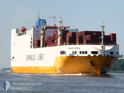
GRANDE AFRICA
Vehicles Carrier
Current Trip
| Time Travelled | 4 days |
|---|---|
| Remaining Time | 1 day |
| Distance Travelled | 55.05 nm |
| Remaining Distance | 1994.69 nm |
| AVG Speed | 11.7 Knots |
| MAX Speed | 16.4 Knots |
| AVG Wind | 7.4 knots |
| MAX Wind | 15 knots |
| MIN Temp | 26.2°C / 79.16°F |
| MAX Temp | 31.3°C / 88.34°F |
| Draught | 8.9 m |
| Position Received | 20 d ago |
Current Position
| Longitude | -13.86042° |
|---|---|
| Latitude | 27.60435° |
| Status | Under way using engine |
| Speed | 16.2 Knots |
| Course | 211.1° |
| Area | North Atlantic Ocean |
| Station | T-AIS |
| Position Received | 20 d ago |
Info
Information
The current position of GRANDE AFRICA is in North Atlantic Ocean with coordinates 27.60435° / -13.86042° as reported on 2025-01-21 15:05 by AIS to our vessel tracker app. The vessel's current speed is 16.2 Knots and is heading at the port of DAKAR. The estimated time of arrival as calculated by MyShipTracking vessel tracking app is 2025-02-12 04:00 LT
The vessel GRANDE AFRICA (IMO: 9130949, MMSI: 215751000) is a Vehicles Carrier that was built in 1998 ( 27 years old ). It's sailing under the flag of [MT] Malta.
In this page you can find informations about the vessels current position, last detected port calls, and current voyage information. If the vessels is not in coverage by AIS you will find the latest position.
The current position of GRANDE AFRICA is detected by our AIS receivers and we are not responsible for the reliability of the data. The last position was recorded while the vessel was in Coverage by the Ais receivers of our vessel tracking app.
The current draught of GRANDE AFRICA as reported by AIS is 8.9 meters
Weather
| Temperature | 29.2°C / 84.56°F |
|---|---|
| Wind Speed | 13 knots |
| Direction | 221° SW |
| Pressure | 1004.6 hPa |
| Humidity | 75.4 % |
| Cloud Coverage | 16 % |
Featured Company
Last Port Calls
| Port | Arrival | Departure | Time In Port |
|---|---|---|---|
| 2025-02-05 17:41 | 2025-02-06 15:05 | 21 h | |
| 2025-02-04 07:57 | 2025-02-05 08:33 | 1 d | |
| 2025-02-01 17:21 | 2025-02-02 10:21 | 16 h | |
| 2025-01-26 21:42 | 2025-01-29 00:06 | 2 d | |
| 2025-01-23 20:19 | 2025-01-25 13:35 | 1 d | |
| 2025-01-16 00:28 | 2025-01-16 22:46 | 22 h | |
| 2025-01-12 17:49 | 2025-01-13 19:12 | 1 d | |
| 2024-12-18 05:07 | 2025-01-11 09:47 | 24 d | |
| 2024-12-04 07:35 | 2024-12-06 06:52 | 1 d | |
| 2024-12-02 11:40 |
Last Trips
| Origin | Departure | Destination | Arrival | Distance | |
|---|---|---|---|---|---|
| 2025-02-05 09:33 | 2025-02-05 18:41 | 137.97 nm | |||
| 2025-02-02 10:21 | 2025-02-04 08:57 | 593.63 nm | |||
| 2025-01-29 00:06 | 2025-02-01 17:21 | 1147.83 nm | |||
| 2025-01-25 13:35 | 2025-01-26 21:42 | 454.38 nm | |||
| 2025-01-16 23:46 | 2025-01-23 20:19 | 2457.94 nm | |||
| 2025-01-13 20:12 | 2025-01-16 01:28 | 527.10 nm | |||
| 2025-01-11 10:47 | 2025-01-12 18:49 | 373.49 nm | |||
| 2024-12-06 07:52 | 2024-12-18 06:07 | 4181.37 nm | |||
| 2024-12-02 11:40 | 2024-12-04 08:35 | 181.73 nm |
Events
| Time | Event | Details | Position / Dest | Info |
|---|---|---|---|---|
| 2025-02-06 19:18 | STOP Moving | 15.31 nm, South West of DOUALA |
3.88284 / 9.50110
FRLEH > SNDKR
|
Speed: 0.3 kn Course: 226° |
| 2025-02-06 15:05 | PORT DEPARTURE |
|
3.76809 / 8.77572
FRLEH > SNDKR
|
Speed: 5.3 kn Course: 309° |
| 2025-02-06 15:01 | START Moving |
3.76380 / 8.77803
[GQ] MALABO
|
Speed: 5.3 kn Course: 309° |
|
| 2025-02-05 17:57 | STOP Moving |
3.76083 / 8.78100
[GQ] MALABO
|
Speed: 0.1 kn Course: 122° |
|
| 2025-02-05 17:41 | PORT ARRIVAL |
|
3.76483 / 8.77816
[GQ] MALABO
|
Speed: 2.2 kn Course: 188° |
| 2025-02-05 08:33 | START Moving | 0.39 nm, North West of BATA |
1.83366 / 9.73119
FRLEH > SNDKR
|
Speed: 7.8 kn Course: 325° |
| 2025-02-05 08:33 | PORT DEPARTURE |
|
1.83366 / 9.73119
FRLEH > SNDKR
|
Speed: 1.3 kn Course: 321° |
| 2025-02-04 08:17 | STOP Moving |
1.82473 / 9.73508
[GQ] BATA
|
Speed: 0.2 kn Course: 181° |
|
| 2025-02-04 07:57 | PORT ARRIVAL |
|
1.83119 / 9.73451
[GQ] BATA
|
Speed: 2.8 kn Course: 157° |
| 2025-02-04 06:49 | START Moving | 3.15 nm, North West of BATA |
1.86746 / 9.69979
FRLEH > SNDKR
|
Speed: 4.5 kn Course: 130° |