
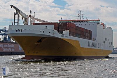
GRANDE SENEGAL
Ro-Ro Cargo
Current Trip
| Time Travelled | 13 days |
|---|---|
| Remaining Time | --- |
| Distance Travelled | 4816.50 nm |
| Remaining Distance | --- |
| AVG Speed | 15.4 Knots |
| MAX Speed | 15.4 Knots |
| AVG Wind | 12.5 knots |
| MAX Wind | 28 knots |
| MIN Temp | 10.4°C / 50.72°F |
| MAX Temp | 40.5°C / 104.9°F |
| Draught | 9.2 m |
| Position Received | 1 m ago |
Current Position
| Longitude | 34.95864° |
|---|---|
| Latitude | 19.38432° |
| Status | Under way using engine |
| Speed | 10 Knots |
| Course | 270° |
| Area | Red Sea |
| Station | T-AIS |
| Position Received | 1 m ago |
Information
The current position of GRANDE SENEGAL is in Red Sea with coordinates 19.38432° / 34.95864° as reported on 2025-06-08 05:37 by AIS to our vessel tracker app. The vessel's current speed is 10 Knots and is heading at the port of JEDDAH. The estimated time of arrival as calculated by MyShipTracking vessel tracking app is 2025-06-07 03:00 LT
The vessel GRANDE SENEGAL (IMO: 9377470, MMSI: 247285500) is a Ro-Ro Cargo that was built in 2010 ( 15 years old ). It's sailing under the flag of [IT] Italy.
In this page you can find informations about the vessels current position, last detected port calls, and current voyage information. If the vessels is not in coverage by AIS you will find the latest position.
The current position of GRANDE SENEGAL is detected by our AIS receivers and we are not responsible for the reliability of the data. The last position was recorded while the vessel was in Coverage by the Ais receivers of our vessel tracking app.
The current draught of GRANDE SENEGAL as reported by AIS is 9.2 meters
Weather
| Temperature | 34.1°C / 93.38°F |
|---|---|
| Wind Speed | 4 knots |
| Direction | 33° NNE |
| Pressure | 1008.3 hPa |
| Humidity | 13.2 % |
| Cloud Coverage | 10 % |
Featured Company
Last Port Calls
| Port | Arrival | Departure | Time In Port |
|---|---|---|---|
| 2025-06-05 02:52 | 2025-06-05 10:57 | 8 h | |
| 2025-05-24 23:57 | 2025-05-25 20:37 | 20 h | |
| 2025-05-21 17:51 | 2025-05-24 00:10 | 2 d | |
| 2025-05-09 02:39 | 2025-05-09 22:05 | 19 h | |
| 2025-05-08 03:42 | 2025-05-09 02:29 | 22 h | |
| 2025-05-02 01:44 | 2025-05-03 07:23 | 1 d | |
| 2025-04-28 11:42 | 2025-04-29 05:24 | 17 h | |
| 2025-04-25 11:20 | 2025-04-26 06:08 | 18 h | |
| 2025-04-19 11:55 | 2025-04-20 01:21 | 13 h | |
| 2025-04-17 18:17 | 2025-04-18 05:57 | 11 h |
Most Visited Ports (Last year)
| Port | Arrivals | |
|---|---|---|
| 9 | ||
| 7 | ||
| 5 | ||
| 5 | ||
| 4 | ||
| 4 |
Last Trips
| Origin | Departure | Destination | Arrival | Distance | |
|---|---|---|---|---|---|
| 2025-05-25 22:37 | 2025-06-05 04:52 | 3600.79 nm | |||
| 2025-05-24 02:10 | 2025-05-25 01:57 | 340.91 nm | |||
| 2025-05-09 18:05 | 2025-05-21 19:51 | 4139.46 nm | |||
| 2025-05-08 22:29 | 2025-05-08 22:39 | 1.00 nm | |||
| 2025-05-03 02:23 | 2025-05-07 23:42 | 1981.08 nm | |||
| 2025-04-29 00:24 | 2025-05-01 20:44 | 257.76 nm | |||
| 2025-04-26 01:08 | 2025-04-28 06:42 | 640.29 nm | |||
| 2025-04-19 21:21 | 2025-04-25 06:20 | 1993.01 nm | |||
| 2025-04-18 01:57 | 2025-04-19 07:55 | 434.09 nm | |||
| 2025-04-09 20:36 | 2025-04-17 14:17 | 2944.38 nm |
Events
| Time | Event | Details | Position / Dest | Info |
|---|---|---|---|---|
| 2025-06-08 04:40 | Status Changed | Under way using engine Default |
19.38427 / 35.12149
DE BRV>SA JED
|
Speed: 9.6 kn Course: 270° |
| 2025-06-08 04:35 | IN Coverage |
19.38427 / 35.11811
Red Sea
|
Speed: 9.7 kn Course: 270° |
|
| 2025-06-07 22:10 | Status Changed | Default Under way using engine |
19.38427 / 36.23521
DE BRV>SA JED
|
Speed: 9.7 kn Course: 270° |
| 2025-06-07 22:03 | OUT of Coverage |
19.38428 / 36.25474
Red Sea
|
Speed: 9.7 kn Course: 270° |
|
| 2025-06-07 21:59 | IN Coverage |
19.38427 / 36.25996
Red Sea
|
Speed: 9.7 kn Course: 270° |
|
| 2025-06-07 20:39 | OUT of Coverage |
19.38428 / 36.49426
Red Sea
|
Speed: 9.7 kn Course: 270° |
|
| 2025-06-07 20:39 | IN Coverage |
19.38428 / 36.49426
Red Sea
|
Speed: 9.7 kn Course: 270° |
|
| 2025-06-07 19:36 | OUT of Coverage |
19.38428 / 36.67523
Red Sea
|
Speed: 9.7 kn Course: 270° |
|
| 2025-06-07 17:59 | Status Changed | Under way using engine Default |
19.38428 / 36.95165
DE BRV>SA JED
|
Speed: 9.7 kn Course: 90° |
| 2025-06-07 17:59 | IN Coverage |
19.38428 / 36.94541
Red Sea
|
Speed: 9.8 kn Course: 270° |