
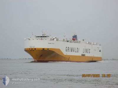
GRANDE SICILIA
Vehicles Carrier
Current Trip
| Time Travelled | --- |
|---|---|
| Remaining Time | 2 days |
| Distance Travelled | --- |
| Remaining Distance | 796.19 nm |
| AVG Speed | --- |
| MAX Speed | --- |
| AVG Wind | --- |
| MAX Wind | --- |
| MIN Temp | --- |
| MAX Temp | --- |
| Draught | 8.2 m |
| Position Received | 4 h, 3 m ago |
Current Position
| Longitude | 15.64733° |
|---|---|
| Latitude | 35.67047° |
| Status | Under way using engine |
| Speed | 14.8 Knots |
| Course | 358.2° |
| Area | Mediterranean Sea - Eastern Basin |
| Station | T-AIS |
| Position Received | 4 h, 3 m ago |
Info
Information
The current position of GRANDE SICILIA is in Mediterranean Sea - Eastern Basin with coordinates 35.67047° / 15.64733° as reported on 2026-01-05 21:33 by AIS to our vessel tracker app. The vessel's current speed is 14.8 Knots and is heading at the port of ALEXANDRIA. The estimated time of arrival as calculated by MyShipTracking vessel tracking app is 2026-01-08 07:52 LT
The vessel GRANDE SICILIA (IMO: 9312092, MMSI: 247186500) is a Vehicles Carrier that was built in 2006 ( 20 years old ). It's sailing under the flag of [IT] Italy.
In this page you can find informations about the vessels current position, last detected port calls, and current voyage information. If the vessels is not in coverage by AIS you will find the latest position.
The current position of GRANDE SICILIA is detected by our AIS receivers and we are not responsible for the reliability of the data. The last position was recorded while the vessel was in Coverage by the Ais receivers of our vessel tracking app.
The current draught of GRANDE SICILIA as reported by AIS is 8.2 meters
Weather
| Temperature | 17.1°C / 62.78°F |
|---|---|
| Wind Speed | 15 knots |
| Direction | 227° SW |
| Pressure | 1006.7 hPa |
| Humidity | 84.6 % |
| Cloud Coverage | --- |
Featured Company
Last Port Calls
| Port | Arrival | Departure | Time In Port |
|---|---|---|---|
| 2026-01-04 11:37 | |||
| 2026-01-01 18:33 | 2026-01-02 18:42 | 1 d | |
| 2025-12-30 20:36 | 2025-12-31 06:18 | 9 h | |
| 2025-12-30 06:42 | 2025-12-30 17:23 | 10 h | |
| 2025-12-14 21:16 | 2025-12-16 01:06 | 1 d | |
| 2025-12-11 11:49 | 2025-12-13 19:30 | 2 d | |
| 2025-12-01 23:27 | 2025-12-03 05:09 | 1 d | |
| 2025-11-30 06:19 | 2025-11-30 14:52 | 8 h | |
| 2025-11-28 10:22 | 2025-11-28 20:52 | 10 h | |
| 2025-11-27 12:27 | 2025-11-27 20:57 | 8 h |
Last Trips
| Origin | Departure | Destination | Arrival | Distance | |
|---|---|---|---|---|---|
| 2026-01-02 18:42 | 2026-01-04 11:37 | 623.44 nm | |||
| 2025-12-31 06:18 | 2026-01-01 18:33 | 475.18 nm | |||
| 2025-12-30 17:23 | 2025-12-30 20:36 | 49.59 nm | |||
| 2025-12-16 01:06 | 2025-12-30 06:42 | 4164.96 nm | |||
| 2025-12-13 19:30 | 2025-12-14 21:16 | 376.14 nm | |||
| 2025-12-03 05:09 | 2025-12-11 11:49 | 2328.89 nm | |||
| 2025-11-30 14:52 | 2025-12-01 23:27 | 435.57 nm | |||
| 2025-11-28 20:52 | 2025-11-30 06:19 | 506.84 nm | |||
| 2025-11-27 20:57 | 2025-11-28 10:22 | 210.26 nm | |||
| 2025-11-26 21:57 | 2025-11-27 12:27 | 193.80 nm |
Events
| Time | Event | Details | Position / Dest | Info |
|---|---|---|---|---|
| 2026-01-05 21:41 | Status Changed | Default Under way using engine |
35.70327 / 15.64635
LBKYE>EGALY
|
Speed: 14.8 kn Course: 358.2° |
| 2026-01-05 21:33 | OUT of Coverage |
35.67047 / 15.64733
Mediterranean Sea - Eastern Basin
|
Speed: 14.8 kn Course: 358.2° |
|
| 2026-01-05 21:16 | Change Sea Area | Maltese part of the Mediterranean Sea - Eastern Basin Cypriote part of the Mediterranean Sea - Eastern Basin |
35.60108 / 15.64938
Mediterranean Sea - Eastern Basin
|
Speed: 15 kn Course: 359.5° |
| 2026-01-05 21:16 | Status Changed | Under way using engine Default |
35.59983 / 15.64940
LBKYE>EGALY
|
Speed: 14.9 kn Course: 359° |
| 2026-01-05 21:10 | IN Coverage |
35.60108 / 15.64938
Mediterranean Sea - Eastern Basin
|
Speed: 15 kn Course: 359.5° |
|
| 2026-01-04 09:37 | PORT ARRIVAL |
|
32.11333 / 20.04833
[LY] BENGHAZI
|
Speed: 1 kn Course: -1° |
| 2026-01-04 07:04 | STOP Moving | 2.29 nm, West of BENGHAZI |
32.10166 / 19.99167
LBKYE>EGALY
|
Speed: Course: -1° |
| 2026-01-02 16:42 | PORT DEPARTURE |
|
31.16175 / 29.82731
LBKYE>EGALY
|
Speed: 9.7 kn Course: 253° |
| 2026-01-02 16:16 | START Moving |
31.19183 / 29.87635
[EG] ALEXANDRIA
|
Speed: 3.5 kn Course: 277° |
|
| 2026-01-01 17:17 | STOP Moving |
31.19057 / 29.88072
[EG] ALEXANDRIA
|
Speed: 0.3 kn Course: 24° |