
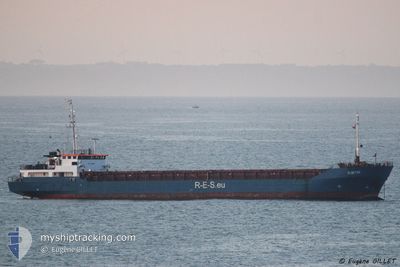
GULF WIND
General Cargo
Current Trip
| Time Travelled | 6 days |
|---|---|
| Remaining Time | --- |
| Distance Travelled | 891.45 nm |
| Remaining Distance | --- |
| AVG Speed | 5.8 Knots |
| MAX Speed | 10 Knots |
| AVG Wind | 21.5 knots |
| MAX Wind | 27.7 knots |
| MIN Temp | 0.5°C / 32.9°F |
| MAX Temp | 15.8°C / 60.44°F |
| Draught | 3.7 m |
| Position Received | 2 h, 13 m ago |
Current Position
| Longitude | 26.48796° |
|---|---|
| Latitude | 40.22633° |
| Status | Under way using engine |
| Speed | 8.5 Knots |
| Course | 58.3° |
| Area | Sea of Marmara |
| Station | T-AIS |
| Position Received | 2 h, 13 m ago |
Info
Information
The current position of GULF WIND is in Sea of Marmara with coordinates 40.22633° / 26.48796° as reported on 2025-02-07 18:19 by AIS to our vessel tracker app. The vessel's current speed is 8.5 Knots and is heading at the port of YALOVA. The estimated time of arrival as calculated by MyShipTracking vessel tracking app is 2025-02-08 04:00 LT
The vessel GULF WIND (IMO: 8818075, MMSI: 304655000) is a General Cargo that was built in 1990 ( 35 years old ). It's sailing under the flag of [AG] Antigua Barbuda.
In this page you can find informations about the vessels current position, last detected port calls, and current voyage information. If the vessels is not in coverage by AIS you will find the latest position.
The current position of GULF WIND is detected by our AIS receivers and we are not responsible for the reliability of the data. The last position was recorded while the vessel was in Coverage by the Ais receivers of our vessel tracking app.
The current draught of GULF WIND as reported by AIS is 3.7 meters
Weather
| Temperature | 2.3°C / 36.14°F |
|---|---|
| Wind Speed | 13 knots |
| Direction | 28° NNE |
| Pressure | 1036.8 hPa |
| Humidity | 70 % |
| Cloud Coverage | 10 % |
Featured Company
Last Port Calls
| Port | Arrival | Departure | Time In Port |
|---|---|---|---|
| 2025-01-31 06:34 | 2025-02-01 18:04 | 1 d | |
| 2025-01-12 12:27 | 2025-01-18 12:04 | 5 d | |
| 2025-01-08 20:08 | 2025-01-10 03:16 | 1 d | |
| 2024-12-31 07:53 | 2025-01-02 14:21 | 2 d | |
| 2024-12-27 22:09 | 2024-12-29 21:41 | 1 d | |
| 2024-12-15 22:03 | 2024-12-20 19:19 | 4 d | |
| 2024-12-02 16:16 | 2024-12-04 04:21 | 1 d |
Most Visited Ports (Last year)
| Port | Arrivals | |
|---|---|---|
| 2 | ||
| 2 | ||
| 2 | ||
| 2 | ||
| 2 | ||
| 1 |
Last Trips
| Origin | Departure | Destination | Arrival | Distance | |
|---|---|---|---|---|---|
| 2025-01-18 12:04 | 2025-01-31 06:34 | 1409.90 nm | |||
| 2025-01-10 03:16 | 2025-01-12 12:27 | 399.68 nm | |||
| 2025-01-02 14:21 | 2025-01-08 20:08 | 640.51 nm | |||
| 2024-12-29 21:41 | 2024-12-31 07:53 | 247.78 nm | |||
| 2024-12-20 19:19 | 2024-12-27 22:09 | 253.55 nm | |||
| 2024-12-04 04:21 | 2024-12-15 22:03 | 1476.15 nm | |||
| 2024-11-26 12:55 | 2024-12-02 16:16 | 234.19 nm |
Events
| Time | Event | Details | Position / Dest | Info |
|---|---|---|---|---|
| 2025-02-07 18:22 | Status Changed | Default Under way using engine |
40.23031 / 26.49495
TRYAL
|
Speed: 8.5 kn Course: 58.3° |
| 2025-02-07 18:19 | OUT of Coverage |
40.22633 / 26.48796
Sea of Marmara
TRYAL
|
Speed: 8.5 kn Course: 58.3° |
|
| 2025-02-07 17:14 | Status Changed | Under way using engine Default |
40.14296 / 26.38985
TRYAL
|
Speed: 5.2 kn Course: 17° |
| 2025-02-07 17:10 | Status Changed | Default Under way using engine |
40.13534 / 26.38766
TRYAL
|
Speed: 5.2 kn Course: 17° |
| 2025-02-07 16:16 | Change Sea Area | Turkish part of the Sea of Marmara Turkish part of the Aegean Sea |
40.05779 / 26.31366
Sea of Marmara
TRYAL
|
Speed: 8.6 kn Course: 38.5° |
| 2025-02-07 16:15 | Status Changed | Under way using engine Default |
40.05655 / 26.31237
TRYAL
|
Speed: 9.7 kn Course: 51° |
| 2025-02-07 16:15 | IN Coverage |
40.05779 / 26.31366
Sea of Marmara
TRYAL
|
Speed: 8.6 kn Course: 38.5° |
|
| 2025-02-07 14:47 | Status Changed | Default Under way using engine |
39.96688 / 26.13874
TRYAL
|
Speed: 4.9 kn Course: 28° |
| 2025-02-07 14:40 | Status Changed | Under way using engine Default |
39.95735 / 26.13273
TRYAL
|
Speed: 5.6 kn Course: 17° |
| 2025-02-07 14:40 | OUT of Coverage |
39.95735 / 26.13273
Aegean Sea
TRYAL
|
Speed: 4.9 kn Course: 26.2° |