
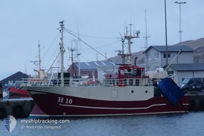
HANNE
Fishing
Current Trip
KEEP CLEAR 03NM
| Time Travelled | 16 h, 57 mins |
|---|---|
| Remaining Time | --- |
| Distance Travelled | 59.60 nm |
| Remaining Distance | --- |
| AVG Speed | 5.7 Knots |
| MAX Speed | 7.8 Knots |
| AVG Wind | 10.8 knots |
| MAX Wind | 15 knots |
| MIN Temp | -0.9°C / 30.38°F |
| MAX Temp | 0.3°C / 32.54°F |
| Draught | 3 m |
| Position Received | 1 m ago |
Current Position
| Longitude | 11.93961° |
|---|---|
| Latitude | 56.70743° |
| Status | Engaged in Fishing |
| Speed | 2.4 Knots |
| Course | 66° |
| Area | Kattegat |
| Station | T-AIS |
| Position Received | 1 m ago |
Info
Information
The current position of HANNE is in Kattegat with coordinates 56.70743° / 11.93961° as reported on 2026-01-05 03:48 by AIS to our vessel tracker app. The vessel's current speed is 2.4 Knots
The vessel HANNE (MMSI: 219004128) is a Fishing It's sailing under the flag of [DK] Denmark.
In this page you can find informations about the vessels current position, last detected port calls, and current voyage information. If the vessels is not in coverage by AIS you will find the latest position.
The current position of HANNE is detected by our AIS receivers and we are not responsible for the reliability of the data. The last position was recorded while the vessel was in Coverage by the Ais receivers of our vessel tracking app.
The current draught of HANNE as reported by AIS is 3 meters
Weather
| Temperature | -0.7°C / 30.74°F |
|---|---|
| Wind Speed | 13 knots |
| Direction | 116° ESE |
| Pressure | 1006.8 hPa |
| Humidity | 92.8 % |
| Cloud Coverage | 100 % |
Featured Company
Last Port Calls
| Port | Arrival | Departure | Time In Port |
|---|---|---|---|
| 2025-12-18 05:34 | 2026-01-04 11:53 | 17 d | |
| 2025-12-16 04:20 | |||
| 2025-12-09 12:08 | |||
| 2025-12-04 07:56 | 2025-12-07 14:10 | 3 d | |
| 2025-11-27 07:20 | 2025-12-02 14:16 | 5 d | |
| 2025-11-20 07:28 | 2025-11-24 13:22 | 4 d | |
| 2025-11-18 08:53 | 2025-11-18 13:01 | 4 h | |
| 2025-11-12 06:15 | 2025-11-16 14:01 | 4 d | |
| 2025-11-11 09:16 | 2025-11-11 14:35 | 5 h | |
| 2025-11-10 09:46 | 2025-11-10 13:00 | 3 h |
Last Trips
| Origin | Departure | Destination | Arrival | Distance | |
|---|---|---|---|---|---|
| 2025-12-16 04:20 | 2025-12-18 05:34 | 161.88 nm | |||
| 2025-12-02 14:16 | 2025-12-04 07:56 | 8.06 nm | |||
| 2025-11-24 13:22 | 2025-11-27 07:20 | 16.14 nm | |||
| 2025-11-18 13:01 | 2025-11-20 07:28 | 25.74 nm | |||
| 2025-11-16 14:01 | 2025-11-18 08:53 | 14.07 nm | |||
| 2025-11-11 14:35 | 2025-11-12 06:15 | 12.02 nm | |||
| 2025-11-10 13:00 | 2025-11-11 09:16 | 27.40 nm | |||
| 2025-11-09 13:22 | 2025-11-10 09:46 | 12.53 nm | |||
| 2025-11-06 14:41 | 2025-11-07 06:32 | 68.64 nm | |||
| 2025-11-05 13:32 | 2025-11-06 13:05 | 62.06 nm |
Events
| Time | Event | Details | Position / Dest | Info |
|---|---|---|---|---|
| 2026-01-04 22:09 | START Moving |
56.62259 / 11.63599
KEEP CLEAR 03NM
|
Speed: 3.1 kn Course: 348° |
|
| 2026-01-04 22:00 | STOP Moving |
56.61901 / 11.63570
KEEP CLEAR 03NM
|
Speed: 0.2 kn Course: 29° |
|
| 2026-01-04 10:53 | PORT DEPARTURE |
|
56.13119 / 12.31172
KEEP CLEAR 03NM
|
Speed: 5.2 kn Course: 343° |
| 2026-01-04 10:52 | START Moving |
56.12912 / 12.31116
[DK] GILLELEJE
|
Speed: 5.6 kn Course: 2° |