
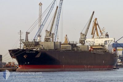
HAO HUNG 66
Wood Chips Carrier
Current Trip
| Trip Time | 1 day |
|---|---|
| Trip Distance | 170.67 nm |
| AVG Speed | 8.3 Knots |
| MAX Speed | 9.7 Knots |
| Draught | 6.8 m |
| AVG Wind | 5.8 knots |
| MAX Wind | 10 knots |
| MIN Temp | 19.7°C / 67.46°F |
| MAX Temp | 24°C / 75.2°F |
| Position Received | 2 d ago |
Current Position
| Longitude | 107.08791° |
|---|---|
| Latitude | 20.88818° |
| Status | Under way using engine |
| Speed | 7.3 Knots |
| Course | 159.8° |
| Area | South China Sea |
| Station | T-AIS |
| Position Received | 2 d ago |
Info
Information
The current position of HAO HUNG 66 is in South China Sea with coordinates 20.88818° / 107.08791° as reported on 2025-03-01 06:32 by AIS to our vessel tracker app. The vessel's current speed is 7.3 Knots and is currently inside the port of TIESHAN.
The vessel HAO HUNG 66 (IMO: 9145671, MMSI: 356570000) is a Wood Chips Carrier that was built in 1996 ( 29 years old ). It's sailing under the flag of [PA] Panama.
In this page you can find informations about the vessels current position, last detected port calls, and current voyage information. If the vessels is not in coverage by AIS you will find the latest position.
The current position of HAO HUNG 66 is detected by our AIS receivers and we are not responsible for the reliability of the data. The last position was recorded while the vessel was in Coverage by the Ais receivers of our vessel tracking app.
The current draught of HAO HUNG 66 as reported by AIS is 6.8 meters
Weather
| Temperature | 24°C / 75.2°F |
|---|---|
| Wind Speed | 5 knots |
| Direction | 246° WSW |
| Pressure | 1006.9 hPa |
| Humidity | 76.2 % |
| Cloud Coverage | 10 % |
Featured Company
Last Trips
| Origin | Departure | Destination | Arrival | Distance | |
|---|---|---|---|---|---|
| 2025-03-01 13:01 | 2025-03-02 20:09 | 170.67 nm | |||
| 2025-02-16 22:17 | 2025-02-27 08:21 | 208.35 nm | |||
| 2025-02-10 07:49 | 2025-02-13 21:25 | 389.86 nm | |||
| 2025-02-07 12:37 | 2025-02-08 12:57 | 129.10 nm | |||
| 2024-12-15 18:20 | 2025-02-05 10:21 | 152.86 nm |
Events
| Time | Event | Details | Position / Dest | Info |
|---|---|---|---|---|
| 2025-03-02 12:09 | STOP Moving |
21.49294 / 109.55741
[CN] TIESHAN
|
Speed: 0.3 kn Course: 204° |
|
| 2025-03-02 12:09 | PORT ARRIVAL |
|
21.49294 / 109.55741
[CN] TIESHAN
|
Speed: 0.7 kn Course: 219° |
| 2025-03-02 09:53 | START Moving | 13.74 nm, South of TIESHAN |
21.27572 / 109.48145
VNDQT
|
Speed: 5 kn Course: 45° |
| 2025-03-02 01:41 | STOP Moving | 13.97 nm, South of TIESHAN |
21.27248 / 109.47872
VNDQT
|
Speed: 0.2 kn Course: 31° |
| 2025-03-01 09:37 | START Moving | 11.94 nm, South East of HON GAI |
20.78365 / 107.15479
VNDQT
|
Speed: 6.7 kn Course: 157° |
| 2025-03-01 07:33 | STOP Moving | 11.37 nm, South East of HON GAI |
20.79501 / 107.15659
VNDQT
|
Speed: 0.1 kn Course: 168° |
| 2025-03-01 06:38 | Status Changed | Default Under way using engine |
20.87597 / 107.09272
VNDQT
|
Speed: 7.3 kn Course: 159.8° |
| 2025-03-01 06:32 | OUT of Coverage |
20.88818 / 107.08791
South China Sea
|
Speed: 7.3 kn Course: 159.8° |
|
| 2025-03-01 06:30 | Status Changed | Under way using engine Default |
20.89034 / 107.08709
VNDQT
|
Speed: 6.4 kn Course: 161° |
| 2025-03-01 06:29 | Status Changed | Default Under way using engine |
20.89266 / 107.08621
VNDQT
|
Speed: 7.9 kn Course: 159.6° |