
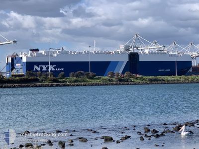
HARVEST LEADER
Cargo
Current Trip
| Time Travelled | 5 days |
|---|---|
| Remaining Time | --- |
| Distance Travelled | 1655.34 nm |
| Remaining Distance | --- |
| AVG Speed | 12.5 Knots |
| MAX Speed | 19.8 Knots |
| AVG Wind | 9.6 knots |
| MAX Wind | 25.8 knots |
| MIN Temp | 9.5°C / 49.1°F |
| MAX Temp | 16.5°C / 61.7°F |
| Draught | 8.1 m |
| Position Received | 2 d ago |
Current Position
| Longitude | -123.77087° |
|---|---|
| Latitude | 37.56460° |
| Status | Under way using engine |
| Speed | 14.4 Knots |
| Course | 270.2° |
| Area | North Pacific Ocean |
| Station | T-AIS |
| Position Received | 2 d ago |
Information
The current position of HARVEST LEADER is in North Pacific Ocean with coordinates 37.56460° / -123.77087° as reported on 2025-06-05 08:53 by AIS to our vessel tracker app. The vessel's current speed is 14.4 Knots and is heading at the port of YOKOSUKA. The estimated time of arrival as calculated by MyShipTracking vessel tracking app is 2025-06-20 10:30 LT
The vessel HARVEST LEADER (IMO: 9690523, MMSI: 311000187) is a Cargo It's sailing under the flag of [BS] Bahamas.
In this page you can find informations about the vessels current position, last detected port calls, and current voyage information. If the vessels is not in coverage by AIS you will find the latest position.
The current position of HARVEST LEADER is detected by our AIS receivers and we are not responsible for the reliability of the data. The last position was recorded while the vessel was in Coverage by the Ais receivers of our vessel tracking app.
The current draught of HARVEST LEADER as reported by AIS is 8.1 meters
Weather
| Temperature | 9.5°C / 49.1°F |
|---|---|
| Wind Speed | 8 knots |
| Direction | 320° NW |
| Pressure | 1030.6 hPa |
| Humidity | 79.2 % |
| Cloud Coverage | 100 % |
Featured Company
Last Port Calls
| Port | Arrival | Departure | Time In Port |
|---|---|---|---|
| 2025-06-02 13:45 | 2025-06-02 22:13 | 8 h | |
| 2025-05-30 11:44 | 2025-05-30 19:44 | 7 h | |
| 2025-05-16 21:14 | 2025-05-18 06:10 | 1 d | |
| 2025-05-15 08:16 | 2025-05-16 07:17 | 23 h | |
| 2025-05-14 22:23 | 2025-05-15 07:22 | 8 h | |
| 2025-04-22 12:50 | 2025-04-23 00:32 | 11 h | |
| 2025-04-18 11:28 | 2025-04-18 21:13 | 9 h | |
| 2025-04-16 11:24 | 2025-04-17 03:12 | 15 h | |
| 2025-04-03 20:06 | 2025-04-04 06:42 | 10 h |
Last Trips
| Origin | Departure | Destination | Arrival | Distance | |
|---|---|---|---|---|---|
| 2025-05-30 12:44 | 2025-06-02 06:45 | 954.41 nm | |||
| 2025-05-18 15:10 | 2025-05-30 04:44 | 4210.09 nm | |||
| 2025-05-16 16:17 | 2025-05-17 06:14 | 190.64 nm | |||
| 2025-05-15 16:22 | 2025-05-15 17:16 | 6.48 nm | |||
| 2025-04-22 17:32 | 2025-05-15 07:23 | 5011.55 nm | |||
| 2025-04-18 14:13 | 2025-04-22 05:50 | 1156.90 nm | |||
| 2025-04-16 20:12 | 2025-04-18 04:28 | 397.48 nm | |||
| 2025-04-04 15:42 | 2025-04-16 04:24 | 4229.50 nm | |||
| 2025-03-31 17:11 | 2025-04-04 05:06 | 464.95 nm |
Events
| Time | Event | Details | Position / Dest | Info |
|---|---|---|---|---|
| 2025-06-05 09:00 | Status Changed | Default Under way using engine |
37.56479 / -123.80590
JP YOS
|
Speed: 14.4 kn Course: 270.2° |
| 2025-06-05 08:53 | OUT of Coverage |
37.56460 / -123.77087
North Pacific Ocean
JP YOS
|
Speed: 14.4 kn Course: 270.2° |
|
| 2025-06-05 08:49 | Status Changed | Under way using engine Default |
37.56454 / -123.75253
JP YOS
|
Speed: 14.6 kn Course: 270° |
| 2025-06-05 08:48 | Status Changed | Default Under way using engine |
37.56462 / -123.74844
JP YOS
|
Speed: 14.5 kn Course: 270.5° |
| 2025-06-05 08:41 | Status Changed | Under way using engine Default |
37.56432 / -123.71091
JP YOS
|
Speed: 14.4 kn Course: 270° |
| 2025-06-05 08:30 | Status Changed | Default Under way using engine |
37.56459 / -123.65286
JP YOS
|
Speed: 14.5 kn Course: 269.2° |
| 2025-06-05 07:56 | Status Changed | Under way using engine Default |
37.56439 / -123.48245
JP YOS
|
Speed: 14.9 kn Course: 272° |
| 2025-06-05 07:43 | Status Changed | Default Under way using engine |
37.56366 / -123.41825
JP YOS
|
Speed: 16.4 kn Course: 269.8° |
| 2025-06-05 07:21 | Status Changed | Under way using engine Default |
37.56433 / -123.29706
JP YOS
|
Speed: 14.7 kn Course: 273° |
| 2025-06-05 07:19 | Status Changed | Default Under way using engine |
37.56408 / -123.28453
JP YOS
|
Speed: 12.7 kn Course: 270.8° |