
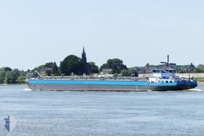
HELGA DEYMANN
Tanker
Current Trip
LADEN LOSSEN
| Time Travelled | 2 days |
|---|---|
| Remaining Time | --- |
| Distance Travelled | 178.05 nm |
| Remaining Distance | --- |
| AVG Speed | 11.1 Knots |
| MAX Speed | 12.4 Knots |
| AVG Wind | 4.4 knots |
| MAX Wind | 8 knots |
| MIN Temp | 6.9°C / 44.42°F |
| MAX Temp | 13.1°C / 55.58°F |
| Draught | 0.2 m |
| Position Received | 1 d ago |
Current Position
| Longitude | 7.94399° |
|---|---|
| Latitude | 49.97319° |
| Status | Under way using engine |
| Speed | 10.3 Knots |
| Course | 246.9° |
| Area | North Sea |
| Station | T-AIS |
| Position Received | 1 d ago |
Info
Information
The current position of HELGA DEYMANN is in North Sea with coordinates 49.97319° / 7.94399° as reported on 2025-02-22 15:08 by AIS to our vessel tracker app. The vessel's current speed is 10.3 Knots
The vessel HELGA DEYMANN (MMSI: 211519100) is a Tanker It's sailing under the flag of [DE] Germany.
In this page you can find informations about the vessels current position, last detected port calls, and current voyage information. If the vessels is not in coverage by AIS you will find the latest position.
The current position of HELGA DEYMANN is detected by our AIS receivers and we are not responsible for the reliability of the data. The last position was recorded while the vessel was in Coverage by the Ais receivers of our vessel tracking app.
The current draught of HELGA DEYMANN as reported by AIS is 0.2 meters
Weather
| Temperature | 10.3°C / 50.54°F |
|---|---|
| Wind Speed | 6 knots |
| Direction | 191° S |
| Pressure | 1019.5 hPa |
| Humidity | 85.2 % |
| Cloud Coverage | 100 % |
Featured Company
Last Port Calls
| Port | Arrival | Departure | Time In Port |
|---|---|---|---|
| 2025-02-20 18:31 | 2025-02-21 12:51 | 18 h | |
| 2025-02-19 07:55 | 2025-02-19 08:36 | 41 m | |
| 2025-02-14 03:01 | 2025-02-14 03:52 | 51 m | |
| 2025-02-13 19:43 | 2025-02-13 20:31 | 47 m | |
| 2025-02-12 13:47 | 2025-02-13 10:07 | 20 h | |
| 2025-02-11 05:18 | 2025-02-12 07:55 | 1 d | |
| 2025-02-06 03:05 | 2025-02-10 21:31 | 4 d | |
| 2025-02-05 10:28 | 2025-02-05 11:13 | 45 m | |
| 2025-02-04 13:33 | 2025-02-05 08:48 | 19 h | |
| 2025-02-04 02:54 | 2025-02-04 03:43 | 49 m |
Most Visited Ports (Last year)
| Port | Arrivals | |
|---|---|---|
| 27 | ||
| 25 | ||
| 23 | ||
| 10 | ||
| 10 | ||
| 9 |
Last Trips
| Origin | Departure | Destination | Arrival | Distance | |
|---|---|---|---|---|---|
| 2025-02-19 09:36 | 2025-02-20 19:31 | 132.06 nm | |||
| 2025-02-14 04:52 | 2025-02-19 08:55 | 312.86 nm | |||
| 2025-02-13 21:31 | 2025-02-14 04:01 | 40.13 nm | |||
| 2025-02-13 11:07 | 2025-02-13 20:43 | 75.45 nm | |||
| 2025-02-12 08:55 | 2025-02-12 14:47 | 51.47 nm | |||
| 2025-02-10 22:31 | 2025-02-11 06:18 | 54.20 nm | |||
| 2025-02-05 12:13 | 2025-02-06 04:05 | 162.29 nm | |||
| 2025-02-05 09:48 | 2025-02-05 11:28 | 15.12 nm | |||
| 2025-02-04 04:43 | 2025-02-04 14:33 | 56.38 nm | |||
| 2025-02-03 19:58 | 2025-02-04 03:54 | 42.14 nm |
Events
| Time | Event | Details | Position / Dest | Info |
|---|---|---|---|---|
| 2025-02-22 15:08 | OUT of Coverage |
49.97319 / 7.94399
North Sea
|
Speed: 10.3 kn Course: 246.9° |
|
| 2025-02-22 11:50 | IN Coverage |
49.72137 / 8.43780
North Sea
|
Speed: 11.9 kn Course: 41.5° |
|
| 2025-02-22 10:45 | OUT of Coverage |
49.55789 / 8.41322
North Sea
|
Speed: 11.8 kn Course: 357.3° |
|
| 2025-02-22 06:04 | IN Coverage |
48.84113 / 8.11537
North Sea
|
Speed: 9.1 kn Course: 5° |
|
| 2025-02-22 02:04 | OUT of Coverage |
48.83038 / 8.11302
North Sea
|
Speed: Course: 28.7° |
|
| 2025-02-22 02:04 | STOP Moving | 5.44 nm, South of MUNCHHAUSEN |
48.83037 / 8.11302
LADEN LOSSEN
|
Speed: 0.1 kn Course: 511° |
| 2025-02-22 01:16 | Status Changed | Under way using engine Default |
48.76169 / 8.01583
LADEN LOSSEN
|
Speed: 10.3 kn Course: 104° |
| 2025-02-22 01:12 | IN Coverage |
48.76169 / 8.01583
North Sea
|
Speed: 10.1 kn Course: 54.3° |
|
| 2025-02-21 14:36 | OUT of Coverage |
47.76846 / 7.52663
North Sea
|
Speed: Course: 0° |
|
| 2025-02-21 14:35 | STOP Moving | 10.46 nm, North of HUNINGUE |
47.76849 / 7.52667
LADEN LOSSEN
|
Speed: Course: 511° |