

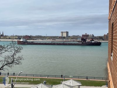
HERBERT C JACKSON
Self Discharging Bulk Carrier
Current Trip
USFPT>USPSS
| Time Travelled | 14 h, 42 mins |
|---|---|
| Remaining Time | --- |
| Distance Travelled | 164.79 nm |
| Remaining Distance | --- |
| AVG Speed | 9.9 Knots |
| MAX Speed | 12.7 Knots |
| AVG Wind | 11 knots |
| MAX Wind | 14.9 knots |
| MIN Temp | 9.8°C / 49.64°F |
| MAX Temp | 18.9°C / 66.02°F |
| Draught | 6.4 m |
| Position Received | 7 h, 47 m ago |
Current Position
| Longitude | -82.45311° |
|---|---|
| Latitude | 43.34790° |
| Status | Under way using engine |
| Speed | 12.4 Knots |
| Course | 352.7° |
| Area | --- |
| Station | T-AIS |
| Position Received | 7 h, 47 m ago |
Information
The current position of HERBERT C JACKSON is in --- with coordinates 43.34790° / -82.45311° as reported on 2025-06-10 17:19 by AIS to our vessel tracker app. The vessel's current speed is 12.4 Knots
The vessel HERBERT C JACKSON (IMO: 5148417, MMSI: 366904930) is a Self Discharging Bulk Carrier that was built in 1959 ( 66 years old ). It's sailing under the flag of [US] USA.
In this page you can find informations about the vessels current position, last detected port calls, and current voyage information. If the vessels is not in coverage by AIS you will find the latest position.
The current position of HERBERT C JACKSON is detected by our AIS receivers and we are not responsible for the reliability of the data. The last position was recorded while the vessel was in Coverage by the Ais receivers of our vessel tracking app.
The current draught of HERBERT C JACKSON as reported by AIS is 6.4 meters
Weather
| Temperature | 10.3°C / 50.54°F |
|---|---|
| Wind Speed | 5 knots |
| Direction | 145° SE |
| Pressure | 1011.9 hPa |
| Humidity | 86 % |
| Cloud Coverage | 100 % |
Featured Company
Last Port Calls
| Port | Arrival | Departure | Time In Port |
|---|---|---|---|
| 2025-06-10 05:34 | 2025-06-10 06:24 | 49 m | |
| 2025-06-09 13:13 | 2025-06-09 20:25 | 7 h | |
| 2025-06-07 18:04 | 2025-06-08 06:12 | 12 h | |
| 2025-06-03 16:58 | 2025-06-03 20:15 | 3 h | |
| 2025-06-02 18:05 | 2025-06-03 09:51 | 15 h | |
| 2025-06-02 00:00 | 2025-06-02 09:51 | 9 h | |
| 2025-05-30 13:20 | 2025-05-31 06:52 | 17 h | |
| 2025-05-29 07:25 | 2025-05-29 17:13 | 9 h | |
| 2025-05-23 19:47 | 2025-05-24 12:33 | 16 h | |
| 2025-05-22 20:44 | 2025-05-23 12:48 | 16 h |
Last Trips
| Origin | Departure | Destination | Arrival | Distance | |
|---|---|---|---|---|---|
| 2025-06-09 20:25 | 2025-06-10 05:34 | 103.30 nm | |||
| 2025-06-08 06:12 | 2025-06-09 13:13 | 359.96 nm | |||
| 2025-06-03 20:15 | 2025-06-07 18:04 | 760.42 nm | |||
| 2025-06-03 09:51 | 2025-06-03 16:58 | 75.84 nm | |||
| 2025-06-02 09:51 | 2025-06-02 18:05 | 91.55 nm | |||
| 2025-05-31 06:52 | 2025-06-02 00:00 | 387.83 nm | |||
| 2025-05-29 17:13 | 2025-05-30 13:20 | 239.94 nm | |||
| 2025-05-24 12:33 | 2025-05-29 07:25 | 874.37 nm | |||
| 2025-05-23 12:48 | 2025-05-23 19:47 | 73.26 nm | |||
| 2025-05-22 00:16 | 2025-05-22 20:44 | 55.88 nm |
Events
| Time | Event | Details | Position / Dest | Info |
|---|---|---|---|---|
| 2025-06-10 17:25 | Status Changed | Default Under way using engine |
43.36620 / -82.45615
USFPT>USPSS
|
Speed: 12.4 kn Course: 352.7° |
| 2025-06-10 17:19 | OUT of Coverage |
43.34790 / -82.45311
USFPT>USPSS
|
Speed: 12.4 kn Course: 352.7° |
|
| 2025-06-10 13:17 | Status Changed | Under way using engine Default |
42.66271 / -82.50981
USFPT>USPSS
|
Speed: 10.2 kn Course: 10° |
| 2025-06-10 13:09 | Status Changed | Default Under way using engine |
42.64010 / -82.51026
USFPT>USPSS
|
Speed: 10.4 kn Course: 8.5° |
| 2025-06-10 12:59 | Status Changed | Under way using engine Default |
42.61205 / -82.51920
USFPT>USPSS
|
Speed: 9.9 kn Course: 49° |
| 2025-06-10 12:49 | Status Changed | Default Under way using engine |
42.59376 / -82.54366
USFPT>USPSS
|
Speed: 10.1 kn Course: 45.3° |
| 2025-06-10 10:24 | PORT DEPARTURE |
|
42.32933 / -83.00036
USFPT>USPSS
|
Speed: 10.3 kn Course: 83° |
| 2025-06-10 09:55 | ETA Changed | 2025/06/11 04:00 2025/06/11 03:00 |
42.29828 / -83.08890
[US] DETROIT
|
Speed: 10.3 kn Course: 38° |
| 2025-06-10 09:55 | Status Changed | Under way using engine Moored |
42.29828 / -83.08890
[US] DETROIT
|
Speed: 10.4 kn Course: 38° |
| 2025-06-10 09:34 | PORT ARRIVAL |
|
42.24766 / -83.12325
[US] DETROIT
|
Speed: 10.1 kn Course: 29.1° |