
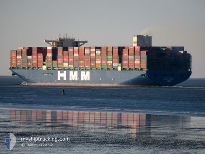
HMM ROTTERDAM
Cargo
Current Trip
| Time Travelled | 18 days |
|---|---|
| Remaining Time | 21 days |
| Distance Travelled | 3444.36 nm |
| Remaining Distance | 9316.62 nm |
| AVG Speed | 8.9 Knots |
| MAX Speed | 18.5 Knots |
| AVG Wind | 20.9 knots |
| MAX Wind | 44 knots |
| MIN Temp | 4.6°C / 40.28°F |
| MAX Temp | 20.4°C / 68.72°F |
| Draught | 12.8 m |
| Position Received | 1 d ago |
Current Position
| Longitude | -14.49554° |
|---|---|
| Latitude | 27.25133° |
| Status | Under way using engine |
| Speed | 18.5 Knots |
| Course | 227° |
| Area | North Atlantic Ocean |
| Station | T-AIS |
| Position Received | 1 d ago |
Info
Information
The current position of HMM ROTTERDAM is in North Atlantic Ocean with coordinates 27.25133° / -14.49554° as reported on 2025-02-11 13:34 by AIS to our vessel tracker app. The vessel's current speed is 18.5 Knots and is heading at the port of SINGAPORE. The estimated time of arrival as calculated by MyShipTracking vessel tracking app is 2025-03-07 09:57 LT
The vessel HMM ROTTERDAM (IMO: 9868338, MMSI: 440328000) is a Cargo It's sailing under the flag of [KR] Korea.
In this page you can find informations about the vessels current position, last detected port calls, and current voyage information. If the vessels is not in coverage by AIS you will find the latest position.
The current position of HMM ROTTERDAM is detected by our AIS receivers and we are not responsible for the reliability of the data. The last position was recorded while the vessel was in Coverage by the Ais receivers of our vessel tracking app.
The current draught of HMM ROTTERDAM as reported by AIS is 12.8 meters
Weather
| Temperature | 20.4°C / 68.72°F |
|---|---|
| Wind Speed | 17 knots |
| Direction | 346° NNW |
| Pressure | 1013 hPa |
| Humidity | 82.1 % |
| Cloud Coverage | 6 % |
Featured Company
Last Port Calls
| Port | Arrival | Departure | Time In Port |
|---|---|---|---|
| 2025-01-23 10:55 | 2025-01-25 15:46 | 2 d | |
| 2025-01-14 15:20 | 2025-01-18 18:21 | 4 d | |
| 2025-01-08 00:55 | 2025-01-11 00:51 | 2 d | |
| 2024-12-19 14:10 | 2024-12-20 03:54 | 13 h |
Last Trips
| Origin | Departure | Destination | Arrival | Distance | |
|---|---|---|---|---|---|
| 2025-01-18 19:21 | 2025-01-23 11:55 | 407.88 nm | |||
| 2025-01-11 01:51 | 2025-01-14 16:20 | 432.79 nm | |||
| 2024-12-20 04:54 | 2025-01-08 01:55 | 2006.65 nm | |||
| 2024-11-18 09:22 | 2024-12-19 15:10 | 9615.53 nm |
Events
| Time | Event | Details | Position / Dest | Info |
|---|---|---|---|---|
| 2025-02-11 13:39 | Status Changed | Default Under way using engine |
27.23490 / -14.51519
SGSIN(PWBGA)
|
Speed: 18.5 kn Course: 227° |
| 2025-02-11 13:34 | OUT of Coverage |
27.25133 / -14.49554
North Atlantic Ocean
SGSIN(PWBGA)
|
Speed: 18.5 kn Course: 227° |
|
| 2025-02-11 13:29 | Status Changed | Under way using engine Default |
27.27030 / -14.47288
SGSIN(PWBGA)
|
Speed: 18.5 kn Course: 226° |
| 2025-02-11 13:27 | Status Changed | Default Under way using engine |
27.27495 / -14.46736
SGSIN(PWBGA)
|
Speed: 18.5 kn Course: 227.4° |
| 2025-02-11 13:21 | Status Changed | Under way using engine Default |
27.29559 / -14.44239
SGSIN(PWBGA)
|
Speed: 18.5 kn Course: 228° |
| 2025-02-11 12:59 | Status Changed | Default Under way using engine |
27.37233 / -14.34943
SGSIN(PWBGA)
|
Speed: 18.5 kn Course: 227.2° |
| 2025-02-11 12:52 | Status Changed | Under way using engine Default |
27.39813 / -14.31813
SGSIN(PWBGA)
|
Speed: 18.5 kn Course: 227° |
| 2025-02-11 12:47 | Status Changed | Default Under way using engine |
27.41500 / -14.29769
SGSIN(PWBGA)
|
Speed: 18.4 kn Course: 227.3° |
| 2025-02-11 12:13 | Status Changed | Under way using engine Default |
27.53480 / -14.15260
SGSIN(PWBGA)
|
Speed: 18.5 kn Course: 227° |
| 2025-02-11 12:11 | Status Changed | Default Under way using engine |
27.54069 / -14.14549
SGSIN(PWBGA)
|
Speed: 18.5 kn Course: 226.9° |