
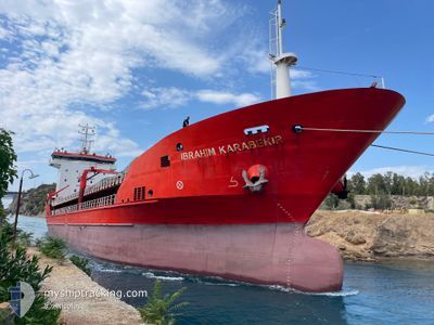
IBRAHIM KARABEKIR
General Cargo
Current Trip
TRRIZ
| Time Travelled | 12 days |
|---|---|
| Remaining Time | --- |
| Distance Travelled | 634.61 nm |
| Remaining Distance | --- |
| AVG Speed | 8.9 Knots |
| MAX Speed | 10.6 Knots |
| AVG Wind | 14.4 knots |
| MAX Wind | 34.7 knots |
| MIN Temp | -1.8°C / 28.76°F |
| MAX Temp | 11.5°C / 52.7°F |
| Draught | 4.6 m |
| Position Received | 4 d ago |
Current Position
| Longitude | 27.70554° |
|---|---|
| Latitude | 42.48551° |
| Status | Under way using engine |
| Speed | 8.9 Knots |
| Course | 276.3° |
| Area | Black Sea |
| Station | T-AIS |
| Position Received | 4 d ago |
Info
Information
The current position of IBRAHIM KARABEKIR is in Black Sea with coordinates 42.48551° / 27.70554° as reported on 2026-01-01 01:49 by AIS to our vessel tracker app. The vessel's current speed is 8.9 Knots
The vessel IBRAHIM KARABEKIR (IMO: 9275854, MMSI: 271000724) is a General Cargo that was built in 2004 ( 22 years old ). It's sailing under the flag of [TR] Turkey.
In this page you can find informations about the vessels current position, last detected port calls, and current voyage information. If the vessels is not in coverage by AIS you will find the latest position.
The current position of IBRAHIM KARABEKIR is detected by our AIS receivers and we are not responsible for the reliability of the data. The last position was recorded while the vessel was in Coverage by the Ais receivers of our vessel tracking app.
The current draught of IBRAHIM KARABEKIR as reported by AIS is 4.6 meters
Weather
| Temperature | 13°C / 55.4°F |
|---|---|
| Wind Speed | 8 knots |
| Direction | 187° S |
| Pressure | 1014.4 hPa |
| Humidity | 73.8 % |
| Cloud Coverage | 100 % |
Featured Company
Last Port Calls
| Port | Arrival | Departure | Time In Port |
|---|---|---|---|
| 2025-12-23 08:38 | 2025-12-24 17:56 | 1 d | |
| 2025-12-16 10:31 | 2025-12-21 00:58 | 4 d | |
| 2025-12-02 12:03 | 2025-12-12 04:05 | 9 d | |
| 2025-11-17 20:08 | 2025-11-22 10:13 | 4 d | |
| 2025-11-14 10:04 | 2025-11-16 08:48 | 1 d | |
| 2025-11-08 00:48 | 2025-11-12 01:32 | 4 d | |
| 2025-11-03 16:31 |
Last Trips
| Origin | Departure | Destination | Arrival | Distance | |
|---|---|---|---|---|---|
| 2025-12-21 00:58 | 2025-12-23 08:38 | 580.44 nm | |||
| 2025-12-12 04:05 | 2025-12-16 10:31 | 652.43 nm | |||
| 2025-11-22 10:13 | 2025-12-02 12:03 | 698.68 nm | |||
| 2025-11-16 08:48 | 2025-11-17 20:08 | 224.03 nm | |||
| 2025-11-12 01:32 | 2025-11-14 10:04 | 214.35 nm | |||
| 2025-11-03 16:31 | 2025-11-08 00:48 | 289.55 nm |
Events
| Time | Event | Details | Position / Dest | Info |
|---|---|---|---|---|
| 2026-01-01 02:46 | STOP Moving | 3.25 nm, North East of BURGAS |
42.49338 / 27.55095
TRRIZ
|
Speed: 0.3 kn Course: 337° |
| 2026-01-01 01:57 | Status Changed | Default Under way using engine |
42.48430 / 27.67911
TRRIZ
|
Speed: 8.9 kn Course: 276.3° |
| 2026-01-01 01:49 | OUT of Coverage |
42.48551 / 27.70554
Black Sea
|
Speed: 8.9 kn Course: 276.3° |
|
| 2026-01-01 01:44 | Status Changed | Under way using engine Default |
42.48077 / 27.72065
TRRIZ
|
Speed: 9.6 kn Course: 309° |
| 2026-01-01 01:41 | Status Changed | Default Under way using engine |
42.47573 / 27.73158
TRRIZ
|
Speed: 9.7 kn Course: 311.1° |
| 2026-01-01 01:35 | Change Sea Area | Bulgarian part of the Black Sea Turkish part of the Black Sea |
42.46652 / 27.74653
Black Sea
|
Speed: 9.7 kn Course: 311.1° |
| 2026-01-01 01:34 | Status Changed | Under way using engine Default |
42.46418 / 27.75028
TRRIZ
|
Speed: 9.8 kn Course: 310° |
| 2026-01-01 01:20 | IN Coverage |
42.46652 / 27.74653
Black Sea
|
Speed: 9.7 kn Course: 311.1° |
|
| 2025-12-30 06:37 | START Moving | 1.7 nm, South East of SINOP |
41.99963 / 35.16407
TRRIZ
|
Speed: 9.1 kn Course: 94° |