
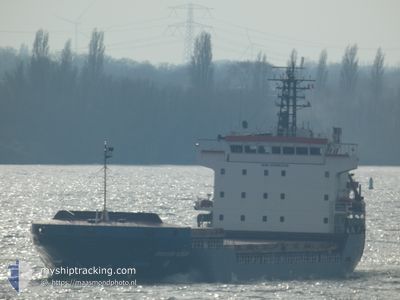
IBRAHIM KONAN
General Cargo
Current Trip
BGBOJ
| Time Travelled | 7 h, 39 mins |
|---|---|
| Remaining Time | --- |
| Distance Travelled | 72.25 nm |
| Remaining Distance | --- |
| AVG Speed | 10 Knots |
| MAX Speed | 10.6 Knots |
| AVG Wind | 10.9 knots |
| MAX Wind | 16 knots |
| MIN Temp | 11.5°C / 52.7°F |
| MAX Temp | 15.4°C / 59.72°F |
| Draught | 6.9 m |
| Position Received | 5 d ago |
Current Position
| Longitude | 30.73523° |
|---|---|
| Latitude | 42.38129° |
| Status | Under way using engine |
| Speed | 9.1 Knots |
| Course | 274.3° |
| Area | Black Sea |
| Station | T-AIS |
| Position Received | 5 d ago |
Info
Information
The current position of IBRAHIM KONAN is in Black Sea with coordinates 42.38129° / 30.73523° as reported on 2025-03-09 21:47 by AIS to our vessel tracker app. The vessel's current speed is 9.1 Knots
The vessel IBRAHIM KONAN (IMO: 9306328, MMSI: 357224000) is a General Cargo that was built in 2006 ( 19 years old ). It's sailing under the flag of [PA] Panama.
In this page you can find informations about the vessels current position, last detected port calls, and current voyage information. If the vessels is not in coverage by AIS you will find the latest position.
The current position of IBRAHIM KONAN is detected by our AIS receivers and we are not responsible for the reliability of the data. The last position was recorded while the vessel was in Coverage by the Ais receivers of our vessel tracking app.
The current draught of IBRAHIM KONAN as reported by AIS is 6.9 meters
Weather
| Temperature | 11.8°C / 53.24°F |
|---|---|
| Wind Speed | 11 knots |
| Direction | 177° S |
| Pressure | 1016.2 hPa |
| Humidity | 75 % |
| Cloud Coverage | 14 % |
Featured Company
Last Port Calls
| Port | Arrival | Departure | Time In Port |
|---|---|---|---|
| 2025-03-10 15:53 | 2025-03-14 19:41 | 4 d | |
| 2025-02-10 14:03 | 2025-02-10 21:28 | 7 h | |
| 2025-02-02 15:36 | 2025-02-04 18:15 | 2 d | |
| 2025-01-17 00:58 | 2025-01-30 19:21 | 13 d |
Last Trips
| Origin | Departure | Destination | Arrival | Distance | |
|---|---|---|---|---|---|
| 2025-02-10 21:28 | 2025-03-10 15:53 | 2748.80 nm | |||
| 2025-02-04 18:15 | 2025-02-10 14:03 | 1305.96 nm | |||
| 2025-01-30 19:21 | 2025-02-02 15:36 | 571.91 nm | |||
| 2024-12-29 02:05 | 2025-01-17 00:58 | 3116.39 nm |
Events
| Time | Event | Details | Position / Dest | Info |
|---|---|---|---|---|
| 2025-03-14 17:41 | PORT DEPARTURE |
|
42.47545 / 27.52445
BGBOJ
|
Speed: 9.2 kn Course: 85° |
| 2025-03-14 17:22 | START Moving |
42.48385 / 27.48040
[BG] BURGAS
|
Speed: 5 kn Course: 163° |
|
| 2025-03-10 14:37 | STOP Moving |
42.48751 / 27.47415
[BG] BURGAS
|
Speed: Course: 271° |
|
| 2025-03-10 13:53 | PORT ARRIVAL |
|
42.47579 / 27.51377
[BG] BURGAS
|
Speed: 6.2 kn Course: 260° |
| 2025-03-09 22:01 | Status Changed | Default Under way using engine |
42.38353 / 30.68917
BGBOJ
|
Speed: 9.1 kn Course: 274.3° |
| 2025-03-09 21:47 | OUT of Coverage |
42.38129 / 30.73523
Black Sea
BGBOJ
|
Speed: 9.1 kn Course: 274.3° |
|
| 2025-03-09 21:44 | Status Changed | Under way using engine Default |
42.38072 / 30.74599
BGBOJ
|
Speed: 9 kn Course: 272° |
| 2025-03-09 21:38 | Status Changed | Default Under way using engine |
42.37973 / 30.76714
BGBOJ
|
Speed: 9.1 kn Course: 270.7° |
| 2025-03-09 20:27 | Status Changed | Under way using engine Default |
42.37092 / 31.01024
BGBOJ
|
Speed: 9 kn Course: 275° |
| 2025-03-09 20:15 | IN Coverage |
42.37098 / 31.00911
Black Sea
BGBOJ
|
Speed: 9.1 kn Course: 273.4° |