
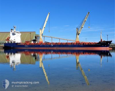
ICS SILVER LINING
General Cargo
Current Trip
| Time Travelled | 22 h, 52 mins |
|---|---|
| Remaining Time | 4 h, 5 mins |
| Distance Travelled | 274.57 nm |
| Remaining Distance | 43.77 nm |
| AVG Speed | 11.6 Knots |
| MAX Speed | 13.4 Knots |
| AVG Wind | 16 knots |
| MAX Wind | 23.7 knots |
| MIN Temp | 15.7°C / 60.26°F |
| MAX Temp | 20.1°C / 68.18°F |
| Draught | 8.6 m |
| Position Received | 1 m ago |
Current Position
| Longitude | 148.05519° |
|---|---|
| Latitude | -43.28654° |
| Status | Under way using engine |
| Speed | 10 Knots |
| Course | 214.4° |
| Area | Tasman Sea |
| Station | T-AIS |
| Position Received | 1 m ago |
Info
Information
The current position of ICS SILVER LINING is in Tasman Sea with coordinates -43.28654° / 148.05519° as reported on 2025-02-28 08:48 by AIS to our vessel tracker app. The vessel's current speed is 10 Knots and is heading at the port of HOBART. The estimated time of arrival as calculated by MyShipTracking vessel tracking app is 2025-02-28 23:54 LT
The vessel ICS SILVER LINING (IMO: 9314351, MMSI: 305593000) is a General Cargo that was built in 2005 ( 20 years old ). It's sailing under the flag of [AG] Antigua Barbuda.
In this page you can find informations about the vessels current position, last detected port calls, and current voyage information. If the vessels is not in coverage by AIS you will find the latest position.
The current position of ICS SILVER LINING is detected by our AIS receivers and we are not responsible for the reliability of the data. The last position was recorded while the vessel was in Coverage by the Ais receivers of our vessel tracking app.
The current draught of ICS SILVER LINING as reported by AIS is 8.6 meters
Weather
| Temperature | 16°C / 60.8°F |
|---|---|
| Wind Speed | 22 knots |
| Direction | 222° SW |
| Pressure | 1010.9 hPa |
| Humidity | 62.8 % |
| Cloud Coverage | 100 % |
Featured Company
Last Port Calls
| Port | Arrival | Departure | Time In Port |
|---|---|---|---|
| 2025-02-26 20:49 | 2025-02-27 20:57 | 1 d | |
| 2025-02-17 23:10 | 2025-02-24 06:02 | 6 d | |
| 2025-02-12 12:31 | 2025-02-13 05:24 | 16 h | |
| 2025-02-10 11:56 | 2025-02-11 05:29 | 17 h | |
| 2025-01-29 07:58 | 2025-02-04 20:13 | 6 d | |
| 2025-01-19 16:32 | 2025-01-20 16:48 | 1 d | |
| 2025-01-11 00:37 | 2025-01-16 07:54 | 5 d | |
| 2024-12-24 20:42 | 2024-12-30 20:34 | 5 d | |
| 2024-12-18 19:06 | 2024-12-19 17:58 | 22 h | |
| 2024-12-08 14:01 | 2024-12-12 04:11 | 3 d |
Last Trips
| Origin | Departure | Destination | Arrival | Distance | |
|---|---|---|---|---|---|
| 2025-02-24 06:02 | 2025-02-26 20:49 | 752.32 nm | |||
| 2025-02-13 05:24 | 2025-02-17 23:10 | 751.60 nm | |||
| 2025-02-11 05:29 | 2025-02-12 12:31 | 323.66 nm | |||
| 2025-02-04 20:13 | 2025-02-10 11:56 | 1038.89 nm | |||
| 2025-01-20 16:48 | 2025-01-29 07:58 | 1367.48 nm | |||
| 2025-01-16 07:54 | 2025-01-19 16:32 | 756.16 nm | |||
| 2024-12-30 20:34 | 2025-01-11 00:37 | 2079.06 nm | |||
| 2024-12-19 17:58 | 2024-12-24 20:42 | 755.21 nm | |||
| 2024-12-12 04:11 | 2024-12-18 19:06 | 1366.22 nm | |||
| 2024-11-23 09:41 | 2024-12-08 14:01 | 2092.49 nm |
Events
| Time | Event | Details | Position / Dest | Info |
|---|---|---|---|---|
| 2025-02-28 05:14 | Status Changed | Under way using engine Default |
-42.70868 / 148.32280
AU HBA
|
Speed: 11.4 kn Course: 199° |
| 2025-02-28 05:13 | Status Changed | Default Under way using engine |
-42.70368 / 148.32524
AU HBA
|
Speed: 11.5 kn Course: 197.1° |
| 2025-02-28 05:05 | Status Changed | Under way using engine Default |
-42.68132 / 148.33522
AU HBA
|
Speed: 11.5 kn Course: 198° |
| 2025-02-28 05:05 | IN Coverage |
-42.68132 / 148.33522
Tasman Sea
AU HBA
|
Speed: 11.5 kn Course: 197.1° |
|
| 2025-02-28 02:36 | Status Changed | Default Under way using engine |
-42.22527 / 148.52954
AU HBA
|
Speed: 12 kn Course: 180.6° |
| 2025-02-28 02:31 | Status Changed | Under way using engine Default |
-42.20919 / 148.52998
AU HBA
|
Speed: 12.1 kn Course: 180° |
| 2025-02-28 02:31 | OUT of Coverage |
-42.20919 / 148.52998
Tasman Sea
AU HBA
|
Speed: 12 kn Course: 180.6° |
|
| 2025-02-28 02:29 | Status Changed | Default Under way using engine |
-42.19910 / 148.53001
AU HBA
|
Speed: 12.1 kn Course: 179.3° |
| 2025-02-28 02:08 | Status Changed | Under way using engine Default |
-42.13113 / 148.52801
AU HBA
|
Speed: 13 kn Course: 177° |
| 2025-02-28 02:04 | Status Changed | Default Under way using engine |
-42.11746 / 148.52727
AU HBA
|
Speed: 12.9 kn Course: 178.3° |