
IMAGE
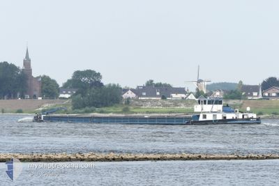
Cargo
Current Trip
EUROPA
| Time Travelled | 2 days |
|---|---|
| Remaining Time | --- |
| Distance Travelled | 72.83 nm |
| Remaining Distance | --- |
| AVG Speed | 6.8 Knots |
| MAX Speed | 8.2 Knots |
| AVG Wind | 5.6 knots |
| MAX Wind | 8.5 knots |
| MIN Temp | 5.5°C / 41.9°F |
| MAX Temp | 10.3°C / 50.54°F |
| Draught | 0.3 m |
| Position Received | 2 d ago |
Current Position
| Longitude | 5.69065° |
|---|---|
| Latitude | 50.79076° |
| Status | Under way using engine |
| Speed | 6.6 Knots |
| Course | 185.9° |
| Area | North Sea |
| Station | T-AIS |
| Position Received | 2 d ago |
Info
Information
The current position of IMAGE is in North Sea with coordinates 50.79076° / 5.69065° as reported on 2025-12-16 19:36 by AIS to our vessel tracker app. The vessel's current speed is 6.6 Knots
The vessel IMAGE (MMSI: 205569690) is a Cargo It's sailing under the flag of [BE] Belgium.
In this page you can find informations about the vessels current position, last detected port calls, and current voyage information. If the vessels is not in coverage by AIS you will find the latest position.
The current position of IMAGE is detected by our AIS receivers and we are not responsible for the reliability of the data. The last position was recorded while the vessel was in Coverage by the Ais receivers of our vessel tracking app.
The current draught of IMAGE as reported by AIS is 0.3 meters
Weather
| Temperature | 8.8°C / 47.84°F |
|---|---|
| Wind Speed | 3 knots |
| Direction | 196° SSW |
| Pressure | 1014.3 hPa |
| Humidity | 56.2 % |
| Cloud Coverage | 100 % |
Featured Company
Last Port Calls
| Port | Arrival | Departure | Time In Port |
|---|---|---|---|
| 2025-12-15 21:43 | 2025-12-16 06:23 | 8 h | |
| 2025-12-09 16:47 | 2025-12-12 17:40 | 3 d | |
| 2025-11-25 09:02 | 2025-11-25 09:59 | 56 m | |
| 2025-11-17 17:30 | 2025-11-17 22:40 | 5 h | |
| 2025-11-15 14:10 | 2025-11-17 16:34 | 2 d | |
| 2025-11-15 06:38 | 2025-11-15 10:07 | 3 h | |
| 2025-11-14 20:29 | 2025-11-15 06:14 | 9 h | |
| 2025-11-10 21:16 | 2025-11-11 05:58 | 8 h | |
| 2025-11-03 21:29 | 2025-11-04 06:10 | 8 h | |
| 2025-11-01 14:30 | 2025-11-02 07:36 | 17 h |
Last Trips
| Origin | Departure | Destination | Arrival | Distance | |
|---|---|---|---|---|---|
| 2025-12-12 17:40 | 2025-12-15 21:43 | 212.57 nm | |||
| 2025-11-25 09:59 | 2025-12-09 16:47 | 126.75 nm | |||
| 2025-11-17 22:40 | 2025-11-25 09:02 | 248.85 nm | |||
| 2025-11-17 16:34 | 2025-11-17 17:30 | 4.07 nm | |||
| 2025-11-15 10:07 | 2025-11-15 14:10 | 23.70 nm | |||
| 2025-11-15 06:14 | 2025-11-15 06:38 | 1.79 nm | |||
| 2025-11-11 05:58 | 2025-11-14 20:29 | 122.68 nm | |||
| 2025-11-04 06:10 | 2025-11-10 21:16 | 226.13 nm | |||
| 2025-11-02 07:36 | 2025-11-03 21:29 | 71.58 nm | |||
| 2025-10-26 07:19 | 2025-11-01 14:30 | 193.62 nm |
Events
| Time | Event | Details | Position / Dest | Info |
|---|---|---|---|---|
| 2025-12-16 19:36 | OUT of Coverage |
50.79076 / 5.69065
North Sea
|
Speed: 6.6 kn Course: 185.9° |
|
| 2025-12-16 19:36 | START Moving | 0.55 nm, South West of WAOLENWIERT |
50.79133 / 5.69074
EUROPA
|
Speed: 6.2 kn Course: 185° |
| 2025-12-16 19:34 | Status Changed | Under way using engine Moored |
50.79397 / 5.69112
EUROPA
|
Speed: 0.7 kn Course: 182° |
| 2025-12-16 19:31 | Status Changed | Moored Under way using engine |
50.79455 / 5.69111
EUROPA
|
Speed: 0.1 kn Course: 180° |
| 2025-12-16 19:25 | IN Coverage |
50.79454 / 5.69117
North Sea
|
Speed: Course: 0° |
|
| 2025-12-16 16:21 | OUT of Coverage |
50.96658 / 5.74968
North Sea
|
Speed: 5.4 kn Course: 176.2° |
|
| 2025-12-16 15:37 | START Moving | 1.68 nm, South of BARGE TERMINAL BORN |
51.03420 / 5.79807
EUROPA
|
Speed: 4.2 kn Course: 196° |
| 2025-12-16 15:19 | STOP Moving | 1.56 nm, South of BARGE TERMINAL BORN |
51.03597 / 5.79894
EUROPA
|
Speed: 0.2 kn Course: 199° |
| 2025-12-16 14:38 | IN Coverage |
51.10044 / 5.84374
North Sea
|
Speed: 7.4 kn Course: 208.2° |
|
| 2025-12-16 10:02 | OUT of Coverage |
51.44073 / 6.15385
North Sea
|
Speed: 7.7 kn Course: 186.8° |