
IRON DUKE
Bulk Carrier
Current Trip
| Time Travelled | 3 days |
|---|---|
| Remaining Time | 5 days |
| Distance Travelled | 911.15 nm |
| Remaining Distance | 1419.07 nm |
| AVG Speed | 10.6 Knots |
| MAX Speed | 12.4 Knots |
| AVG Wind | 10.4 knots |
| MAX Wind | 22.2 knots |
| MIN Temp | 19.3°C / 66.74°F |
| MAX Temp | 27.6°C / 81.68°F |
| Draught | 13 m |
| Position Received | 2025-01-02 08:19 |
Current Position
| Longitude | -13.62361° |
|---|---|
| Latitude | 28.09644° |
| Status | Under way using engine |
| Speed | 11.6 Knots |
| Course | 209.6° |
| Area | North Atlantic Ocean |
| Station | T-AIS |
| Position Received | 2025-01-02 08:19 |
Info
Information
The current position of IRON DUKE is in North Atlantic Ocean with coordinates 28.09644° / -13.62361° as reported on 2025-01-02 08:19 by AIS to our vessel tracker app. The vessel's current speed is 11.6 Knots and is heading at the port of TAKORADI. The estimated time of arrival as calculated by MyShipTracking vessel tracking app is 2025-02-10 10:40 LT
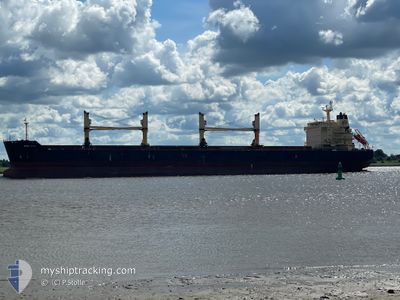
The vessel IRON DUKE (IMO: 9577422, MMSI: 232035614) is a Bulk Carrier that was built in 2011 ( 14 years old ). It's sailing under the flag of [GB] United Kingdom.
In this page you can find informations about the vessels current position, last detected port calls, and current voyage information. If the vessels is not in coverage by AIS you will find the latest position.
The current position of IRON DUKE is detected by our AIS receivers and we are not responsible for the reliability of the data. The last position was recorded while the vessel was in Coverage by the Ais receivers of our vessel tracking app.
The current draught of IRON DUKE as reported by AIS is 13 meters
Weather
| Temperature | 19.6°C / 67.28°F |
|---|---|
| Wind Speed | 16 knots |
| Direction | 29° NNE |
| Pressure | 1015.3 hPa |
| Humidity | 62.6 % |
| Cloud Coverage | 20 % |
Featured Company
Last Port Calls
| Port | Arrival | Departure | Time In Port |
|---|---|---|---|
| 2025-01-30 19:57 | 2025-02-01 03:34 | 1 d | |
| 2025-01-19 14:33 | 2025-01-25 10:33 | 5 d | |
| 2025-01-15 15:20 | 2025-01-18 01:05 | 2 d | |
| 2025-01-10 19:33 | 2025-01-13 13:27 | 2 d | |
| 2024-12-27 07:58 | 2024-12-28 03:14 | 19 h | |
| 2024-12-23 16:56 | 2024-12-24 18:34 | 1 d | |
| 2024-12-04 06:24 | 2024-12-15 19:30 | 11 d |
Last Trips
| Origin | Departure | Destination | Arrival | Distance | |
|---|---|---|---|---|---|
| 2025-01-25 10:33 | 2025-01-30 19:57 | 1153.97 nm | |||
| 2025-01-18 01:05 | 2025-01-19 14:33 | 347.36 nm | |||
| 2025-01-13 13:27 | 2025-01-15 15:20 | 541.82 nm | |||
| 2024-12-28 03:14 | 2025-01-10 19:33 | 3116.74 nm | |||
| 2024-12-24 18:34 | 2024-12-27 07:58 | 20.54 nm | |||
| 2024-12-15 19:30 | 2024-12-23 16:56 | 1507.02 nm | |||
| 2024-11-02 17:43 | 2024-12-04 06:24 | 4230.74 nm |
Events
| Time | Event | Details | Position / Dest | Info |
|---|---|---|---|---|
| 2025-02-01 03:34 | PORT DEPARTURE |
|
5.85949 / -10.06305
GHTKD
|
Speed: 4.6 kn Course: 275° |
| 2025-02-01 03:31 | START Moving |
5.85869 / -10.05796
[LR] BUCHANAN
|
Speed: 4.6 kn Course: 275° |
|
| 2025-01-30 20:25 | STOP Moving |
5.85793 / -10.05018
[LR] BUCHANAN
|
Speed: Course: 308° |
|
| 2025-01-30 19:57 | PORT ARRIVAL |
|
5.85916 / -10.06052
[LR] BUCHANAN
|
Speed: 5.2 kn Course: 97° |
| 2025-01-30 18:42 | START Moving | 3.91 nm, West of BUCHANAN |
5.85377 / -10.11995
GHTKD
|
Speed: 3.7 kn Course: 85° |
| 2025-01-29 21:39 | STOP Moving | 5.72 nm, South West of BUCHANAN |
5.78043 / -10.11116
GHTKD
|
Speed: 0.2 kn Course: 212° |
| 2025-01-29 20:03 | START Moving | 5.38 nm, South West of BUCHANAN |
5.79082 / -10.11483
GHTKD
|
Speed: 4.4 kn Course: 286° |
| 2025-01-29 19:02 | STOP Moving | 5.08 nm, South West of BUCHANAN |
5.79812 / -10.11518
GHTKD
|
Speed: 0.3 kn Course: 164° |
| 2025-01-29 18:09 | START Moving | 2.67 nm, West of BUCHANAN |
5.85086 / -10.09882
GHTKD
|
Speed: 5.1 kn Course: 199° |
| 2025-01-29 17:52 | STOP Moving | 2.59 nm, West of BUCHANAN |
5.85458 / -10.09793
GHTKD
|
Speed: 0.2 kn Course: 205° |