

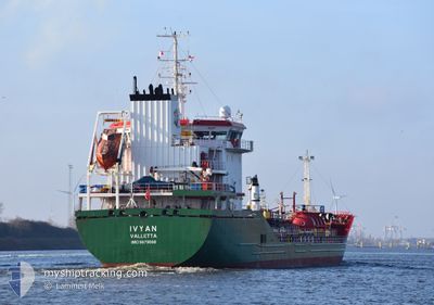
IVYAN
Tanker

Current Trip
| Time Travelled | 3 days |
|---|---|
| Remaining Time | 2 h, 56 mins |
| Distance Travelled | 678.65 nm |
| Remaining Distance | 41.25 nm |
| AVG Speed | 11.1 Knots |
| MAX Speed | 14 Knots |
| AVG Wind | 12.8 knots |
| MAX Wind | 21 knots |
| MIN Temp | 11.6°C / 52.88°F |
| MAX Temp | 18.1°C / 64.58°F |
| Draught | 5.5 m |
| Position Received | 1 m ago |
Current Position
| Longitude | 3.47610° |
|---|---|
| Latitude | 51.49579° |
| Status | Under way using engine |
| Speed | 13.2 Knots |
| Course | 126.4° |
| Area | North Sea |
| Station | T-AIS |
| Position Received | 1 m ago |
Information
The current position of IVYAN is in North Sea with coordinates 51.49579° / 3.47610° as reported on 2025-05-21 14:06 by AIS to our vessel tracker app. The vessel's current speed is 13.2 Knots and is heading at the port of ANTWERP. The estimated time of arrival as calculated by MyShipTracking vessel tracking app is 2025-05-21 19:03 LT
The vessel IVYAN (IMO: 9879088, MMSI: 215867000) is a Tanker It's sailing under the flag of [MT] Malta.
In this page you can find informations about the vessels current position, last detected port calls, and current voyage information. If the vessels is not in coverage by AIS you will find the latest position.
The current position of IVYAN is detected by our AIS receivers and we are not responsible for the reliability of the data. The last position was recorded while the vessel was in Coverage by the Ais receivers of our vessel tracking app.
The current draught of IVYAN as reported by AIS is 5.5 meters
Weather
| Temperature | 12.2°C / 53.96°F |
|---|---|
| Wind Speed | 13 knots |
| Direction | 350° N |
| Pressure | 1015 hPa |
| Humidity | 81.5 % |
| Cloud Coverage | 100 % |


Featured Company
Last Port Calls
| Port | Arrival | Departure | Time In Port |
|---|---|---|---|
| 2025-05-16 19:43 | 2025-05-17 19:47 | 1 d | |
| 2025-05-11 07:32 | 2025-05-12 14:46 | 1 d | |
| 2025-05-01 22:43 | 2025-05-04 04:11 | 2 d | |
| 2025-04-29 13:36 | 2025-04-30 20:31 | 1 d | |
| 2025-04-26 10:33 | 2025-04-27 17:28 | 1 d | |
| 2025-04-23 14:37 | 2025-04-24 15:02 | 1 d | |
| 2025-04-20 22:40 | 2025-04-21 19:36 | 20 h | |
| 2025-04-18 14:30 | 2025-04-19 14:53 | 1 d | |
| 2025-04-15 23:07 | 2025-04-16 19:21 | 20 h | |
| 2025-04-09 16:49 | 2025-04-11 00:51 | 1 d |
Last Trips
| Origin | Departure | Destination | Arrival | Distance | |
|---|---|---|---|---|---|
| 2025-05-12 14:46 | 2025-05-16 19:43 | 675.08 nm | |||
| 2025-05-04 04:11 | 2025-05-11 07:32 | 699.08 nm | |||
| 2025-04-30 20:31 | 2025-05-01 22:43 | 276.54 nm | |||
| 2025-04-27 17:28 | 2025-04-29 13:36 | 470.96 nm | |||
| 2025-04-24 15:02 | 2025-04-26 10:33 | 480.85 nm | |||
| 2025-04-21 19:36 | 2025-04-23 14:37 | 468.85 nm | |||
| 2025-04-19 14:53 | 2025-04-20 22:40 | 109.78 nm | |||
| 2025-04-16 19:21 | 2025-04-18 14:30 | 416.67 nm | |||
| 2025-04-11 00:51 | 2025-04-15 23:07 | 915.63 nm | |||
| 2025-04-04 15:18 | 2025-04-09 16:49 | 677.01 nm |
Events
| Time | Event | Details | Position / Dest | Info |
|---|---|---|---|---|
| 2025-05-21 12:21 | Status Changed | Under way using engine Default |
51.78562 / 3.25748
NLRTM>BEANR
|
Speed: 7.9 kn Course: 204° |
| 2025-05-21 12:08 | Status Changed | Default Under way using engine |
51.81280 / 3.27707
NLRTM>BEANR
|
Speed: 8.2 kn Course: 225.9° |
| 2025-05-21 12:02 | Status Changed | Under way using engine Default |
51.82156 / 3.29063
NLRTM>BEANR
|
Speed: 9.1 kn Course: 258° |
| 2025-05-21 11:47 | START Moving | 17.83 nm, North West of BURGHSLUIS |
51.83095 / 3.35012
NLRTM>BEANR
|
Speed: 8 kn Course: 260° |
| 2025-05-21 11:47 | IN Coverage |
51.82156 / 3.29063
North Sea
|
Speed: 8.2 kn Course: 225.9° |
|
| 2025-05-21 09:41 | Status Changed | Default At anchor |
51.83234 / 3.36243
NLRTM>BEANR
|
Speed: 0.1 kn Course: 232° |
| 2025-05-21 09:38 | OUT of Coverage |
51.83239 / 3.36244
North Sea
|
Speed: 0.1 kn Course: 197.8° |
|
| 2025-05-21 09:14 | Status Changed | At anchor Default |
51.83239 / 3.36258
NLRTM>BEANR
|
Speed: Course: 230° |
| 2025-05-21 08:59 | Status Changed | Default At anchor |
51.83238 / 3.36258
NLRTM>BEANR
|
Speed: Course: 235° |
| 2025-05-21 08:56 | Status Changed | At anchor Default |
51.83238 / 3.36256
NLRTM>BEANR
|
Speed: 0.2 kn Course: 229° |