
JAN WILLEM
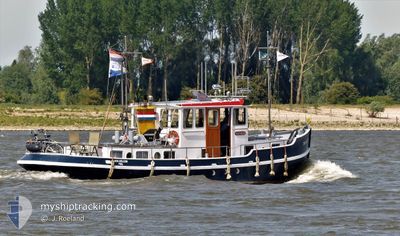
Tug
Current Trip
Current Position
| Longitude | 5.44085° |
|---|---|
| Latitude | 51.88755° |
| Status | Default |
| Speed | |
| Course | --- |
| Area | North Sea |
| Station | T-AIS |
| Position Received | Now |
Info
Information
The current position of JAN WILLEM is in North Sea with coordinates 51.88755° / 5.44085° as reported on 2025-02-14 06:51 by AIS to our vessel tracker app. The vessel's current speed is 0 Knots and is currently inside the port of TIEL.
The vessel JAN WILLEM (MMSI: 244730388) is a Tug It's sailing under the flag of [NL] Netherlands.
In this page you can find informations about the vessels current position, last detected port calls, and current voyage information. If the vessels is not in coverage by AIS you will find the latest position.
The current position of JAN WILLEM is detected by our AIS receivers and we are not responsible for the reliability of the data. The last position was recorded while the vessel was in Coverage by the Ais receivers of our vessel tracking app.
Weather
| Temperature | 0.4°C / 32.72°F |
|---|---|
| Wind Speed | 4 knots |
| Direction | 34° NE |
| Pressure | 1026.4 hPa |
| Humidity | 82.5 % |
| Cloud Coverage | 49 % |
Featured Company
Most Visited Ports (Last year)
| Port | Arrivals | |
|---|---|---|
| 16 | ||
| 4 | ||
| 3 | ||
| 2 | ||
| 2 | ||
| 2 |
Events
| Time | Event | Details | Position / Dest | Info |
|---|---|---|---|---|
| 2025-02-14 02:16 | IN Coverage |
51.88757 / 5.44079
North Sea
[NL] TIEL
|
Speed: Course: 0° |
|
| 2025-02-13 23:47 | OUT of Coverage |
51.88757 / 5.44084
North Sea
[NL] TIEL
|
Speed: Course: 0° |
|
| 2025-02-06 12:56 | IN Coverage |
51.88747 / 5.44085
North Sea
[NL] TIEL
|
Speed: Course: 0° |
|
| 2025-02-06 07:58 | OUT of Coverage |
51.88754 / 5.44080
North Sea
[NL] TIEL
|
Speed: Course: 0° |
|
| 2025-02-05 14:58 | IN Coverage |
51.88752 / 5.44078
North Sea
[NL] TIEL
|
Speed: Course: 0° |
|
| 2025-02-05 09:38 | OUT of Coverage |
51.88755 / 5.44083
North Sea
[NL] TIEL
|
Speed: Course: 334.7° |
|
| 2025-02-05 07:28 | IN Coverage |
51.88757 / 5.44086
North Sea
[NL] TIEL
|
Speed: Course: 0° |
|
| 2025-02-05 01:39 | OUT of Coverage |
51.88755 / 5.44079
North Sea
[NL] TIEL
|
Speed: Course: 0° |
|
| 2025-02-05 00:10 | IN Coverage |
51.88755 / 5.44079
North Sea
[NL] TIEL
|
Speed: Course: 0° |
|
| 2025-02-04 21:23 | OUT of Coverage |
51.88757 / 5.44070
North Sea
[NL] TIEL
|
Speed: Course: 0° |