
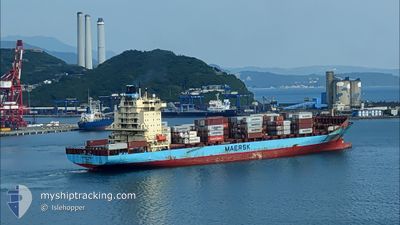
JOHANNES MAERSK
Container Ship
Current Trip
| Time Travelled | 3 h, 24 mins |
|---|---|
| Remaining Time | --- |
| Distance Travelled | 19.97 nm |
| Remaining Distance | --- |
| AVG Speed | 13.8 Knots |
| MAX Speed | 16 Knots |
| AVG Wind | 5.9 knots |
| MAX Wind | 7.3 knots |
| MIN Temp | 13°C / 55.4°F |
| MAX Temp | 15°C / 59°F |
| Draught | 12.1 m |
| Position Received | 2 h, 1 m ago |
Current Position
| Longitude | 34.28155° |
|---|---|
| Latitude | 31.95738° |
| Status | Under way using engine |
| Speed | 16 Knots |
| Course | 286.2° |
| Area | Mediterranean Sea - Eastern Basin |
| Station | T-AIS |
| Position Received | 2 h, 1 m ago |
Info
Information
The current position of JOHANNES MAERSK is in Mediterranean Sea - Eastern Basin with coordinates 31.95738° / 34.28155° as reported on 2025-02-11 08:38 by AIS to our vessel tracker app. The vessel's current speed is 16 Knots and is heading at the port of THAMES. The estimated time of arrival as calculated by MyShipTracking vessel tracking app is 2025-02-20 10:00 LT
The vessel JOHANNES MAERSK (IMO: 9215189, MMSI: 219982000) is a Container Ship that was built in 2001 ( 24 years old ). It's sailing under the flag of [DK] Denmark.
In this page you can find informations about the vessels current position, last detected port calls, and current voyage information. If the vessels is not in coverage by AIS you will find the latest position.
The current position of JOHANNES MAERSK is detected by our AIS receivers and we are not responsible for the reliability of the data. The last position was recorded while the vessel was in Coverage by the Ais receivers of our vessel tracking app.
The current draught of JOHANNES MAERSK as reported by AIS is 12.1 meters
Weather
| Temperature | 15.7°C / 60.26°F |
|---|---|
| Wind Speed | 11 knots |
| Direction | 287° WNW |
| Pressure | 1018.8 hPa |
| Humidity | 53.1 % |
| Cloud Coverage | 77 % |
Featured Company
Last Port Calls
| Port | Arrival | Departure | Time In Port |
|---|---|---|---|
| 2025-02-10 13:10 | 2025-02-11 07:15 | 18 h | |
| 2025-02-06 19:25 | 2025-02-07 16:37 | 21 h | |
| 2025-01-23 20:49 | 2025-01-24 04:32 | 7 h | |
| 2025-01-19 02:46 | 2025-01-20 20:00 | 1 d | |
| 2025-01-19 02:14 | 2025-01-19 02:32 | 17 m | |
| 2025-01-19 00:59 | 2025-01-19 01:40 | 40 m | |
| 2025-01-15 14:06 | 2025-01-17 16:24 | 2 d | |
| 2025-01-13 15:15 | 2025-01-14 06:18 | 15 h | |
| 2024-12-30 15:26 | 2024-12-31 08:19 | 16 h | |
| 2024-12-26 14:48 | 2024-12-30 04:16 | 3 d |
Most Visited Ports (Last year)
| Port | Arrivals | |
|---|---|---|
| 12 | ||
| 8 | ||
| 6 | ||
| 5 | ||
| 5 | ||
| 5 |
Last Trips
| Origin | Departure | Destination | Arrival | Distance | |
|---|---|---|---|---|---|
| 2025-01-24 05:32 | 2025-02-10 15:10 | 3570.00 nm | |||
| 2025-01-24 05:32 | 2025-02-06 21:25 | 3412.72 nm | |||
| 2025-01-20 21:00 | 2025-01-23 21:49 | 383.33 nm | |||
| 2025-01-19 03:32 | 2025-01-19 03:46 | 1.28 nm | |||
| 2025-01-19 02:40 | 2025-01-19 03:14 | 5.91 nm | |||
| 2025-01-17 17:24 | 2025-01-19 01:59 | 278.88 nm | |||
| 2025-01-14 06:18 | 2025-01-15 15:06 | 180.49 nm | |||
| 2024-12-30 06:16 | 2025-01-13 15:15 | 3560.41 nm | |||
| 2024-12-30 06:16 | 2024-12-30 17:26 | 153.29 nm | |||
| 2024-12-25 16:08 | 2024-12-26 16:48 | 279.28 nm |
Events
| Time | Event | Details | Position / Dest | Info |
|---|---|---|---|---|
| 2025-02-11 08:44 | Status Changed | Default Under way using engine |
31.96500 / 34.25127
GBLGP
|
Speed: 16 kn Course: 286.2° |
| 2025-02-11 08:38 | OUT of Coverage |
31.95738 / 34.28155
Mediterranean Sea - Eastern Basin
GBLGP
|
Speed: 16 kn Course: 286.2° |
|
| 2025-02-11 07:15 | PORT DEPARTURE |
|
31.85083 / 34.64131
GBLGP
|
Speed: 10.3 kn Course: 3° |
| 2025-02-11 07:00 | START Moving |
31.83267 / 34.64631
[IL] ASHDOD
|
Speed: 3.8 kn Course: 280° |
|
| 2025-02-11 06:52 | Status Changed | Under way using engine Moored |
31.83210 / 34.64918
[IL] ASHDOD
|
Speed: Course: 270° |
| 2025-02-11 05:49 | ETA Changed | 2025/02/20 10:00 2025/02/19 12:00 |
31.83211 / 34.64919
[IL] ASHDOD
|
Speed: Course: 271° |
| 2025-02-10 18:47 | Status Changed | Moored Default |
31.83212 / 34.64921
[IL] ASHDOD
|
Speed: Course: 270° |
| 2025-02-10 18:38 | Status Changed | Default Moored |
31.83211 / 34.64919
[IL] ASHDOD
|
Speed: Course: 270° |
| 2025-02-10 17:17 | Status Changed | Moored Default |
31.83211 / 34.64918
[IL] ASHDOD
|
Speed: Course: 270° |
| 2025-02-10 17:11 | Status Changed | Default Moored |
31.83211 / 34.64919
[IL] ASHDOD
|
Speed: Course: 270° |