
JONATHAN P
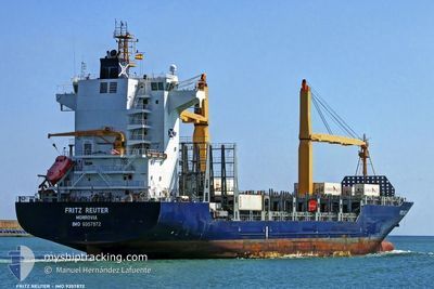
Container Ship
Current Trip
| Time Travelled | 16 h, 10 mins |
|---|---|
| Remaining Time | 2 h, 37 mins |
| Distance Travelled | 152.72 nm |
| Remaining Distance | 28.65 nm |
| AVG Speed | 10.6 Knots |
| MAX Speed | 18.3 Knots |
| AVG Wind | 15 knots |
| MAX Wind | 18.7 knots |
| MIN Temp | 6.6°C / 43.88°F |
| MAX Temp | 9.3°C / 48.74°F |
| Draught | 9.2 m |
| Position Received | 17 m ago |
Current Position
| Longitude | 3.67732° |
|---|---|
| Latitude | 51.96966° |
| Status | Under way using engine |
| Speed | 11.5 Knots |
| Course | 56.4° |
| Area | North Sea |
| Station | T-AIS |
| Position Received | 17 m ago |
Info
Information
The current position of JONATHAN P is in North Sea with coordinates 51.96966° / 3.67732° as reported on 2025-02-05 10:26 by AIS to our vessel tracker app. The vessel's current speed is 11.5 Knots and is heading at the port of ROTTERDAM. The estimated time of arrival as calculated by MyShipTracking vessel tracking app is 2025-02-05 13:21 LT
The vessel JONATHAN P (IMO: 9357872, MMSI: 636020153) is a Container Ship that was built in 2006 ( 19 years old ). It's sailing under the flag of [LR] Liberia.
In this page you can find informations about the vessels current position, last detected port calls, and current voyage information. If the vessels is not in coverage by AIS you will find the latest position.
The current position of JONATHAN P is detected by our AIS receivers and we are not responsible for the reliability of the data. The last position was recorded while the vessel was in Coverage by the Ais receivers of our vessel tracking app.
The current draught of JONATHAN P as reported by AIS is 9.2 meters
Weather
| Temperature | 6.6°C / 43.88°F |
|---|---|
| Wind Speed | 9 knots |
| Direction | 285° WNW |
| Pressure | 1036.3 hPa |
| Humidity | 88.7 % |
| Cloud Coverage | 5 % |
Featured Company
Last Port Calls
| Port | Arrival | Departure | Time In Port |
|---|---|---|---|
| 2025-02-03 16:50 | 2025-02-04 18:34 | 1 d | |
| 2025-01-27 08:54 | 2025-01-29 00:23 | 1 d | |
| 2025-01-25 14:10 | 2025-01-26 14:10 | 1 d | |
| 2025-01-24 08:23 | 2025-01-25 00:47 | 16 h | |
| 2025-01-20 16:26 | 2025-01-21 00:51 | 8 h | |
| 2025-01-17 18:04 | 2025-01-18 13:34 | 19 h | |
| 2025-01-15 09:10 | 2025-01-16 14:49 | 1 d | |
| 2025-01-14 08:12 | 2025-01-15 08:53 | 1 d | |
| 2025-01-13 17:53 | 2025-01-14 07:56 | 14 h | |
| 2025-01-10 19:29 | 2025-01-12 09:00 | 1 d |
Most Visited Ports (Last year)
| Port | Arrivals | |
|---|---|---|
| 6 | ||
| 5 | ||
| 5 | ||
| 5 | ||
| 4 | ||
| 4 |
Last Trips
| Origin | Departure | Destination | Arrival | Distance | |
|---|---|---|---|---|---|
| 2025-01-29 01:23 | 2025-02-03 16:50 | 1747.64 nm | |||
| 2025-01-26 15:10 | 2025-01-27 09:54 | 288.95 nm | |||
| 2025-01-25 01:47 | 2025-01-25 15:10 | 197.76 nm | |||
| 2025-01-21 01:51 | 2025-01-24 09:23 | 644.54 nm | |||
| 2025-01-18 14:34 | 2025-01-20 17:26 | 748.61 nm | |||
| 2025-01-16 15:49 | 2025-01-17 19:04 | 302.97 nm | |||
| 2025-01-15 09:53 | 2025-01-15 10:10 | 2.01 nm | |||
| 2025-01-14 08:56 | 2025-01-14 09:12 | 1.71 nm | |||
| 2025-01-12 10:00 | 2025-01-13 18:53 | 125.74 nm | |||
| 2025-01-09 06:47 | 2025-01-10 20:29 | 412.60 nm |
Events
| Time | Event | Details | Position / Dest | Info |
|---|---|---|---|---|
| 2025-02-05 10:29 | Status Changed | Default Under way using engine |
51.97598 / 3.69306
NLRTM
|
Speed: 11.5 kn Course: 56.4° |
| 2025-02-05 10:26 | Status Changed | Under way using engine Default |
51.96966 / 3.67732
NLRTM
|
Speed: 7.3 kn Course: 75° |
| 2025-02-05 10:09 | IN Coverage |
51.96966 / 3.67732
North Sea
NLRTM
|
Speed: 11.5 kn Course: 56.4° |
|
| 2025-02-05 09:27 | Status Changed | Default Under way using engine |
51.92258 / 3.43986
NLRTM
|
Speed: 9.5 kn Course: 69° |
| 2025-02-05 09:22 | OUT of Coverage |
51.91814 / 3.42101
North Sea
NLRTM
|
Speed: 9.5 kn Course: 69° |
|
| 2025-02-05 08:43 | ETA Changed | 2025/02/05 11:00 2025/02/05 09:00 |
51.86074 / 3.35642
NLRTM
|
Speed: 5.4 kn Course: 327.6° |
| 2025-02-05 07:10 | Status Changed | Under way using engine Default |
51.87504 / 3.39422
NLRTM
|
Speed: 9 kn Course: 127° |
| 2025-02-05 07:05 | Status Changed | Default Under way using engine |
51.88517 / 3.37750
NLRTM
|
Speed: 9 kn Course: 127° |
| 2025-02-05 05:04 | Status Changed | Under way using engine Default |
51.87436 / 2.94648
NLRTM
|
Speed: 7.4 kn Course: 89° |
| 2025-02-05 04:39 | Status Changed | Default Under way using engine |
51.87304 / 2.85671
NLRTM
|
Speed: 10.4 kn Course: 87.5° |