
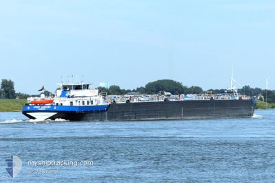
JOSEF JAEGERS
Tanker
Current Trip
| Time Travelled | 7 days |
|---|---|
| Remaining Time | 2 h, 28 mins |
| Distance Travelled | 502.57 nm |
| Remaining Distance | 25.88 nm |
| AVG Speed | 7.4 Knots |
| MAX Speed | 10.8 Knots |
| AVG Wind | 7.2 knots |
| MAX Wind | 17.2 knots |
| MIN Temp | 0.6°C / 33.08°F |
| MAX Temp | 9.9°C / 49.82°F |
| Draught | 2.1 m |
| Position Received | 11 m ago |
Current Position
| Longitude | 4.42530° |
|---|---|
| Latitude | 51.69999° |
| Status | Under way using engine |
| Speed | 1 Knots |
| Course | --- |
| Area | North Sea |
| Station | T-AIS |
| Position Received | 11 m ago |
Info
Information
The current position of JOSEF JAEGERS is in North Sea with coordinates 51.69999° / 4.42530° as reported on 2025-12-23 20:23 by AIS to our vessel tracker app. The vessel's current speed is 1 Knots and is heading at the port of ANTWERP. The estimated time of arrival as calculated by MyShipTracking vessel tracking app is 2025-12-24 00:02 LT
The vessel JOSEF JAEGERS (MMSI: 211500430) is a Tanker It's sailing under the flag of [DE] Germany.
In this page you can find informations about the vessels current position, last detected port calls, and current voyage information. If the vessels is not in coverage by AIS you will find the latest position.
The current position of JOSEF JAEGERS is detected by our AIS receivers and we are not responsible for the reliability of the data. The last position was recorded while the vessel was in Coverage by the Ais receivers of our vessel tracking app.
The current draught of JOSEF JAEGERS as reported by AIS is 2.1 meters
Weather
| Temperature | 4.8°C / 40.64°F |
|---|---|
| Wind Speed | 17 knots |
| Direction | 80° E |
| Pressure | 1023.8 hPa |
| Humidity | 66.3 % |
| Cloud Coverage | 100 % |
Featured Company
Last Port Calls
| Port | Arrival | Departure | Time In Port |
|---|---|---|---|
| 2025-12-16 16:17 | 2025-12-16 18:04 | 1 h | |
| 2025-12-16 05:08 | 2025-12-16 06:35 | 1 h | |
| 2025-12-14 16:38 | 2025-12-15 15:17 | 22 h | |
| 2025-12-09 07:13 | 2025-12-09 21:26 | 14 h | |
| 2025-12-06 16:34 | |||
| 2025-12-06 16:22 | |||
| 2025-12-05 10:08 | 2025-12-05 11:01 | 52 m | |
| 2025-12-04 05:34 | 2025-12-04 22:35 | 17 h | |
| 2025-11-30 10:43 | 2025-12-03 17:08 | 3 d | |
| 2025-11-29 19:03 | 2025-11-30 07:07 | 12 h |
Most Visited Ports (Last year)
| Port | Arrivals | |
|---|---|---|
| 46 | ||
| 34 | ||
| 20 | ||
| 9 | ||
| 4 | ||
| 3 |
Last Trips
| Origin | Departure | Destination | Arrival | Distance | |
|---|---|---|---|---|---|
| 2025-12-16 06:35 | 2025-12-16 16:17 | 45.53 nm | |||
| 2025-12-15 15:17 | 2025-12-16 05:08 | 77.96 nm | |||
| 2025-12-09 21:26 | 2025-12-14 16:38 | 602.47 nm | |||
| 2025-12-06 16:22 | 2025-12-09 07:13 | 385.85 nm | |||
| 2025-12-05 11:01 | 2025-12-06 16:34 | 140.72 nm | |||
| 2025-12-04 22:35 | 2025-12-05 10:08 | 78.15 nm | |||
| 2025-12-03 17:08 | 2025-12-04 05:34 | 121.98 nm | |||
| 2025-11-30 07:07 | 2025-11-30 10:43 | 43.84 nm | |||
| 2025-11-27 18:43 | 2025-11-29 19:03 | 218.33 nm | |||
| 2025-11-26 17:30 | 2025-11-27 18:46 | 117.06 nm |
Events
| Time | Event | Details | Position / Dest | Info |
|---|---|---|---|---|
| 2025-12-23 20:30 | Status Changed | Default Under way using engine |
51.69991 / 4.42464
ANTWERPEN
|
Speed: 1 kn Course: 511° |
| 2025-12-23 20:30 | STOP Moving | 0.67 nm, North West of WILLEMSTAD |
51.69991 / 4.42464
ANTWERPEN
|
Speed: Course: -1° |
| 2025-12-23 20:21 | Status Changed | Under way using engine Default |
51.70000 / 4.42712
ANTWERPEN
|
Speed: 5.7 kn Course: 265° |
| 2025-12-23 20:18 | Status Changed | Default Under way using engine |
51.70023 / 4.43214
ANTWERPEN
|
Speed: 5.8 kn Course: 265.8° |
| 2025-12-23 20:03 | Status Changed | Under way using engine Default |
51.69532 / 4.48479
ANTWERPEN
|
Speed: 8.7 kn Course: 275° |
| 2025-12-23 20:02 | Status Changed | Default Under way using engine |
51.69492 / 4.49057
ANTWERPEN
|
Speed: 8.8 kn Course: 260.1° |
| 2025-12-23 19:14 | Status Changed | Under way using engine Default |
51.72336 / 4.67117
ANTWERPEN
|
Speed: 8.9 kn Course: 240° |
| 2025-12-23 19:10 | Status Changed | Default Under way using engine |
51.72823 / 4.68631
ANTWERPEN
|
Speed: 8.7 kn Course: 228.2° |
| 2025-12-23 18:59 | Status Changed | Under way using engine Default |
51.74479 / 4.72139
ANTWERPEN
|
Speed: 8.8 kn Course: 228° |
| 2025-12-23 18:58 | Status Changed | Default Under way using engine |
51.74585 / 4.72340
ANTWERPEN
|
Speed: 9.2 kn Course: 207° |