
JUAN DIEGO
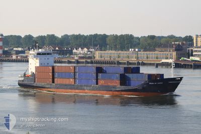
General Cargo
Current Trip
| Trip Time | 5 days |
|---|---|
| Trip Distance | 1154.51 nm |
| AVG Speed | 10.4 Knots |
| MAX Speed | 15.1 Knots |
| Draught | 5.1 m |
| AVG Wind | 13.8 knots |
| MAX Wind | 23 knots |
| MIN Temp | 17.8°C / 64.04°F |
| MAX Temp | 25.9°C / 78.62°F |
| Position Received | 6 d ago |
Current Position
| Longitude | -85.99550° |
|---|---|
| Latitude | 29.63078° |
| Status | Under way using engine |
| Speed | 13.5 Knots |
| Course | 206° |
| Area | Gulf of Mexico |
| Station | T-AIS |
| Position Received | 6 d ago |
Info
Information
The current position of JUAN DIEGO is in Gulf of Mexico with coordinates 29.63078° / -85.99550° as reported on 2025-12-17 22:59 by AIS to our vessel tracker app. The vessel's current speed is 13.5 Knots and is currently inside the port of PANAMA CITY.
The vessel JUAN DIEGO (IMO: 9189574, MMSI: 212370000) is a General Cargo that was built in 1999 ( 26 years old ). It's sailing under the flag of [CY] Cyprus.
In this page you can find informations about the vessels current position, last detected port calls, and current voyage information. If the vessels is not in coverage by AIS you will find the latest position.
The current position of JUAN DIEGO is detected by our AIS receivers and we are not responsible for the reliability of the data. The last position was recorded while the vessel was in Coverage by the Ais receivers of our vessel tracking app.
The current draught of JUAN DIEGO as reported by AIS is 5.1 meters
Weather
| Temperature | 17.3°C / 63.14°F |
|---|---|
| Wind Speed | 3 knots |
| Direction | 250° WSW |
| Pressure | 1026 hPa |
| Humidity | 88.2 % |
| Cloud Coverage | --- |
Featured Company
Last Port Calls
| Port | Arrival | Departure | Time In Port |
|---|---|---|---|
| 2025-12-22 17:52 | |||
| 2025-12-15 18:20 | 2025-12-17 13:57 | 1 d | |
| 2025-12-12 23:07 | 2025-12-13 12:19 | 13 h | |
| 2025-12-10 07:14 | 2025-12-11 00:43 | 17 h | |
| 2025-12-07 08:07 | 2025-12-08 07:07 | 23 h | |
| 2025-12-04 05:32 | 2025-12-04 12:17 | 6 h | |
| 2025-12-04 05:19 |
Most Visited Ports (Last year)
| Port | Arrivals | |
|---|---|---|
| 36 | ||
| 29 |
Last Trips
| Origin | Departure | Destination | Arrival | Distance | |
|---|---|---|---|---|---|
| 2025-12-17 13:57 | 2025-12-22 17:52 | 1154.51 nm | |||
| 2025-12-13 12:19 | 2025-12-15 18:20 | 579.08 nm | |||
| 2025-12-11 00:43 | 2025-12-12 23:07 | 573.49 nm | |||
| 2025-12-08 07:07 | 2025-12-10 07:14 | 577.57 nm | |||
| 2025-12-04 12:17 | 2025-12-07 08:07 | 586.37 nm | |||
| 2025-12-04 05:19 | 2025-12-04 05:32 | 0.69 nm |
Events
| Time | Event | Details | Position / Dest | Info |
|---|---|---|---|---|
| 2025-12-22 23:52 | STOP Moving |
30.17599 / -85.72971
[US] PANAMA CITY
|
Speed: 0.1 kn Course: 275° |
|
| 2025-12-22 23:52 | PORT ARRIVAL |
|
30.17599 / -85.72971
[US] PANAMA CITY
|
Speed: 1 kn Course: -1° |
| 2025-12-19 12:51 | STOP Moving |
24.53500 / -88.41167
MXPGO
|
Speed: Course: -1° |
|
| 2025-12-17 23:06 | Status Changed | Default Under way using engine |
29.60667 / -86.00833
MXPGO
|
Speed: 13.5 kn Course: 206° |
| 2025-12-17 22:59 | Status Changed | Under way using engine Default |
29.63078 / -85.99550
MXPGO
|
Speed: 13 kn Course: 205° |
| 2025-12-17 22:59 | OUT of Coverage |
29.63078 / -85.99550
Gulf of Mexico
MXPGO
|
Speed: 13.5 kn Course: 206° |
|
| 2025-12-17 22:42 | Status Changed | Default Under way using engine |
29.68833 / -85.96500
MXPGO
|
Speed: 13.3 kn Course: 202° |
| 2025-12-17 22:28 | Status Changed | Under way using engine Default |
29.73770 / -85.94430
MXPGO
|
Speed: 13.2 kn Course: 203° |
| 2025-12-17 22:28 | Status Changed | Default Under way using engine |
29.74002 / -85.94318
MXPGO
|
Speed: 13.1 kn Course: 202° |
| 2025-12-17 22:27 | Status Changed | Under way using engine Default |
29.74285 / -85.94183
MXPGO
|
Speed: 13 kn Course: 202° |