
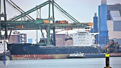
JUTTA
Cargo
Current Trip
| Time Travelled | 42 days |
|---|---|
| Remaining Time | 29 days |
| Distance Travelled | 1477.72 nm |
| Remaining Distance | 4964.80 nm |
| AVG Speed | 9 Knots |
| MAX Speed | 23.7 Knots |
| AVG Wind | 10.7 knots |
| MAX Wind | 25.7 knots |
| MIN Temp | 4.6°C / 40.28°F |
| MAX Temp | 19.2°C / 66.56°F |
| Draught | 18.4 m |
| Position Received | 2 h, 55 m ago |
Current Position
| Longitude | 32.55039° |
|---|---|
| Latitude | 29.87317° |
| Status | Under way using engine |
| Speed | 8.9 Knots |
| Course | 172.8° |
| Area | Gulf of Suez |
| Station | T-AIS |
| Position Received | 2 h, 55 m ago |
Info
Information
The current position of JUTTA is in Gulf of Suez with coordinates 29.87317° / 32.55039° as reported on 2025-12-17 19:14 by AIS to our vessel tracker app. The vessel's current speed is 8.9 Knots and is heading at the port of SINGAPORE. The estimated time of arrival as calculated by MyShipTracking vessel tracking app is 2026-01-16 09:41 LT
The vessel JUTTA (IMO: 9730402, MMSI: 636017188) is a Cargo It's sailing under the flag of [LR] Liberia.
In this page you can find informations about the vessels current position, last detected port calls, and current voyage information. If the vessels is not in coverage by AIS you will find the latest position.
The current position of JUTTA is detected by our AIS receivers and we are not responsible for the reliability of the data. The last position was recorded while the vessel was in Coverage by the Ais receivers of our vessel tracking app.
The current draught of JUTTA as reported by AIS is 18.4 meters
Weather
| Temperature | 13.9°C / 57.02°F |
|---|---|
| Wind Speed | 7 knots |
| Direction | 27° NNE |
| Pressure | 1025 hPa |
| Humidity | 53.2 % |
| Cloud Coverage | 1 % |
Featured Company
Last Port Calls
| Port | Arrival | Departure | Time In Port |
|---|---|---|---|
| 2025-12-17 11:02 | 2025-12-17 20:31 | 9 h | |
| 2025-11-05 11:49 | 2025-11-05 13:34 | 1 h | |
| 2025-10-31 08:54 | 2025-10-31 17:39 | 8 h |
Last Trips
| Origin | Departure | Destination | Arrival | Distance | |
|---|---|---|---|---|---|
| 2025-11-05 13:34 | 2025-12-17 11:02 | 1381.25 nm | |||
| 2025-09-23 20:26 | 2025-11-05 11:49 | 8222.60 nm | |||
| 2025-09-23 20:26 | 2025-10-31 08:54 | 8816.29 nm |
Events
| Time | Event | Details | Position / Dest | Info |
|---|---|---|---|---|
| 2025-12-17 20:55 | STOP Moving | 10.07 nm, South East of AL ADABIYAH |
29.74220 / 32.58149
SG SIN
|
Speed: 0.3 kn Course: 80° |
| 2025-12-17 19:22 | Status Changed | Default Under way using engine |
29.85337 / 32.55358
SG SIN
|
Speed: 8.9 kn Course: 172.8° |
| 2025-12-17 19:14 | OUT of Coverage |
29.87317 / 32.55039
Gulf of Suez
SG SIN
|
Speed: 8.9 kn Course: 172.8° |
|
| 2025-12-17 18:32 | Change Sea Area | Egyptian part of the Gulf of Suez Egyptian part of the Mediterranean Sea - Eastern Basin |
29.94446 / 32.57653
Gulf of Suez
SG SIN
|
Speed: 6.5 kn Course: 214° |
| 2025-12-17 18:31 | PORT DEPARTURE |
|
29.94526 / 32.57713
SG SIN
|
Speed: 6.5 kn Course: 213° |
| 2025-12-17 16:46 | Destination Changed | SG SIN EG PSD |
30.20824 / 32.55745
[EG] SUEZ CANAL
|
Speed: 8.2 kn Course: 155° |
| 2025-12-17 16:46 | ETA Changed | 2026/01/07 04:00 2025/12/16 07:30 |
30.20824 / 32.55745
[EG] SUEZ CANAL
|
Speed: 8.2 kn Course: 155° |
| 2025-12-17 16:42 | Status Changed | Under way using engine Default |
30.20824 / 32.55745
[EG] SUEZ CANAL
|
Speed: 8.6 kn Course: 151° |
| 2025-12-17 16:34 | Status Changed | Default Under way using engine |
30.22537 / 32.54673
[EG] SUEZ CANAL
|
Speed: 9.5 kn Course: 144° |
| 2025-12-17 16:26 | Status Changed | Under way using engine Default |
30.24204 / 32.53382
[EG] SUEZ CANAL
|
Speed: 10 kn Course: 114° |