

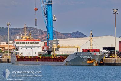
KARINA C
General Cargo

Current Trip
| Trip Time | 20 days |
|---|---|
| Trip Distance | 3406.58 nm |
| AVG Speed | 9.5 Knots |
| MAX Speed | 13 Knots |
| Draught | 6.3 m |
| AVG Wind | 10.2 knots |
| MAX Wind | 20 knots |
| MIN Temp | 6.8°C / 44.24°F |
| MAX Temp | 19.1°C / 66.38°F |
| Position Received | 7 d ago |
Current Position
| Longitude | 31.71353° |
|---|---|
| Latitude | 31.64135° |
| Status | At anchor |
| Speed | |
| Course | 54° |
| Area | Mediterranean Sea - Eastern Basin |
| Station | T-AIS |
| Position Received | 7 d ago |
Information
The current position of KARINA C is in Mediterranean Sea - Eastern Basin with coordinates 31.64135° / 31.71353° as reported on 2025-04-08 04:15 by AIS to our vessel tracker app. The vessel's current speed is 0 Knots and is currently inside the port of DAMIETTA.
The vessel KARINA C (IMO: 9558000, MMSI: 255806311) is a General Cargo that was built in 2010 ( 15 years old ). It's sailing under the flag of [PT] Portugal.
In this page you can find informations about the vessels current position, last detected port calls, and current voyage information. If the vessels is not in coverage by AIS you will find the latest position.
The current position of KARINA C is detected by our AIS receivers and we are not responsible for the reliability of the data. The last position was recorded while the vessel was in Coverage by the Ais receivers of our vessel tracking app.
The current draught of KARINA C as reported by AIS is 6.3 meters
Weather
| Temperature | 16.7°C / 62.06°F |
|---|---|
| Wind Speed | 9 knots |
| Direction | 58° ENE |
| Pressure | 1020.7 hPa |
| Humidity | 63 % |
| Cloud Coverage | 89 % |


Featured Company
Last Port Calls
| Port | Arrival | Departure | Time In Port |
|---|---|---|---|
| 2025-04-12 17:21 | |||
| 2025-03-19 01:36 | 2025-03-23 00:39 | 3 d | |
| 2025-03-09 13:02 | 2025-03-12 13:14 | 3 d | |
| 2025-02-14 15:23 | 2025-02-18 23:25 | 4 d | |
| 2025-02-10 11:27 | 2025-02-12 19:22 | 2 d | |
| 2025-02-01 04:34 | 2025-02-02 22:47 | 1 d |
Most Visited Ports (Last year)
| Port | Arrivals | |
|---|---|---|
| 5 | ||
| 3 | ||
| 3 | ||
| 2 | ||
| 2 | ||
| 2 |
Last Trips
| Origin | Departure | Destination | Arrival | Distance | |
|---|---|---|---|---|---|
| 2025-03-23 00:39 | 2025-04-12 17:21 | 3406.58 nm | |||
| 2025-03-12 13:14 | 2025-03-19 01:36 | 953.08 nm | |||
| 2025-02-18 23:25 | 2025-03-09 13:02 | 3100.07 nm | |||
| 2025-02-12 19:22 | 2025-02-14 15:23 | 437.78 nm | |||
| 2025-02-02 22:47 | 2025-02-10 11:27 | 1650.77 nm | |||
| 2025-01-29 22:17 | 2025-02-01 04:34 | 429.73 nm |
Events
| Time | Event | Details | Position / Dest | Info |
|---|---|---|---|---|
| 2025-04-12 16:16 | STOP Moving |
31.46917 / 31.76170
[EG] DAMIETTA
|
Speed: Course: 21° |
|
| 2025-04-12 15:21 | PORT ARRIVAL |
|
31.49146 / 31.75952
[EG] DAMIETTA
|
Speed: 6.2 kn Course: 193° |
| 2025-04-12 13:43 | START Moving | 10.36 nm, North of DAMIETTA |
31.63795 / 31.72411
EGDAM
|
Speed: 4.3 kn Course: 152° |
| 2025-04-08 04:27 | Status Changed | Default At anchor |
31.64144 / 31.71348
EGDAM
|
Speed: Course: 54° |
| 2025-04-08 04:15 | OUT of Coverage |
31.64135 / 31.71353
Mediterranean Sea - Eastern Basin
|
Speed: Course: 51.3° |
|
| 2025-04-08 04:03 | Status Changed | At anchor Default |
31.64142 / 31.71351
EGDAM
|
Speed: 0.4 kn Course: 68° |
| 2025-04-08 03:45 | Status Changed | Default At anchor |
31.64175 / 31.71338
EGDAM
|
Speed: Course: 58° |
| 2025-04-08 03:39 | Status Changed | At anchor Default |
31.64145 / 31.71346
EGDAM
|
Speed: 0.2 kn Course: 79° |
| 2025-04-08 03:24 | IN Coverage |
31.64145 / 31.71346
Mediterranean Sea - Eastern Basin
|
Speed: Course: 205.9° |
|
| 2025-04-08 00:12 | OUT of Coverage |
31.64130 / 31.71368
Mediterranean Sea - Eastern Basin
|
Speed: Course: 49.2° |