
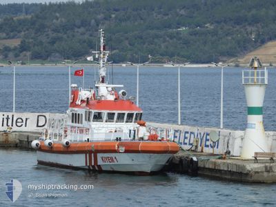
KIYEM-1
Not available
Current Trip
CANAKKALE
| Time Travelled | 1 h, 40 mins |
|---|---|
| Remaining Time | --- |
| Distance Travelled | 6.63 nm |
| Remaining Distance | --- |
| AVG Speed | 9.6 Knots |
| MAX Speed | 13.2 Knots |
| AVG Wind | 9.1 knots |
| MAX Wind | 10 knots |
| MIN Temp | 7.3°C / 45.14°F |
| MAX Temp | 8.6°C / 47.48°F |
| Draught | 2.5 m |
| Position Received | 1 m ago |
Current Position
| Longitude | 26.42678° |
|---|---|
| Latitude | 40.22717° |
| Status | Underway |
| Speed | |
| Course | 358° |
| Area | Sea of Marmara |
| Station | T-AIS |
| Position Received | 1 m ago |
Info
Information
The current position of KIYEM-1 is in Sea of Marmara with coordinates 40.22717° / 26.42678° as reported on 2025-03-21 08:26 by AIS to our vessel tracker app. The vessel's current speed is 0 Knots
The vessel KIYEM-1 (MMSI: 271042656) is a Not available It's sailing under the flag of [TR] Turkey.
In this page you can find informations about the vessels current position, last detected port calls, and current voyage information. If the vessels is not in coverage by AIS you will find the latest position.
The current position of KIYEM-1 is detected by our AIS receivers and we are not responsible for the reliability of the data. The last position was recorded while the vessel was in Coverage by the Ais receivers of our vessel tracking app.
The current draught of KIYEM-1 as reported by AIS is 2.5 meters
Weather
| Temperature | 8.1°C / 46.58°F |
|---|---|
| Wind Speed | 9 knots |
| Direction | 54° NE |
| Pressure | 1029 hPa |
| Humidity | 49.9 % |
| Cloud Coverage | --- |
Featured Company
Last Port Calls
| Port | Arrival | Departure | Time In Port |
|---|---|---|---|
| 2025-03-20 18:52 | 2025-03-21 09:48 | 14 h | |
| 2025-03-15 11:34 | 2025-03-20 10:02 | 4 d | |
| 2025-03-08 18:53 | 2025-03-10 19:24 | 2 d | |
| 2025-02-08 18:18 | 2025-02-08 18:27 | 8 m | |
| 2025-02-05 13:00 | 2025-02-06 16:55 | 1 d | |
| 2025-01-16 17:32 | 2025-01-16 17:34 | 2 m |
Most Visited Ports (Last year)
| Port | Arrivals | |
|---|---|---|
| 37 | ||
| 1 | ||
| 1 |
Last Trips
| Origin | Departure | Destination | Arrival | Distance | |
|---|---|---|---|---|---|
| 2025-03-20 10:02 | 2025-03-20 18:52 | 40.93 nm | |||
| 2025-03-10 19:24 | 2025-03-15 11:34 | 33.84 nm | |||
| 2025-02-08 18:27 | 2025-03-08 18:53 | 290.69 nm | |||
| 2025-02-06 16:55 | 2025-02-08 18:18 | 27.24 nm | |||
| 2025-01-16 17:34 | 2025-02-05 13:00 | 311.47 nm | |||
| 2024-12-01 00:46 | 2025-01-16 17:32 | 570.43 nm |
Events
| Time | Event | Details | Position / Dest | Info |
|---|---|---|---|---|
| 2025-03-21 07:32 | STOP Moving | 4.49 nm, North of CANAKKALE |
40.22726 / 26.42679
CANAKKALE
|
Speed: Course: 356° |
| 2025-03-21 07:10 | START Moving | 2.54 nm, North West of CANAKKALE |
40.18548 / 26.36484
CANAKKALE
|
Speed: 9.4 kn Course: 32.4° |
| 2025-03-21 07:07 | STOP Moving | 2.58 nm, North West of CANAKKALE |
40.18436 / 26.36219
CANAKKALE
|
Speed: 0.3 kn Course: 158° |
| 2025-03-21 06:48 | PORT DEPARTURE |
|
40.15481 / 26.39428
CANAKKALE
|
Speed: 9.7 kn Course: 333° |
| 2025-03-21 06:46 | START Moving |
40.15137 / 26.39783
[TR] CANAKKALE
|
Speed: 9.1 kn Course: 305° |
|
| 2025-03-20 15:55 | STOP Moving |
40.15059 / 26.40082
[TR] CANAKKALE
|
Speed: 0.3 kn Course: 12° |
|
| 2025-03-20 15:52 | PORT ARRIVAL |
|
40.14936 / 26.39748
[TR] CANAKKALE
|
Speed: 12.6 kn Course: 26.5° |
| 2025-03-20 15:35 | START Moving | 3.05 nm, South of CANAKKALE |
40.10766 / 26.37758
CANAKKALE
|
Speed: 7.7 kn Course: 8.8° |
| 2025-03-20 14:54 | STOP Moving | 3.17 nm, South of CANAKKALE |
40.10539 / 26.37793
CANAKKALE
|
Speed: 0.3 kn Course: 356° |
| 2025-03-20 14:13 | START Moving | 3.07 nm, South West of CANAKKALE |
40.11019 / 26.37006
CANAKKALE
|
Speed: 3.4 kn Course: 96° |