
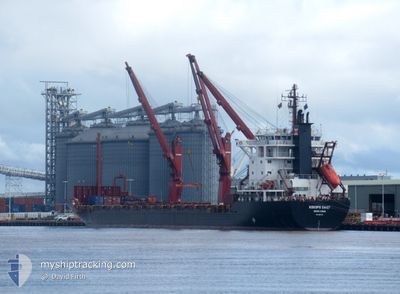
KOKOPO CHIEF
Container Ship
Current Trip
| Time Travelled | 3 days |
|---|---|
| Remaining Time | 18 h, 58 mins |
| Distance Travelled | 874.12 nm |
| Remaining Distance | 461.80 nm |
| AVG Speed | 12.4 Knots |
| MAX Speed | 13.8 Knots |
| AVG Wind | 16.1 knots |
| MAX Wind | 23.7 knots |
| MIN Temp | 27.2°C / 80.96°F |
| MAX Temp | 29.6°C / 85.28°F |
| Draught | 7.6 m |
| Position Received | 11 d ago |
Current Position
| Longitude | 112.82124° |
|---|---|
| Latitude | -6.76098° |
| Status | Under way using engine |
| Speed | 13 Knots |
| Course | 89.2° |
| Area | Java Sea |
| Station | T-AIS |
| Position Received | 11 d ago |
Info
Information
The current position of KOKOPO CHIEF is in Java Sea with coordinates -6.76098° / 112.82124° as reported on 2025-02-01 11:24 by AIS to our vessel tracker app. The vessel's current speed is 13 Knots and is heading at the port of DILI. The estimated time of arrival as calculated by MyShipTracking vessel tracking app is 2025-02-13 12:02 LT
The vessel KOKOPO CHIEF (IMO: 8907412, MMSI: 477062000) is a Container Ship that was built in 1991 ( 34 years old ). It's sailing under the flag of [HK] Hong Kong.
In this page you can find informations about the vessels current position, last detected port calls, and current voyage information. If the vessels is not in coverage by AIS you will find the latest position.
The current position of KOKOPO CHIEF is detected by our AIS receivers and we are not responsible for the reliability of the data. The last position was recorded while the vessel was in Coverage by the Ais receivers of our vessel tracking app.
The current draught of KOKOPO CHIEF as reported by AIS is 7.6 meters
Weather
| Temperature | 27.5°C / 81.5°F |
|---|---|
| Wind Speed | 15 knots |
| Direction | 294° WNW |
| Pressure | 1011.4 hPa |
| Humidity | 84 % |
| Cloud Coverage | 22 % |
Featured Company
Last Port Calls
| Port | Arrival | Departure | Time In Port |
|---|---|---|---|
| 2025-02-07 06:56 | 2025-02-09 01:56 | 1 d | |
| 2025-01-31 23:28 | 2025-02-01 08:44 | 9 h | |
| 2025-01-28 07:19 | 2025-01-28 23:27 | 16 h | |
| 2025-01-26 18:02 | 2025-01-27 18:53 | 1 d | |
| 2025-01-18 02:32 | 2025-01-19 23:48 | 1 d | |
| 2025-01-08 01:58 | 2025-01-09 00:18 | 22 h | |
| 2024-12-28 16:20 | 2024-12-31 04:32 | 2 d | |
| 2024-12-22 06:42 | 2024-12-22 16:33 | 9 h | |
| 2024-12-18 08:45 | 2024-12-19 02:45 | 18 h | |
| 2024-12-16 23:03 | 2024-12-17 18:16 | 19 h |
Last Trips
| Origin | Departure | Destination | Arrival | Distance | |
|---|---|---|---|---|---|
| 2025-02-01 15:44 | 2025-02-07 16:26 | 1267.15 nm | |||
| 2025-01-29 07:27 | 2025-02-01 06:28 | 808.48 nm | |||
| 2025-01-28 02:53 | 2025-01-28 15:19 | 14.45 nm | |||
| 2025-01-20 09:18 | 2025-01-27 02:02 | 1925.67 nm | |||
| 2025-01-09 08:18 | 2025-01-18 12:02 | 2065.93 nm | |||
| 2024-12-31 14:02 | 2025-01-08 09:58 | 1947.31 nm | |||
| 2024-12-22 23:33 | 2024-12-29 01:50 | 1271.38 nm | |||
| 2024-12-19 10:45 | 2024-12-22 13:42 | 808.59 nm | |||
| 2024-12-18 02:16 | 2024-12-18 16:45 | 17.24 nm | |||
| 2024-12-10 23:14 | 2024-12-17 07:03 | 1936.00 nm |
Events
| Time | Event | Details | Position / Dest | Info |
|---|---|---|---|---|
| 2025-02-09 01:56 | PORT DEPARTURE |
|
-12.38855 / 130.74994
TLDIL
|
Speed: 11.2 kn Course: 326° |
| 2025-02-09 01:00 | START Moving |
-12.49000 / 130.87418
[AU] DARWIN
|
Speed: 6.7 kn Course: 309° |
|
| 2025-02-07 08:08 | STOP Moving |
-12.49188 / 130.88255
[AU] DARWIN
|
Speed: 0.2 kn Course: 129° |
|
| 2025-02-07 06:56 | PORT ARRIVAL |
|
-12.40491 / 130.76349
[AU] DARWIN
|
Speed: 7.7 kn Course: 143° |
| 2025-02-07 05:52 | START Moving | 12.84 nm, North West of DARWIN |
-12.28505 / 130.64485
TLDIL
|
Speed: 4.5 kn Course: 138° |
| 2025-02-06 11:50 | STOP Moving | 12.94 nm, North West of DARWIN |
-12.28005 / 130.64760
TLDIL
|
Speed: 0.2 kn Course: 265° |
| 2025-02-04 02:31 | STOP Moving | 5.99 nm, West of DILI |
-8.57119 / 125.47742
TLDIL
|
Speed: 0.1 kn Course: 306° |