
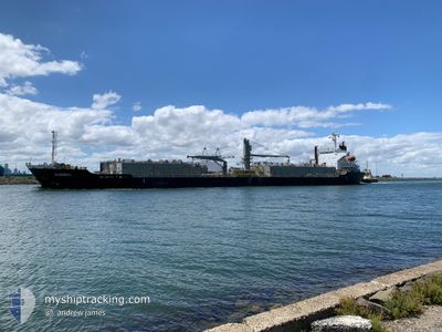
KONDILI
Bulk Carrier
Current Trip
| Time Travelled | 21 h, 43 mins |
|---|---|
| Remaining Time | 2 days |
| Distance Travelled | 286.79 nm |
| Remaining Distance | 749.42 nm |
| AVG Speed | 12.2 Knots |
| MAX Speed | 15.1 Knots |
| AVG Wind | 10.1 knots |
| MAX Wind | 19 knots |
| MIN Temp | 25.5°C / 77.9°F |
| MAX Temp | 26°C / 78.8°F |
| Draught | 9.6 m |
| Position Received | 4 h, 18 m ago |
Current Position
| Longitude | 153.77704° |
|---|---|
| Latitude | -29.36622° |
| Status | Under way using engine |
| Speed | 14.7 Knots |
| Course | 189.1° |
| Area | Coral Sea |
| Station | T-AIS |
| Position Received | 4 h, 18 m ago |
Info
Information
The current position of KONDILI is in Coral Sea with coordinates -29.36622° / 153.77704° as reported on 2025-02-12 06:35 by AIS to our vessel tracker app. The vessel's current speed is 14.7 Knots and is heading at the port of MELBOURNE. The estimated time of arrival as calculated by MyShipTracking vessel tracking app is 2025-02-14 12:44 LT
The vessel KONDILI (IMO: 9367633, MMSI: 311000696) is a Bulk Carrier that was built in 2006 ( 19 years old ). It's sailing under the flag of [BS] Bahamas.
In this page you can find informations about the vessels current position, last detected port calls, and current voyage information. If the vessels is not in coverage by AIS you will find the latest position.
The current position of KONDILI is detected by our AIS receivers and we are not responsible for the reliability of the data. The last position was recorded while the vessel was in Coverage by the Ais receivers of our vessel tracking app.
The current draught of KONDILI as reported by AIS is 9.6 meters
Weather
| Temperature | 25.5°C / 77.9°F |
|---|---|
| Wind Speed | 17 knots |
| Direction | 49° NE |
| Pressure | 1013.3 hPa |
| Humidity | 73.4 % |
| Cloud Coverage | 100 % |
Featured Company
Last Port Calls
| Port | Arrival | Departure | Time In Port |
|---|---|---|---|
| 2025-02-09 19:20 | 2025-02-11 13:11 | 1 d | |
| 2025-02-05 07:44 | 2025-02-08 08:57 | 3 d | |
| 2025-01-28 01:45 | 2025-01-31 08:11 | 3 d | |
| 2025-01-21 14:49 | 2025-01-24 03:43 | 2 d | |
| 2025-01-17 04:29 | 2025-01-20 06:04 | 3 d | |
| 2025-01-09 20:51 | 2025-01-12 09:26 | 2 d | |
| 2025-01-03 20:07 | 2025-01-07 02:58 | 3 d | |
| 2024-12-23 07:04 | 2024-12-27 07:41 | 4 d | |
| 2024-12-19 07:21 | 2024-12-21 09:32 | 2 d | |
| 2024-12-14 13:40 | 2024-12-17 09:36 | 2 d |
Last Trips
| Origin | Departure | Destination | Arrival | Distance | |
|---|---|---|---|---|---|
| 2025-02-08 18:57 | 2025-02-10 05:20 | 324.36 nm | |||
| 2025-01-31 19:11 | 2025-02-05 17:44 | 1329.31 nm | |||
| 2025-01-24 13:43 | 2025-01-28 12:45 | 1119.28 nm | |||
| 2025-01-20 16:04 | 2025-01-22 00:49 | 331.88 nm | |||
| 2025-01-12 20:26 | 2025-01-17 14:29 | 752.31 nm | |||
| 2025-01-07 12:58 | 2025-01-10 07:51 | 751.75 nm | |||
| 2024-12-27 18:41 | 2025-01-04 06:07 | 1352.16 nm | |||
| 2024-12-21 20:02 | 2024-12-23 18:04 | 517.55 nm | |||
| 2024-12-17 20:36 | 2024-12-19 17:51 | 517.60 nm | |||
| 2024-12-04 09:32 | 2024-12-15 00:40 | 529.52 nm |
Events
| Time | Event | Details | Position / Dest | Info |
|---|---|---|---|---|
| 2025-02-12 06:40 | Status Changed | Default Under way using engine |
-29.38604 / 153.77300
AU MEL
|
Speed: 14.7 kn Course: 189.1° |
| 2025-02-12 06:35 | Status Changed | Under way using engine Default |
-29.36622 / 153.77704
AU MEL
|
Speed: 14.7 kn Course: 190° |
| 2025-02-12 06:35 | OUT of Coverage |
-29.36622 / 153.77704
Coral Sea
AU MEL
|
Speed: 14.7 kn Course: 189.1° |
|
| 2025-02-12 06:32 | Status Changed | Default Under way using engine |
-29.35377 / 153.77968
AU MEL
|
Speed: 14.8 kn Course: 190.2° |
| 2025-02-12 06:21 | Status Changed | Under way using engine Default |
-29.30816 / 153.78972
AU MEL
|
Speed: 14.7 kn Course: 190° |
| 2025-02-12 06:12 | Status Changed | Default Under way using engine |
-29.27386 / 153.79704
AU MEL
|
Speed: 14.6 kn Course: 190.6° |
| 2025-02-12 06:10 | Status Changed | Under way using engine Default |
-29.26541 / 153.79881
AU MEL
|
Speed: 14.6 kn Course: 191° |
| 2025-02-12 06:08 | IN Coverage |
-29.26541 / 153.79881
Coral Sea
AU MEL
|
Speed: 14.6 kn Course: 190.6° |
|
| 2025-02-12 05:16 | Status Changed | Default Under way using engine |
-29.04661 / 153.84038
AU MEL
|
Speed: 14.6 kn Course: 190.8° |
| 2025-02-12 05:08 | OUT of Coverage |
-29.01682 / 153.84658
Coral Sea
AU MEL
|
Speed: 14.6 kn Course: 190.8° |