
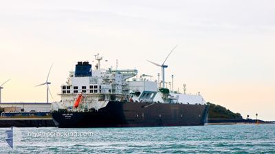
KOOL ICE
Tanker
Current Trip
| Time Travelled | 15 h, 21 mins |
|---|---|
| Remaining Time | --- |
| Distance Travelled | 205.83 nm |
| Remaining Distance | --- |
| AVG Speed | 13.1 Knots |
| MAX Speed | 16.7 Knots |
| AVG Wind | 8 knots |
| MAX Wind | 11 knots |
| MIN Temp | -1.2°C / 29.84°F |
| MAX Temp | 7.8°C / 46.04°F |
| Draught | 11.1 m |
| Position Received | 6 h, 58 m ago |
Current Position
| Longitude | -75.72979° |
|---|---|
| Latitude | 36.80459° |
| Status | Under way using engine |
| Speed | 9.3 Knots |
| Course | 106.3° |
| Area | North Atlantic Ocean |
| Station | T-AIS |
| Position Received | 6 h, 58 m ago |
Info
Information
The current position of KOOL ICE is in North Atlantic Ocean with coordinates 36.80459° / -75.72979° as reported on 2025-02-23 16:22 by AIS to our vessel tracker app. The vessel's current speed is 9.3 Knots and is heading at the port of THAMESPORT. The estimated time of arrival as calculated by MyShipTracking vessel tracking app is 2025-03-08 00:01 LT
The vessel KOOL ICE (IMO: 9637325, MMSI: 538004976) is a Tanker It's sailing under the flag of [MH] Marshall Is.
In this page you can find informations about the vessels current position, last detected port calls, and current voyage information. If the vessels is not in coverage by AIS you will find the latest position.
The current position of KOOL ICE is detected by our AIS receivers and we are not responsible for the reliability of the data. The last position was recorded while the vessel was in Coverage by the Ais receivers of our vessel tracking app.
The current draught of KOOL ICE as reported by AIS is 11.1 meters
Weather
| Temperature | 8.5°C / 47.3°F |
|---|---|
| Wind Speed | 3 knots |
| Direction | 276° W |
| Pressure | 1021 hPa |
| Humidity | 50 % |
| Cloud Coverage | 1 % |
Featured Company
Last Port Calls
| Port | Arrival | Departure | Time In Port |
|---|---|---|---|
| 2025-02-22 11:51 | 2025-02-23 07:59 | 20 h | |
| 2025-02-06 06:42 | 2025-02-07 02:51 | 20 h | |
| 2025-01-25 11:55 | 2025-01-26 05:39 | 17 h | |
| 2024-12-30 05:46 | 2024-12-31 05:57 | 1 d | |
| 2024-12-18 11:51 | 2024-12-19 07:07 | 19 h | |
| 2024-12-08 11:59 | 2024-12-09 10:43 | 22 h |
Most Visited Ports (Last year)
| Port | Arrivals | |
|---|---|---|
| 4 | ||
| 2 | ||
| 1 | ||
| 1 | ||
| 1 | ||
| 1 |
Last Trips
| Origin | Departure | Destination | Arrival | Distance | |
|---|---|---|---|---|---|
| 2025-02-07 03:51 | 2025-02-22 06:51 | 4053.16 nm | |||
| 2025-01-26 00:39 | 2025-02-06 07:42 | 4048.18 nm | |||
| 2024-12-31 06:57 | 2025-01-25 06:55 | 5920.26 nm | |||
| 2024-12-19 02:07 | 2024-12-30 06:46 | 4086.74 nm | |||
| 2024-12-09 05:43 | 2024-12-18 06:51 | 2782.17 nm | |||
| 2024-11-29 19:18 | 2024-12-08 06:59 | 2727.40 nm |
Events
| Time | Event | Details | Position / Dest | Info |
|---|---|---|---|---|
| 2025-02-23 16:27 | Status Changed | Default Under way using engine |
36.80057 / -75.71212
GBIOG
|
Speed: 9.3 kn Course: 106.3° |
| 2025-02-23 16:22 | OUT of Coverage |
36.80459 / -75.72979
North Atlantic Ocean
GBIOG
|
Speed: 9.3 kn Course: 106.3° |
|
| 2025-02-23 16:17 | Status Changed | Under way using engine Default |
36.80809 / -75.74518
GBIOG
|
Speed: 9.1 kn Course: 105° |
| 2025-02-23 16:15 | Status Changed | Default Under way using engine |
36.80898 / -75.74923
GBIOG
|
Speed: 8.8 kn Course: 105° |
| 2025-02-23 16:06 | Status Changed | Under way using engine Default |
36.81647 / -75.77614
GBIOG
|
Speed: 9.4 kn Course: 122° |
| 2025-02-23 16:03 | Status Changed | Default Under way using engine |
36.82040 / -75.78401
GBIOG
|
Speed: 9.4 kn Course: 121.3° |
| 2025-02-23 12:41 | Draught Changed | 11.1 9.6 |
37.36401 / -76.07787
GBIOG
|
Speed: 14.3 kn Course: 180.5° |
| 2025-02-23 12:41 | Destination Changed | GBIOG USCP6 |
37.36401 / -76.07787
GBIOG
|
Speed: 14.3 kn Course: 180.5° |
| 2025-02-23 12:41 | ETA Changed | 2025/03/08 00:01 2025/02/21 05:01 |
37.36401 / -76.07787
GBIOG
|
Speed: 14.3 kn Course: 180.5° |
| 2025-02-23 12:20 | Status Changed | Under way using engine Default |
37.44280 / -76.08591
USCP6
|
Speed: 14.1 kn Course: 207° |