
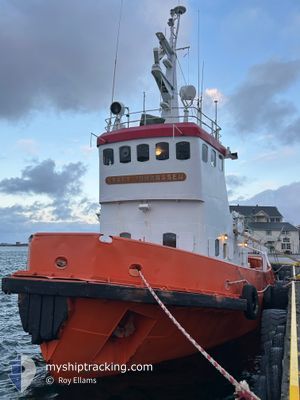
KRAFT JOHANSSEN
Tug
Current Trip
| Trip Time | 8 days |
|---|---|
| Trip Distance | 130.45 nm |
| AVG Speed | 8 Knots |
| MAX Speed | 11.2 Knots |
| Draught | 0 m |
| AVG Wind | 10.8 knots |
| MAX Wind | 24 knots |
| MIN Temp | -7.4°C / 18.68°F |
| MAX Temp | 3.4°C / 38.12°F |
| Position Received | Now |
Current Position
| Longitude | 12.20938° |
|---|---|
| Latitude | 65.47422° |
| Status | Moored |
| Speed | |
| Course | 216° |
| Area | Norwegian Sea |
| Station | T-AIS |
| Position Received | Now |
Info
Information
The current position of KRAFT JOHANSSEN is in Norwegian Sea with coordinates 65.47422° / 12.20938° as reported on 2025-02-09 16:24 by AIS to our vessel tracker app. The vessel's current speed is 0 Knots and is currently inside the port of BRONNOYSUND.
The vessel KRAFT JOHANSSEN (IMO: 7334008, MMSI: 257061600) is a Tug It's sailing under the flag of [NO] Norway.
In this page you can find informations about the vessels current position, last detected port calls, and current voyage information. If the vessels is not in coverage by AIS you will find the latest position.
The current position of KRAFT JOHANSSEN is detected by our AIS receivers and we are not responsible for the reliability of the data. The last position was recorded while the vessel was in Coverage by the Ais receivers of our vessel tracking app.
Weather
| Temperature | 3.8°C / 38.84°F |
|---|---|
| Wind Speed | 14 knots |
| Direction | 213° SSW |
| Pressure | 1036 hPa |
| Humidity | 89.7 % |
| Cloud Coverage | 100 % |
Featured Company
Last Port Calls
| Port | Arrival | Departure | Time In Port |
|---|---|---|---|
| 2025-01-31 03:26 | |||
| 2024-12-05 11:48 | 2025-01-23 02:17 | ||
| 2024-12-03 16:25 |
Most Visited Ports (Last year)
| Port | Arrivals | |
|---|---|---|
| 3 | ||
| 2 | ||
| 1 |
Last Trips
| Origin | Departure | Destination | Arrival | Distance | |
|---|---|---|---|---|---|
| 2025-01-23 02:17 | 2025-01-31 03:26 | 130.45 nm | |||
| 2024-12-03 16:25 | 2024-12-05 11:48 | 226.44 nm |
Events
| Time | Event | Details | Position / Dest | Info |
|---|---|---|---|---|
| 2025-02-03 10:42 | Status Changed | Moored Default |
65.47423 / 12.20941
[NO] BRONNOYSUND
|
Speed: Course: 217° |
| 2025-02-03 10:39 | Status Changed | Default Moored |
65.47422 / 12.20942
[NO] BRONNOYSUND
|
Speed: Course: 218° |
| 2025-01-31 02:26 | STOP Moving |
65.47424 / 12.20946
[NO] BRONNOYSUND
|
Speed: 0.1 kn Course: 218° |
|
| 2025-01-31 02:26 | PORT ARRIVAL |
|
65.47424 / 12.20946
[NO] BRONNOYSUND
|
Speed: 1.9 kn Course: 163° |
| 2025-01-30 18:57 | START Moving | 3.12 nm, South East of STRAUMOYVALEN |
66.34223 / 12.70358
|
Speed: 6.9 kn Course: 332° |