
KRAICHGAU 3
Wing in ground
Current Trip
| Time Travelled | 4 days |
|---|---|
| Remaining Time | 3 h, 14 mins |
| Distance Travelled | 209.41 nm |
| Remaining Distance | 32.34 nm |
| AVG Speed | 10 Knots |
| MAX Speed | 11.7 Knots |
| AVG Wind | 8.8 knots |
| MAX Wind | 13 knots |
| MIN Temp | -1.4°C / 29.48°F |
| MAX Temp | 5.1°C / 41.18°F |
| Draught | 2.3 m |
| Position Received | 1 m ago |
Current Position
| Longitude | 4.61619° |
|---|---|
| Latitude | 51.71406° |
| Status | Under way using engine |
| Speed | 8.7 Knots |
| Course | 249.1° |
| Area | North Sea |
| Station | T-AIS |
| Position Received | 1 m ago |
Info
Information
The current position of KRAICHGAU 3 is in North Sea with coordinates 51.71406° / 4.61619° as reported on 2025-02-19 14:10 by AIS to our vessel tracker app. The vessel's current speed is 8.7 Knots and is heading at the port of ANTWERP. The estimated time of arrival as calculated by MyShipTracking vessel tracking app is 2025-02-19 17:26 LT
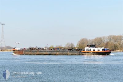
The vessel KRAICHGAU 3 (MMSI: 244140973) is a Wing in ground It's sailing under the flag of [NL] Netherlands.
In this page you can find informations about the vessels current position, last detected port calls, and current voyage information. If the vessels is not in coverage by AIS you will find the latest position.
The current position of KRAICHGAU 3 is detected by our AIS receivers and we are not responsible for the reliability of the data. The last position was recorded while the vessel was in Coverage by the Ais receivers of our vessel tracking app.
The current draught of KRAICHGAU 3 as reported by AIS is 2.3 meters
Weather
| Temperature | 5.3°C / 41.54°F |
|---|---|
| Wind Speed | 9 knots |
| Direction | 131° SE |
| Pressure | 1020.3 hPa |
| Humidity | 36.9 % |
| Cloud Coverage | 100 % |
Featured Company
Last Port Calls
| Port | Arrival | Departure | Time In Port |
|---|---|---|---|
| 2025-02-14 12:00 | 2025-02-15 07:13 | 19 h | |
| 2025-02-13 11:01 | 2025-02-14 06:14 | 19 h | |
| 2025-02-13 06:01 | 2025-02-13 07:16 | 1 h | |
| 2025-02-12 10:02 | 2025-02-12 10:41 | 39 m | |
| 2025-02-08 23:43 | 2025-02-09 13:44 | 14 h | |
| 2025-02-08 07:09 | 2025-02-08 08:33 | 1 h | |
| 2025-02-03 09:27 | 2025-02-04 04:51 | 19 h | |
| 2025-01-26 10:05 | 2025-01-29 06:43 | 2 d | |
| 2025-01-25 11:18 | 2025-01-25 13:43 | 2 h | |
| 2025-01-25 08:08 | 2025-01-25 09:01 | 52 m |
Last Trips
| Origin | Departure | Destination | Arrival | Distance | |
|---|---|---|---|---|---|
| 2025-02-14 07:14 | 2025-02-14 13:00 | 28.05 nm | |||
| 2025-02-13 08:16 | 2025-02-13 12:01 | 12.55 nm | |||
| 2025-02-12 11:41 | 2025-02-13 07:01 | 113.62 nm | |||
| 2025-02-09 14:44 | 2025-02-12 11:02 | 111.96 nm | |||
| 2025-02-08 09:33 | 2025-02-09 00:43 | 135.46 nm | |||
| 2025-02-04 05:51 | 2025-02-08 08:09 | 224.34 nm | |||
| 2025-01-29 07:43 | 2025-02-03 10:27 | 201.95 nm | |||
| 2025-01-25 14:43 | 2025-01-26 11:05 | 45.60 nm | |||
| 2025-01-25 10:01 | 2025-01-25 12:18 | 11.43 nm | |||
| 2025-01-24 09:28 | 2025-01-25 09:08 | 108.32 nm |
Events
| Time | Event | Details | Position / Dest | Info |
|---|---|---|---|---|
| 2025-02-19 14:04 | Status Changed | Under way using engine Default |
51.71822 / 4.63822
ANTWERPEN
|
Speed: 9.3 kn Course: 253° |
| 2025-02-19 13:57 | Status Changed | Default Under way using engine |
51.72287 / 4.66618
ANTWERPEN
|
Speed: 9.4 kn Course: 240.2° |
| 2025-02-19 07:56 | Draught Changed | 2.3 2.5 |
51.84772 / 6.11540
ANTWERPEN
|
Speed: 11.6 kn Course: 274.2° |
| 2025-02-19 07:56 | Destination Changed | ANTWERPEN NLVDMX0108BRDG100003 |
51.84772 / 6.11540
ANTWERPEN
|
Speed: 11.6 kn Course: 274.2° |
| 2025-02-19 07:56 | ETA Changed | 2025/02/19 01:00 2025/02/13 15:00 |
51.84772 / 6.11540
ANTWERPEN
|
Speed: 11.6 kn Course: 274.2° |
| 2025-02-19 07:43 | Status Changed | Under way using engine Default |
51.83622 / 6.18111
NLVDMX0108BRDG100003
|
Speed: 11.6 kn Course: 291° |
| 2025-02-19 07:39 | IN Coverage |
51.83736 / 6.17824
North Sea
|
Speed: 11.3 kn Course: 301.7° |
|
| 2025-02-19 06:01 | OUT of Coverage |
51.66257 / 6.51916
North Sea
|
Speed: 11.2 kn Course: 265.1° |
|
| 2025-02-19 05:54 | IN Coverage |
51.65845 / 6.54872
North Sea
|
Speed: 11.7 kn Course: 270.4° |
|
| 2025-02-15 16:10 | OUT of Coverage |
52.81144 / 7.23917
North Sea
|
Speed: 5 kn Course: 168.5° |