

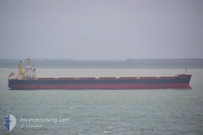
KYPROS SKY
Cargo

Current Trip
JP MYJ
| Time Travelled | 2 days |
|---|---|
| Remaining Time | --- |
| Distance Travelled | 689.08 nm |
| Remaining Distance | --- |
| AVG Speed | 11.6 Knots |
| MAX Speed | 14.8 Knots |
| AVG Wind | 13.8 knots |
| MAX Wind | 30.9 knots |
| MIN Temp | 16.8°C / 62.24°F |
| MAX Temp | 22.7°C / 72.86°F |
| Draught | 9.9 m |
| Position Received | 3 d ago |
Current Position
| Longitude | 132.69614° |
|---|---|
| Latitude | 33.84790° |
| Status | Moored |
| Speed | |
| Course | 121° |
| Area | Inland Sea |
| Station | T-AIS |
| Position Received | 3 d ago |
Information
The current position of KYPROS SKY is in Inland Sea with coordinates 33.84790° / 132.69614° as reported on 2025-05-27 15:51 by AIS to our vessel tracker app. The vessel's current speed is 0 Knots
The vessel KYPROS SKY (IMO: 9713935, MMSI: 212452000) is a Cargo It's sailing under the flag of [CY] Cyprus.
In this page you can find informations about the vessels current position, last detected port calls, and current voyage information. If the vessels is not in coverage by AIS you will find the latest position.
The current position of KYPROS SKY is detected by our AIS receivers and we are not responsible for the reliability of the data. The last position was recorded while the vessel was in Coverage by the Ais receivers of our vessel tracking app.
The current draught of KYPROS SKY as reported by AIS is 9.9 meters
Weather
| Temperature | 20.9°C / 69.62°F |
|---|---|
| Wind Speed | 12 knots |
| Direction | 134° SE |
| Pressure | 1010.8 hPa |
| Humidity | 77.6 % |
| Cloud Coverage | 100 % |


Featured Company
Last Port Calls
| Port | Arrival | Departure | Time In Port |
|---|---|---|---|
| 2025-05-21 17:58 | 2025-05-29 11:18 | 7 d | |
| 2025-05-17 06:42 | 2025-05-19 21:18 | 2 d | |
| 2025-04-13 21:51 | 2025-04-14 23:18 | 1 d | |
| 2025-03-21 15:02 | 2025-03-25 08:34 | 3 d | |
| 2025-03-07 06:13 | 2025-03-09 17:22 | 2 d |
Most Visited Ports (Last year)
| Port | Arrivals | |
|---|---|---|
| 2 | ||
| 2 | ||
| 1 | ||
| 1 | ||
| 1 | ||
| 1 |
Last Trips
| Origin | Departure | Destination | Arrival | Distance | |
|---|---|---|---|---|---|
| 2025-05-19 21:18 | 2025-05-21 17:58 | 411.99 nm | |||
| 2025-04-14 23:18 | 2025-05-17 06:42 | 4360.57 nm | |||
| 2025-03-25 08:34 | 2025-04-13 21:51 | 4764.11 nm | |||
| 2025-03-09 17:22 | 2025-03-21 15:02 | 2772.31 nm | |||
| 2025-02-25 11:30 | 2025-03-07 06:13 | 1803.36 nm |
Events
| Time | Event | Details | Position / Dest | Info |
|---|---|---|---|---|
| 2025-05-29 02:29 | START Moving | 1.23 nm, South West of MATSUYAMA |
33.85536 / 132.68370
JP MYJ
|
Speed: 3.4 kn Course: 315° |
| 2025-05-29 02:18 | PORT DEPARTURE |
|
33.85088 / 132.68919
JP MYJ
|
Speed: 1.7 kn Course: 144° |
| 2025-05-27 15:57 | Status Changed | Default Moored |
33.84792 / 132.69611
[JP] MATSUYAMA
|
Speed: Course: 121° |
| 2025-05-27 15:51 | Status Changed | Moored Default |
33.84790 / 132.69614
[JP] MATSUYAMA
|
Speed: Course: 121° |
| 2025-05-27 15:51 | OUT of Coverage |
33.84790 / 132.69614
Inland Sea
[JP] MATSUYAMA
|
Speed: Course: 54° |
|
| 2025-05-27 15:27 | Status Changed | Default Moored |
33.84795 / 132.69615
[JP] MATSUYAMA
|
Speed: Course: 121° |
| 2025-05-27 15:21 | Status Changed | Moored Default |
33.84790 / 132.69616
[JP] MATSUYAMA
|
Speed: Course: 121° |
| 2025-05-27 15:18 | Status Changed | Default Moored |
33.84794 / 132.69611
[JP] MATSUYAMA
|
Speed: 0.1 kn Course: 121° |
| 2025-05-27 15:09 | Status Changed | Moored Default |
33.84792 / 132.69614
[JP] MATSUYAMA
|
Speed: Course: 121° |
| 2025-05-27 15:00 | Status Changed | Default Moored |
33.84788 / 132.69620
[JP] MATSUYAMA
|
Speed: 0.1 kn Course: 121° |