

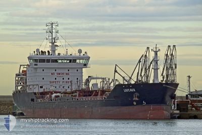
LASCAUX
Oil/Chemical Tanker

Current Trip
| Trip Time | 8 days |
|---|---|
| Trip Distance | 1774.72 nm |
| AVG Speed | 10.5 Knots |
| MAX Speed | 12.6 Knots |
| Draught | 7.2 m |
| AVG Wind | 14.6 knots |
| MAX Wind | 21.9 knots |
| MIN Temp | 13.7°C / 56.66°F |
| MAX Temp | 26.9°C / 80.42°F |
| Position Received | 5 d ago |
Current Position
| Longitude | -15.42952° |
|---|---|
| Latitude | 27.42675° |
| Status | Under way using engine |
| Speed | 11.1 Knots |
| Course | 209.7° |
| Area | North Atlantic Ocean |
| Station | T-AIS |
| Position Received | 5 d ago |
Information
The current position of LASCAUX is in North Atlantic Ocean with coordinates 27.42675° / -15.42952° as reported on 2025-05-17 13:07 by AIS to our vessel tracker app. The vessel's current speed is 11.1 Knots and is currently inside the port of BISSAU.
The vessel LASCAUX (IMO: 9405746, MMSI: 229291000) is a Oil/Chemical Tanker that was built in 2007 ( 18 years old ). It's sailing under the flag of [MT] Malta.
In this page you can find informations about the vessels current position, last detected port calls, and current voyage information. If the vessels is not in coverage by AIS you will find the latest position.
The current position of LASCAUX is detected by our AIS receivers and we are not responsible for the reliability of the data. The last position was recorded while the vessel was in Coverage by the Ais receivers of our vessel tracking app.
The current draught of LASCAUX as reported by AIS is 7.2 meters
Weather
| Temperature | 26.4°C / 79.52°F |
|---|---|
| Wind Speed | 10 knots |
| Direction | 255° WSW |
| Pressure | 1013.3 hPa |
| Humidity | 79.3 % |
| Cloud Coverage | 100 % |


Featured Company
Last Port Calls
| Port | Arrival | Departure | Time In Port |
|---|---|---|---|
| 2025-05-23 07:51 | |||
| 2025-05-13 21:49 | 2025-05-14 20:29 | 22 h | |
| 2025-05-08 23:29 | 2025-05-09 12:48 | 13 h | |
| 2025-04-29 11:43 | 2025-04-30 12:17 | 1 d | |
| 2025-04-19 20:38 | 2025-04-24 17:12 | 4 d | |
| 2025-03-30 18:57 | 2025-04-01 00:48 | 1 d | |
| 2025-03-26 22:14 | 2025-03-28 11:41 | 1 d | |
| 2025-03-22 13:43 | 2025-03-23 09:59 | 20 h | |
| 2025-03-21 00:52 | 2025-03-21 06:31 | 5 h | |
| 2025-03-09 18:57 | 2025-03-09 20:21 | 1 h |
Last Trips
| Origin | Departure | Destination | Arrival | Distance | |
|---|---|---|---|---|---|
| 2025-05-14 20:29 | 2025-05-23 07:51 | 1774.72 nm | |||
| 2025-05-09 12:48 | 2025-05-13 21:49 | 693.43 nm | |||
| 2025-04-30 12:17 | 2025-05-08 23:29 | 485.02 nm | |||
| 2025-04-24 17:12 | 2025-04-29 11:43 | 217.54 nm | |||
| 2025-04-01 00:48 | 2025-04-19 20:38 | 3336.93 nm | |||
| 2025-03-28 11:41 | 2025-03-30 18:57 | 488.08 nm | |||
| 2025-03-23 09:59 | 2025-03-26 22:14 | 452.43 nm | |||
| 2025-03-21 06:31 | 2025-03-22 13:43 | 164.93 nm | |||
| 2025-03-09 20:21 | 2025-03-21 00:52 | 1852.75 nm | |||
| 2025-03-07 18:45 | 2025-03-09 18:57 | 233.64 nm |
Events
| Time | Event | Details | Position / Dest | Info |
|---|---|---|---|---|
| 2025-05-23 07:52 | STOP Moving |
11.85883 / -15.57455
[GW] BISSAU
|
Speed: 0.3 kn Course: 220° |
|
| 2025-05-23 07:51 | PORT ARRIVAL |
|
11.85883 / -15.57455
[GW] BISSAU
|
Speed: 1.4 kn Course: 246° |
| 2025-05-21 15:59 | STOP Moving | 1.41 nm, South West of BISSAU |
11.83736 / -15.58719
GW OXB
|
Speed: 0.1 kn Course: 225° |
| 2025-05-21 15:42 | START Moving | 1.48 nm, South of BISSAU |
11.83323 / -15.57832
GW OXB
|
Speed: 3.3 kn Course: 285° |
| 2025-05-21 14:43 | STOP Moving | 1.48 nm, South of BISSAU |
11.83324 / -15.57296
GW OXB
|
Speed: 0.2 kn Course: 214° |
| 2025-05-17 13:12 | Status Changed | Default Under way using engine |
27.41080 / -15.43992
GW OXB
|
Speed: 11.1 kn Course: 209.7° |
| 2025-05-17 13:07 | OUT of Coverage |
27.42675 / -15.42952
North Atlantic Ocean
GW OXB
|
Speed: 11.1 kn Course: 209.7° |
|
| 2025-05-17 12:49 | Status Changed | Under way using engine Default |
27.47467 / -15.39831
GW OXB
|
Speed: 10.9 kn Course: 211° |
| 2025-05-17 12:44 | Status Changed | Default Under way using engine |
27.48566 / -15.39084
GW OXB
|
Speed: 10.9 kn Course: 211.3° |
| 2025-05-17 12:38 | Status Changed | Under way using engine Default |
27.50161 / -15.37993
GW OXB
|
Speed: 10.9 kn Course: 211° |