
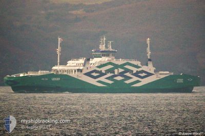
LEIGER
Passenger
Current Trip
| Trip Time | --- |
|---|---|
| Trip Distance | --- |
| AVG Speed | --- |
| MAX Speed | --- |
| Draught | --- |
| AVG Wind | --- |
| MAX Wind | --- |
| MIN Temp | --- |
| MAX Temp | --- |
| Position Received | 1 d ago |
Current Position
| Longitude | 23.32562° |
|---|---|
| Latitude | 58.90770° |
| Status | Under way using engine |
| Speed | 8.4 Knots |
| Course | 267.3° |
| Area | Gulf of Riga |
| Station | T-AIS |
| Position Received | 1 d ago |
Info
Information
The current position of LEIGER is in Gulf of Riga with coordinates 58.90770° / 23.32562° as reported on 2025-02-21 17:21 by AIS to our vessel tracker app. The vessel's current speed is 8.4 Knots and is currently inside the port of ROHUKULA.
The vessel LEIGER (IMO: 9762675, MMSI: 276823000) is a Passenger It's sailing under the flag of [EE] Estonia.
In this page you can find informations about the vessels current position, last detected port calls, and current voyage information. If the vessels is not in coverage by AIS you will find the latest position.
The current position of LEIGER is detected by our AIS receivers and we are not responsible for the reliability of the data. The last position was recorded while the vessel was in Coverage by the Ais receivers of our vessel tracking app.
The current draught of LEIGER as reported by AIS is 4 meters
Weather
| Temperature | -0.7°C / 30.74°F |
|---|---|
| Wind Speed | 20 knots |
| Direction | 199° SSW |
| Pressure | 1026.9 hPa |
| Humidity | 79.7 % |
| Cloud Coverage | 100 % |
Featured Company
Last Port Calls
| Port | Arrival | Departure | Time In Port |
|---|---|---|---|
| 2025-02-21 12:17 | 2025-02-21 12:37 | 19 m | |
| 2025-02-21 11:04 | |||
| 2025-02-20 10:15 | |||
| 2025-02-20 10:15 | |||
| 2025-02-19 21:11 | |||
| 2025-02-19 19:48 | 2025-02-19 20:02 | 13 m | |
| 2025-02-19 09:25 | 2025-02-19 09:34 | 9 m | |
| 2025-02-19 08:00 | 2025-02-19 08:02 | 2 m | |
| 2025-02-19 05:46 | 2025-02-19 06:33 | 46 m | |
| 2025-02-18 05:45 | 2025-02-19 04:36 | 22 h |
Most Visited Ports (Last year)
| Port | Arrivals | |
|---|---|---|
| 695 | ||
| 690 | ||
| 2 |
Last Trips
| Origin | Departure | Destination | Arrival | Distance | |
|---|---|---|---|---|---|
| 2025-02-21 13:04 | 2025-02-21 14:17 | 8.06 nm | |||
| 2025-02-19 22:02 | 2025-02-20 12:15 | 32.93 nm | |||
| 2025-02-19 22:02 | 2025-02-19 23:11 | 9.17 nm | |||
| 2025-02-19 11:34 | 2025-02-19 21:48 | 30.99 nm | |||
| 2025-02-19 10:02 | 2025-02-19 11:25 | 9.67 nm | |||
| 2025-02-19 08:33 | 2025-02-19 10:00 | 9.75 nm | |||
| 2025-02-19 06:36 | 2025-02-19 07:46 | 8.68 nm | |||
| 2025-02-18 06:34 | 2025-02-18 07:45 | 11.25 nm | |||
| 2025-02-16 16:15 | 2025-02-17 17:22 | 28.74 nm | |||
| 2025-02-16 16:15 | 2025-02-16 17:12 | 4.97 nm |
Events
| Time | Event | Details | Position / Dest | Info |
|---|---|---|---|---|
| 2025-02-21 17:21 | OUT of Coverage |
58.90770 / 23.32562
Gulf of Riga
|
Speed: 8.4 kn Course: 267.3° |
|
| 2025-02-21 17:15 | IN Coverage |
58.90780 / 23.35643
Gulf of Riga
|
Speed: 9.6 kn Course: 270.8° |
|
| 2025-02-21 12:37 | PORT DEPARTURE |
|
58.86958 / 23.07707
ROHUKULA - HELTERMAA
|
Speed: 8.3 kn Course: 91° |
| 2025-02-21 12:33 | START Moving |
58.86745 / 23.05647
[EE] HELTERMAA
|
Speed: 8.3 kn Course: 91° |
|
| 2025-02-21 12:18 | STOP Moving |
58.86662 / 23.04900
[EE] HELTERMAA
|
Speed: Course: 58° |
|
| 2025-02-21 12:17 | PORT ARRIVAL |
|
58.86662 / 23.04900
[EE] HELTERMAA
|
Speed: 10.3 kn Course: 254° |
| 2025-02-21 11:28 | START Moving | 4.04 nm, West of ROHUKULA |
58.90150 / 23.29080
ROHUKULA - HELTERMAA
|
Speed: 10.2 kn Course: 248° |
| 2025-02-21 11:04 | PORT DEPARTURE |
|
58.90150 / 23.29080
ROHUKULA - HELTERMAA
|
Speed: Course: 318° |
| 2025-02-21 10:57 | STOP Moving |
58.90695 / 23.42200
[EE] ROHUKULA
|
Speed: Course: 318° |
|
| 2025-02-20 10:15 | PORT DEPARTURE |
|
58.90717 / 23.42246
ROHUKULA - HELTERMAA
|
Speed: Course: 59° |