

LITSA
General Cargo

Current Trip
| Time Travelled | 10 days |
|---|---|
| Remaining Time | --- |
| Distance Travelled | 265.41 nm |
| Remaining Distance | --- |
| AVG Speed | 8.5 Knots |
| MAX Speed | 10.2 Knots |
| AVG Wind | 14.2 knots |
| MAX Wind | 25.9 knots |
| MIN Temp | 26°C / 78.8°F |
| MAX Temp | 30.1°C / 86.18°F |
| Draught | 3.2 m |
| Position Received | 2025-04-15 15:10 |
Current Position
| Longitude | -48.33987° |
|---|---|
| Latitude | -26.75179° |
| Status | Under way using engine |
| Speed | 8.9 Knots |
| Course | 54° |
| Area | South Atlantic Ocean |
| Station | T-AIS |
| Position Received | 2025-04-15 15:10 |
Information
The current position of LITSA is in South Atlantic Ocean with coordinates -26.75179° / -48.33987° as reported on 2025-04-15 15:10 by AIS to our vessel tracker app. The vessel's current speed is 8.9 Knots and is heading at the port of PARANAGUA.
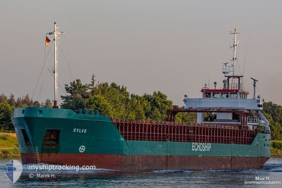
The vessel LITSA (IMO: 8906286, MMSI: 613889000) is a General Cargo that was built in 1990 ( 35 years old ). It's sailing under the flag of [CM] Cameroon.
In this page you can find informations about the vessels current position, last detected port calls, and current voyage information. If the vessels is not in coverage by AIS you will find the latest position.
The current position of LITSA is detected by our AIS receivers and we are not responsible for the reliability of the data. The last position was recorded while the vessel was in Coverage by the Ais receivers of our vessel tracking app.
The current draught of LITSA as reported by AIS is 3.2 meters
Weather
| Temperature | 26.5°C / 79.7°F |
|---|---|
| Wind Speed | 4 knots |
| Direction | 211° SSW |
| Pressure | 1010.6 hPa |
| Humidity | 82.3 % |
| Cloud Coverage | 93 % |


Featured Company
Last Port Calls
| Port | Arrival | Departure | Time In Port |
|---|---|---|---|
| 2025-05-09 08:29 | 2025-05-09 18:46 | 10 h | |
| 2025-04-15 09:48 | 2025-04-15 10:01 | 13 m | |
| 2025-03-01 12:13 |
Most Visited Ports (Last year)
| Port | Arrivals | |
|---|---|---|
| 6 | ||
| 2 | ||
| 2 | ||
| 1 | ||
| 1 | ||
| 1 |
Last Trips
| Origin | Departure | Destination | Arrival | Distance | |
|---|---|---|---|---|---|
| 2025-04-15 10:01 | 2025-05-09 08:29 | 3837.85 nm | |||
| 2025-03-01 12:13 | 2025-04-15 09:48 | 7486.75 nm |
Events
| Time | Event | Details | Position / Dest | Info |
|---|---|---|---|---|
| 2025-05-17 01:57 | STOP Moving | 12.64 nm, North of EL PALITO |
10.69694 / -68.06062
PARANAGUA
|
Speed: 0.3 kn Course: 80° |
| 2025-05-16 20:39 | START Moving | 2.14 nm, North West of PUERTO CABELLO |
10.50909 / -68.02839
PARANAGUA
|
Speed: 4.6 kn Course: 10° |
| 2025-05-16 19:56 | STOP Moving | 2.38 nm, North West of PUERTO CABELLO |
10.51518 / -68.02720
PARANAGUA
|
Speed: 0.3 kn Course: 107° |
| 2025-05-14 11:54 | STOP Moving | 1.45 nm, South of PUNTA DE PIEDRAS |
10.87327 / -64.10909
PARANAGUA
|
Speed: 0.1 kn Course: 108° |
| 2025-05-13 18:06 | STOP Moving | 1.44 nm, South of PUNTA DE PIEDRAS |
10.87282 / -64.10718
PARANAGUA
|
Speed: 0.1 kn Course: 99° |
| 2025-05-12 09:18 | STOP Moving | 1.38 nm, South of PUNTA DE PIEDRAS |
10.87338 / -64.10555
PARANAGUA
|
Speed: 0.2 kn Course: 119° |
| 2025-05-10 21:17 | STOP Moving | 1.43 nm, South of PUNTA DE PIEDRAS |
10.87237 / -64.10448
PARANAGUA
|
Speed: 0.2 kn Course: 74° |