
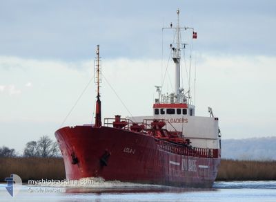
LOLA1
Cement Carrier
Current Trip
| Time Travelled | 1 day |
|---|---|
| Remaining Time | -2 mins |
| Distance Travelled | 304.52 nm |
| Remaining Distance | 2.60 nm |
| AVG Speed | 8.2 Knots |
| MAX Speed | 9.8 Knots |
| AVG Wind | 17.4 knots |
| MAX Wind | 36 knots |
| MIN Temp | 2°C / 35.6°F |
| MAX Temp | 7.5°C / 45.5°F |
| Draught | 3.5 m |
| Position Received | 1 m ago |
Current Position
| Longitude | 5.26567° |
|---|---|
| Latitude | 59.40117° |
| Status | Under way using engine |
| Speed | 4.4 Knots |
| Course | 143° |
| Area | North Sea |
| Station | T-AIS |
| Position Received | 1 m ago |
Info
Information
The current position of LOLA1 is in North Sea with coordinates 59.40117° / 5.26567° as reported on 2025-02-05 07:28 by AIS to our vessel tracker app. The vessel's current speed is 4.4 Knots and is heading at the port of STORASUND. The estimated time of arrival as calculated by MyShipTracking vessel tracking app is 2025-02-05 07:28 LT
The vessel LOLA1 (IMO: 6721151, MMSI: 375219000) is a Cement Carrier that was built in 1967 ( 58 years old ). It's sailing under the flag of [VC] St Vincent Grenadines.
In this page you can find informations about the vessels current position, last detected port calls, and current voyage information. If the vessels is not in coverage by AIS you will find the latest position.
The current position of LOLA1 is detected by our AIS receivers and we are not responsible for the reliability of the data. The last position was recorded while the vessel was in Coverage by the Ais receivers of our vessel tracking app.
The current draught of LOLA1 as reported by AIS is 3.5 meters
Weather
| Temperature | 5.8°C / 42.44°F |
|---|---|
| Wind Speed | 15 knots |
| Direction | 267° W |
| Pressure | 1019 hPa |
| Humidity | 77.4 % |
| Cloud Coverage | 100 % |
Featured Company
Last Port Calls
| Port | Arrival | Departure | Time In Port |
|---|---|---|---|
| 2025-02-03 03:40 | 2025-02-03 16:55 | 13 h | |
| 2025-02-01 09:56 | 2025-02-01 19:21 | 9 h | |
| 2025-01-31 07:34 | 2025-01-31 21:56 | 14 h | |
| 2025-01-29 19:51 | 2025-01-30 19:49 | 23 h | |
| 2025-01-28 08:26 | 2025-01-28 14:46 | 6 h | |
| 2025-01-27 18:08 | 2025-01-27 20:48 | 2 h | |
| 2025-01-27 12:16 | 2025-01-27 15:08 | 2 h | |
| 2025-01-26 20:39 | 2025-01-27 08:49 | 12 h | |
| 2025-01-22 16:54 | 2025-01-25 14:21 | 2 d | |
| 2025-01-19 11:55 | 2025-01-21 09:41 | 1 d |
Last Trips
| Origin | Departure | Destination | Arrival | Distance | |
|---|---|---|---|---|---|
| 2025-02-01 20:21 | 2025-02-03 04:40 | 294.24 nm | |||
| 2025-01-31 22:56 | 2025-02-01 10:56 | 108.68 nm | |||
| 2025-01-30 20:49 | 2025-01-31 08:34 | 108.44 nm | |||
| 2025-01-28 15:46 | 2025-01-29 20:51 | 222.64 nm | |||
| 2025-01-27 21:48 | 2025-01-28 09:26 | 108.48 nm | |||
| 2025-01-27 16:08 | 2025-01-27 19:08 | 28.65 nm | |||
| 2025-01-27 09:49 | 2025-01-27 13:16 | 27.80 nm | |||
| 2025-01-25 14:21 | 2025-01-26 21:39 | 282.81 nm | |||
| 2025-01-21 10:41 | 2025-01-22 16:54 | 279.80 nm | |||
| 2025-01-19 12:39 | 2025-01-19 12:55 | 0.38 nm |
Events
| Time | Event | Details | Position / Dest | Info |
|---|---|---|---|---|
| 2025-02-05 05:12 | ETA Changed | 2025/02/05 08:30 2025/02/05 07:00 |
59.69833 / 5.42300
TORVASTAD
|
Speed: 9 kn Course: 218° |
| 2025-02-04 18:37 | Detected in Sea | Norwegian part of the North Sea |
60.99633 / 4.80250
North Sea
TORVASTAD
|
Speed: 8.2 kn Course: 232° |
| 2025-02-04 12:34 | Status Changed | Under way using engine Default |
61.66750 / 4.96800
TORVASTAD
|
Speed: 7.7 kn Course: 157° |
| 2025-02-04 12:33 | Status Changed | Default Under way using engine |
61.66950 / 4.96617
TORVASTAD
|
Speed: 7.6 kn Course: 153° |
| 2025-02-04 09:36 | ETA Changed | 2025/02/05 07:00 2025/02/04 22:00 |
61.94350 / 5.13550
TORVASTAD
|
Speed: 8 kn Course: 209° |
| 2025-02-03 18:18 | Status Changed | Under way using engine Default |
63.07333 / 7.40667
TORVASTAD
|
Speed: 8.2 kn Course: 247° |
| 2025-02-03 18:17 | Status Changed | Default Under way using engine |
63.07433 / 7.41217
TORVASTAD
|
Speed: 8.2 kn Course: 247° |
| 2025-02-03 18:14 | Status Changed | Under way using engine Default |
63.07683 / 7.42550
TORVASTAD
|
Speed: 8.2 kn Course: 249° |
| 2025-02-03 18:13 | Status Changed | Default Under way using engine |
63.07767 / 7.43033
TORVASTAD
|
Speed: 8.2 kn Course: 247° |
| 2025-02-03 16:55 | PORT DEPARTURE |
|
63.10033 / 7.76383
TORVASTAD
|
Speed: 6.1 kn Course: 255° |