
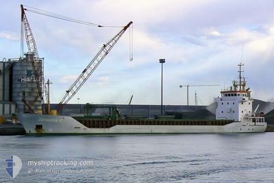
LOVELY LADY
Tanker
Current Trip
| Time Travelled | 25 days |
|---|---|
| Remaining Time | 1 day |
| Distance Travelled | 5620.05 nm |
| Remaining Distance | 344.59 nm |
| AVG Speed | 11.9 Knots |
| MAX Speed | 11.9 Knots |
| AVG Wind | 11.6 knots |
| MAX Wind | 29.7 knots |
| MIN Temp | -2°C / 28.4°F |
| MAX Temp | 27.8°C / 82.04°F |
| Draught | 13.5 m |
| Position Received | 1 m ago |
Current Position
| Longitude | 11.18079° |
|---|---|
| Latitude | 56.12547° |
| Status | Constrained by her draught |
| Speed | 12.7 Knots |
| Course | 226.5° |
| Area | Kattegat |
| Station | T-AIS |
| Position Received | 1 m ago |
Info
Information
The current position of LOVELY LADY is in Kattegat with coordinates 56.12547° / 11.18079° as reported on 2026-01-05 20:05 by AIS to our vessel tracker app. The vessel's current speed is 12.7 Knots and is heading at the port of GDANSK. The estimated time of arrival as calculated by MyShipTracking vessel tracking app is 2026-01-06 23:07 LT
The vessel LOVELY LADY (IMO: 9960978, MMSI: 256372000) is a Tanker It's sailing under the flag of [MT] Malta.
In this page you can find informations about the vessels current position, last detected port calls, and current voyage information. If the vessels is not in coverage by AIS you will find the latest position.
The current position of LOVELY LADY is detected by our AIS receivers and we are not responsible for the reliability of the data. The last position was recorded while the vessel was in Coverage by the Ais receivers of our vessel tracking app.
The current draught of LOVELY LADY as reported by AIS is 13.5 meters
Weather
| Temperature | 0.5°C / 32.9°F |
|---|---|
| Wind Speed | 13 knots |
| Direction | 90° E |
| Pressure | 1009.2 hPa |
| Humidity | 96.3 % |
| Cloud Coverage | 100 % |
Featured Company
Last Port Calls
| Port | Arrival | Departure | Time In Port |
|---|---|---|---|
| 2025-12-21 08:37 | 2025-12-21 17:49 | 9 h | |
| 2025-12-10 06:26 | 2025-12-11 19:33 | 1 d | |
| 2025-12-06 04:21 | 2025-12-06 23:11 | 18 h | |
| 2025-11-19 13:45 | |||
| 2025-11-09 13:11 | 2025-11-11 04:44 | 1 d |
Most Visited Ports (Last year)
| Port | Arrivals | |
|---|---|---|
| 2 | ||
| 2 | ||
| 2 | ||
| 2 | ||
| 2 | ||
| 2 |
Last Trips
| Origin | Departure | Destination | Arrival | Distance | |
|---|---|---|---|---|---|
| 2025-12-11 19:33 | 2025-12-21 08:37 | 1587.04 nm | |||
| 2025-11-19 13:45 | 2025-12-10 06:26 | 5380.40 nm | |||
| 2025-11-19 13:45 | 2025-12-06 04:21 | 4775.57 nm | |||
| 2025-10-07 13:34 | 2025-11-09 13:11 | 6523.30 nm |
Events
| Time | Event | Details | Position / Dest | Info |
|---|---|---|---|---|
| 2026-01-05 17:51 | Status Changed | Constrained by her draught Under way using engine |
56.53763 / 11.64579
PLGDN
|
Speed: 13.3 kn Course: 209.9° |
| 2026-01-05 14:07 | Change Sea Area | Danish part of the Kattegat Swedish part of the Kattegat |
57.28751 / 11.52842
Kattegat
PLGDN
|
Speed: 13.2 kn Course: 158.5° |
| 2026-01-05 12:58 | Change Sea Area | Swedish part of the Kattegat Danish part of the Kattegat |
57.51450 / 11.34140
Kattegat
PLGDN
|
Speed: 12.5 kn Course: 133.7° |
| 2026-01-05 11:13 | Change Sea Area | Danish part of the Kattegat Danish part of the Skaggerak |
57.77526 / 10.86162
Kattegat
PLGDN
|
Speed: 12.3 kn Course: 129.8° |
| 2026-01-05 00:52 | Change Sea Area | Danish part of the Skaggerak Danish part of the North Sea |
57.30726 / 8.28246
Skaggerak
PLGDN
|
Speed: 11.9 kn Course: 54.7° |
| 2026-01-04 23:18 | Draught Changed | 13.5 13.2 |
57.13947 / 7.78389
PLGDN
|
Speed: 12.1 kn Course: 69.7° |
| 2026-01-04 23:10 | ETA Changed | 2026/01/07 07:00 2026/01/07 12:00 |
57.12917 / 7.73900
PLGDN
|
Speed: 12.2 kn Course: 53.6° |
| 2026-01-04 22:51 | Detected in Sea | Danish part of the North Sea |
57.09627 / 7.64185
North Sea
PLGDN
|
Speed: 12.6 kn Course: 59.2° |
| 2026-01-04 22:51 | Status Changed | Under way using engine Default |
57.09627 / 7.64185
PLGDN
|
Speed: 12.8 kn Course: 53° |
| 2026-01-04 22:51 | IN Coverage |
57.09627 / 7.64185
North Sea
PLGDN
|
Speed: 12.6 kn Course: 59.2° |