

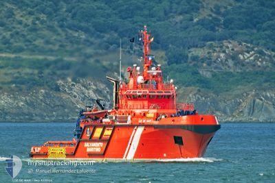
LUZ DE MAR
Pollution Control Vessel

Current Trip
| Time Travelled | 6 days |
|---|---|
| Remaining Time | --- |
| Distance Travelled | 162.33 nm |
| Remaining Distance | --- |
| AVG Speed | 7.8 Knots |
| MAX Speed | 11.8 Knots |
| AVG Wind | 5.5 knots |
| MAX Wind | 10.9 knots |
| MIN Temp | 18.6°C / 65.48°F |
| MAX Temp | 35°C / 95°F |
| Draught | 5.8 m |
| Position Received | 5 d ago |
Current Position
| Longitude | -6.01879° |
|---|---|
| Latitude | 37.31177° |
| Status | Under way using engine |
| Speed | 8.3 Knots |
| Course | 39° |
| Area | North Atlantic Ocean |
| Station | T-AIS |
| Position Received | 5 d ago |
Information
The current position of LUZ DE MAR is in North Atlantic Ocean with coordinates 37.31177° / -6.01879° as reported on 2025-05-27 14:38 by AIS to our vessel tracker app. The vessel's current speed is 8.3 Knots
The vessel LUZ DE MAR (IMO: 9320104, MMSI: 224311000) is a Pollution Control Vessel that was built in 2005 ( 20 years old ). It's sailing under the flag of [ES] Spain.
In this page you can find informations about the vessels current position, last detected port calls, and current voyage information. If the vessels is not in coverage by AIS you will find the latest position.
The current position of LUZ DE MAR is detected by our AIS receivers and we are not responsible for the reliability of the data. The last position was recorded while the vessel was in Coverage by the Ais receivers of our vessel tracking app.
The current draught of LUZ DE MAR as reported by AIS is 5.8 meters
Weather
| Temperature | 34.9°C / 94.82°F |
|---|---|
| Wind Speed | 3 knots |
| Direction | 191° S |
| Pressure | 1017.4 hPa |
| Humidity | 21 % |
| Cloud Coverage | 7 % |


Featured Company
Last Port Calls
| Port | Arrival | Departure | Time In Port |
|---|---|---|---|
| 2025-05-27 16:41 | |||
| 2025-05-21 12:00 | 2025-05-26 20:06 | 5 d | |
| 2025-04-28 11:05 | 2025-05-21 08:48 | 22 d | |
| 2025-04-22 13:21 | 2025-04-28 08:53 | 5 d | |
| 2025-04-16 06:56 | 2025-04-22 08:45 | 6 d | |
| 2025-04-09 13:32 | 2025-04-15 23:08 | 6 d | |
| 2025-04-06 19:35 | 2025-04-09 11:09 | 2 d | |
| 2025-04-06 12:54 |
Most Visited Ports (Last year)
| Port | Arrivals | |
|---|---|---|
| 47 | ||
| 5 | ||
| 5 | ||
| 1 | ||
| 1 |
Last Trips
| Origin | Departure | Destination | Arrival | Distance | |
|---|---|---|---|---|---|
| 2025-05-21 08:48 | 2025-05-21 12:00 | 13.10 nm | |||
| 2025-04-28 08:53 | 2025-04-28 11:05 | 15.61 nm | |||
| 2025-04-22 08:45 | 2025-04-22 13:21 | 26.98 nm | |||
| 2025-04-15 23:08 | 2025-04-16 06:56 | 40.00 nm | |||
| 2025-04-09 11:09 | 2025-04-09 13:32 | 3.95 nm | |||
| 2025-04-06 12:54 | 2025-04-06 19:35 | 39.21 nm |
Events
| Time | Event | Details | Position / Dest | Info |
|---|---|---|---|---|
| 2025-05-27 14:41 | PORT ARRIVAL |
|
37.31588 / -6.01431
[ES] SEVILLA
|
Speed: 8.3 kn Course: 39° |
| 2025-05-27 14:38 | OUT of Coverage |
37.31177 / -6.01879
North Atlantic Ocean
SEVILLA
|
Speed: 8.3 kn Course: 39° |
|
| 2025-05-27 14:22 | ETA Changed | 2025/05/27 16:00 2025/05/27 06:00 |
37.28039 / -6.04856
SEVILLA
|
Speed: 9.2 kn Course: 20.2° |
| 2025-05-27 14:13 | IN Coverage |
37.25824 / -6.06125
North Atlantic Ocean
|
Speed: 10.2 kn Course: 14.8° |
|
| 2025-05-27 11:50 | OUT of Coverage |
36.89656 / -6.23210
North Atlantic Ocean
|
Speed: 11 kn Course: 68.5° |
|
| 2025-05-26 21:49 | Change Sea Area | Spanish part of the North Atlantic Ocean Spanish part of the Strait of Gibraltar |
36.00354 / -5.98722
North Atlantic Ocean
SEVILLA
|
Speed: 10.7 kn Course: 275.1° |
| 2025-05-26 18:06 | PORT DEPARTURE |
|
36.14780 / -5.42572
SEVILLA
|
Speed: 7.9 kn Course: 123° |
| 2025-05-26 17:54 | START Moving |
36.12872 / -5.43612
[ES] ALGECIRAS
|
Speed: 5.4 kn Course: 79° |
|
| 2025-05-26 17:46 | Status Changed | Under way using engine Moored |
36.12748 / -5.43838
[ES] ALGECIRAS
|
Speed: Course: 261° |
| 2025-05-26 17:42 | Draught Changed | 5.8 6.8 |
36.12749 / -5.43840
[ES] ALGECIRAS
|
Speed: Course: 261° |