
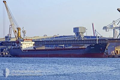
M V DAKOTA
Bulk Carrier
Current Trip
| Time Travelled | 11 days |
|---|---|
| Remaining Time | --- |
| Distance Travelled | 1858.59 nm |
| Remaining Distance | --- |
| AVG Speed | 6.5 Knots |
| MAX Speed | 10.8 Knots |
| AVG Wind | 20.5 knots |
| MAX Wind | 30 knots |
| MIN Temp | 2.6°C / 36.68°F |
| MAX Temp | 15.6°C / 60.08°F |
| Draught | 6.5 m |
| Position Received | 4 h, 6 m ago |
Current Position
| Longitude | -0.14757° |
|---|---|
| Latitude | 39.61713° |
| Status | Under way using engine |
| Speed | 2.8 Knots |
| Course | 291° |
| Area | Balearic Sea |
| Station | T-AIS |
| Position Received | 4 h, 6 m ago |
Info
Information
The current position of M V DAKOTA is in Balearic Sea with coordinates 39.61713° / -0.14757° as reported on 2025-02-15 23:18 by AIS to our vessel tracker app. The vessel's current speed is 2.8 Knots
The vessel M V DAKOTA (IMO: 9349980, MMSI: 248038000) is a Bulk Carrier that was built in 2006 ( 19 years old ). It's sailing under the flag of [MT] Malta.
In this page you can find informations about the vessels current position, last detected port calls, and current voyage information. If the vessels is not in coverage by AIS you will find the latest position.
The current position of M V DAKOTA is detected by our AIS receivers and we are not responsible for the reliability of the data. The last position was recorded while the vessel was in Coverage by the Ais receivers of our vessel tracking app.
The current draught of M V DAKOTA as reported by AIS is 6.5 meters
Weather
| Temperature | 12.6°C / 54.68°F |
|---|---|
| Wind Speed | 5 knots |
| Direction | 264° W |
| Pressure | 1013.7 hPa |
| Humidity | 86.5 % |
| Cloud Coverage | 100 % |
Featured Company
Last Port Calls
| Port | Arrival | Departure | Time In Port |
|---|---|---|---|
| 2025-01-31 03:37 | 2025-02-05 01:12 | 4 d | |
| 2025-01-21 15:42 | 2025-01-25 16:26 | 4 d | |
| 2025-01-11 22:42 | 2025-01-15 16:13 | 3 d | |
| 2024-12-27 11:45 | 2025-01-06 13:29 | 10 d | |
| 2024-12-12 07:17 | 2024-12-19 10:34 | 7 d | |
| 2024-12-05 05:20 | 2024-12-11 17:04 | 6 d |
Most Visited Ports (Last year)
| Port | Arrivals | |
|---|---|---|
| 3 | ||
| 2 | ||
| 2 | ||
| 2 | ||
| 2 | ||
| 1 |
Last Trips
| Origin | Departure | Destination | Arrival | Distance | |
|---|---|---|---|---|---|
| 2025-01-25 17:26 | 2025-01-31 06:37 | 1123.45 nm | |||
| 2025-01-15 18:13 | 2025-01-21 16:42 | 1002.36 nm | |||
| 2025-01-06 15:29 | 2025-01-12 00:42 | 975.85 nm | |||
| 2024-12-19 11:34 | 2024-12-27 13:45 | 1173.68 nm | |||
| 2024-12-11 18:04 | 2024-12-12 08:17 | 45.10 nm | |||
| 2024-11-30 21:35 | 2024-12-05 06:20 | 884.44 nm |
Events
| Time | Event | Details | Position / Dest | Info |
|---|---|---|---|---|
| 2025-02-15 23:53 | STOP Moving | 2.83 nm, South East of SAGUNTO |
39.62008 / -.15440
ESSAG
|
Speed: 0.1 kn Course: 64° |
| 2025-02-15 23:21 | Status Changed | Default Under way using engine |
39.61788 / -.15017
ESSAG
|
Speed: 2.8 kn Course: 291° |
| 2025-02-15 23:18 | OUT of Coverage |
39.61713 / -.14757
Balearic Sea
ESSAG
|
Speed: 2.8 kn Course: 302.4° |
|
| 2025-02-15 22:44 | ETA Changed | 2025/02/16 01:00 2025/02/14 19:00 |
39.58861 / -.05763
ESSAG
|
Speed: 9.6 kn Course: 287.8° |
| 2025-02-15 22:42 | Detected in Sea | Spanish part of the Balearic Sea |
39.58861 / -.05763
Balearic Sea
|
Speed: 9.6 kn Course: 287.8° |
| 2025-02-15 22:41 | Status Changed | Under way using engine Default |
39.58783 / -.05378
ESSAG
|
Speed: 9.6 kn Course: 285° |
| 2025-02-15 22:41 | IN Coverage |
39.58861 / -.05763
Balearic Sea
|
Speed: 9.6 kn Course: 287.8° |
|
| 2025-02-13 10:41 | START Moving | 18.26 nm, South West of MARETTIMO |
37.76320 / 11.78903
ESSAG
|
Speed: 8 kn Course: 293° |
| 2025-02-12 16:09 | Status Changed | Default Under way using engine |
36.55593 / 15.03467
ESSAG
|
Speed: 9.9 kn Course: 268.8° |
| 2025-02-12 16:00 | OUT of Coverage |
36.55610 / 15.06756
Mediterranean Sea - Eastern Basin
ESSAG
|
Speed: 9.9 kn Course: 268.8° |