

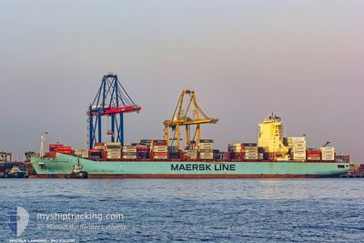
MAERSK LAMANAI
Container Ship

Current Trip
| Time Travelled | 5 days |
|---|---|
| Remaining Time | 1 day |
| Distance Travelled | 2748.39 nm |
| Remaining Distance | 795.77 nm |
| AVG Speed | 19.1 Knots |
| MAX Speed | 21 Knots |
| AVG Wind | 13.9 knots |
| MAX Wind | 24 knots |
| MIN Temp | 18.2°C / 64.76°F |
| MAX Temp | 27.6°C / 81.68°F |
| Draught | 13 m |
| Position Received | 2 d ago |
Current Position
| Longitude | -23.44818° |
|---|---|
| Latitude | 11.37730° |
| Status | Under way using engine |
| Speed | 19.4 Knots |
| Course | 205.8° |
| Area | North Atlantic Ocean |
| Station | T-AIS |
| Position Received | 2 d ago |
Information
The current position of MAERSK LAMANAI is in North Atlantic Ocean with coordinates 11.37730° / -23.44818° as reported on 2025-06-06 02:41 by AIS to our vessel tracker app. The vessel's current speed is 19.4 Knots and is heading at the port of SALVADOR. The estimated time of arrival as calculated by MyShipTracking vessel tracking app is 2025-06-09 16:57 LT
The vessel MAERSK LAMANAI (IMO: 9527051, MMSI: 219527000) is a Container Ship that was built in 2013 ( 12 years old ). It's sailing under the flag of [DK] Denmark.
In this page you can find informations about the vessels current position, last detected port calls, and current voyage information. If the vessels is not in coverage by AIS you will find the latest position.
The current position of MAERSK LAMANAI is detected by our AIS receivers and we are not responsible for the reliability of the data. The last position was recorded while the vessel was in Coverage by the Ais receivers of our vessel tracking app.
The current draught of MAERSK LAMANAI as reported by AIS is 13 meters
Weather
| Temperature | 26.9°C / 80.42°F |
|---|---|
| Wind Speed | 16 knots |
| Direction | 97° E |
| Pressure | 1013.1 hPa |
| Humidity | 78.3 % |
| Cloud Coverage | 34 % |


Featured Company
Last Port Calls
| Port | Arrival | Departure | Time In Port |
|---|---|---|---|
| 2025-06-01 19:15 | 2025-06-02 08:37 | 13 h | |
| 2025-05-30 08:15 | 2025-05-30 22:04 | 13 h | |
| 2025-05-27 07:17 | 2025-05-28 05:18 | 22 h | |
| 2025-05-25 16:58 | 2025-05-26 08:59 | 16 h | |
| 2025-05-10 23:47 | 2025-05-11 12:14 | 12 h | |
| 2025-05-09 07:36 | 2025-05-09 08:28 | 52 m | |
| 2025-05-07 06:18 | 2025-05-08 06:05 | 23 h | |
| 2025-05-04 14:16 | 2025-05-06 01:51 | 1 d | |
| 2025-05-02 22:27 | 2025-05-03 17:57 | 19 h | |
| 2025-04-28 20:59 | 2025-04-29 12:27 | 15 h |
Last Trips
| Origin | Departure | Destination | Arrival | Distance | |
|---|---|---|---|---|---|
| 2025-05-30 22:04 | 2025-06-01 19:15 | 105.72 nm | |||
| 2025-05-28 05:18 | 2025-05-30 08:15 | 10.15 nm | |||
| 2025-05-26 08:59 | 2025-05-27 07:17 | 101.69 nm | |||
| 2025-05-11 12:14 | 2025-05-25 16:58 | 4286.88 nm | |||
| 2025-05-09 08:28 | 2025-05-10 23:47 | 212.78 nm | |||
| 2025-05-08 06:05 | 2025-05-09 07:36 | 178.07 nm | |||
| 2025-05-06 01:51 | 2025-05-07 06:18 | 89.24 nm | |||
| 2025-05-03 17:57 | 2025-05-04 14:16 | 188.74 nm | |||
| 2025-04-29 12:27 | 2025-05-02 22:27 | 970.80 nm | |||
| 2025-04-19 09:59 | 2025-04-28 20:59 | 3533.58 nm |
Events
| Time | Event | Details | Position / Dest | Info |
|---|---|---|---|---|
| 2025-06-06 02:47 | Status Changed | Default Under way using engine |
11.34848 / -23.46231
MAPTM>BRSSA
|
Speed: 19.4 kn Course: 205.8° |
| 2025-06-06 02:41 | Status Changed | Under way using engine Default |
11.37730 / -23.44818
MAPTM>BRSSA
|
Speed: 19.4 kn Course: 206° |
| 2025-06-06 02:41 | OUT of Coverage |
11.37730 / -23.44818
North Atlantic Ocean
MAPTM>BRSSA
|
Speed: 19.4 kn Course: 205.8° |
|
| 2025-06-06 02:39 | Status Changed | Default Under way using engine |
11.38767 / -23.44297
MAPTM>BRSSA
|
Speed: 19.6 kn Course: 204.9° |
| 2025-06-06 02:34 | Change Sea Area | High seas of the North Atlantic Ocean Cape Verdean part of the North Atlantic Ocean |
11.41157 / -23.43129
North Atlantic Ocean
MAPTM>BRSSA
|
Speed: 19.5 kn Course: 205.4° |
| 2025-06-06 02:32 | Status Changed | Under way using engine Default |
11.42295 / -23.42563
MAPTM>BRSSA
|
Speed: 19.5 kn Course: 206° |
| 2025-06-06 01:50 | Status Changed | Default Under way using engine |
11.62913 / -23.32070
MAPTM>BRSSA
|
Speed: 19.8 kn Course: 207.2° |
| 2025-06-06 01:21 | Status Changed | Under way using engine Default |
11.76904 / -23.24821
MAPTM>BRSSA
|
Speed: 19.5 kn Course: 206° |
| 2025-06-06 01:17 | Status Changed | Default Under way using engine |
11.79147 / -23.23688
MAPTM>BRSSA
|
Speed: 19.6 kn Course: 207.5° |
| 2025-06-06 00:52 | Status Changed | Under way using engine Default |
11.90847 / -23.17598
MAPTM>BRSSA
|
Speed: 19.4 kn Course: 207° |