

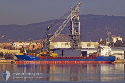
MAGNAR
General Cargo

Current Trip
| Time Travelled | 21 days |
|---|---|
| Remaining Time | --- |
| Distance Travelled | 2446.27 nm |
| Remaining Distance | --- |
| AVG Speed | 11 Knots |
| MAX Speed | 13 Knots |
| AVG Wind | 10.3 knots |
| MAX Wind | 24 knots |
| MIN Temp | 14.7°C / 58.46°F |
| MAX Temp | 22.5°C / 72.5°F |
| Draught | 4.4 m |
| Position Received | 1 d ago |
Current Position
| Longitude | 17.34952° |
|---|---|
| Latitude | 43.04867° |
| Status | At anchor |
| Speed | 0.1 Knots |
| Course | 308° |
| Area | Adriatic Sea |
| Station | T-AIS |
| Position Received | 1 d ago |
Information
The current position of MAGNAR is in Adriatic Sea with coordinates 43.04867° / 17.34952° as reported on 2025-05-28 12:52 by AIS to our vessel tracker app. The vessel's current speed is 0.1 Knots
The vessel MAGNAR (IMO: 9323651, MMSI: 236297000) is a General Cargo that was built in 2005 ( 20 years old ). It's sailing under the flag of [GI] Gibraltar.
In this page you can find informations about the vessels current position, last detected port calls, and current voyage information. If the vessels is not in coverage by AIS you will find the latest position.
The current position of MAGNAR is detected by our AIS receivers and we are not responsible for the reliability of the data. The last position was recorded while the vessel was in Coverage by the Ais receivers of our vessel tracking app.
The current draught of MAGNAR as reported by AIS is 4.4 meters
Weather
| Temperature | 20.8°C / 69.44°F |
|---|---|
| Wind Speed | 7 knots |
| Direction | 278° W |
| Pressure | 1015.5 hPa |
| Humidity | 66.1 % |
| Cloud Coverage | 82 % |


Featured Company
Events
| Time | Event | Details | Position / Dest | Info |
|---|---|---|---|---|
| 2025-05-28 13:16 | Status Changed | Default At anchor |
43.04853 / 17.34932
HRPLE
|
Speed: 0.1 kn Course: 308° |
| 2025-05-28 12:52 | Status Changed | At anchor Default |
43.04867 / 17.34952
HRPLE
|
Speed: 0.1 kn Course: 348° |
| 2025-05-28 12:52 | IN Coverage |
43.04867 / 17.34952
Adriatic Sea
|
Speed: 0.1 kn Course: 202.1° |
|
| 2025-05-28 12:52 | OUT of Coverage |
43.04867 / 17.34952
Adriatic Sea
|
Speed: 0.1 kn Course: 202.1° |
|
| 2025-05-28 11:04 | Status Changed | Default At anchor |
43.04968 / 17.34919
HRPLE
|
Speed: 0.1 kn Course: 242° |
| 2025-05-28 10:37 | OUT of Coverage |
43.04994 / 17.34914
Adriatic Sea
|
Speed: 0.1 kn Course: 142.9° |
|
| 2025-05-28 09:28 | IN Coverage |
43.05036 / 17.34776
Adriatic Sea
|
Speed: Course: 138.7° |
|
| 2025-05-22 00:12 | STOP Moving |
42.32179 / 17.23195
HRPLE
|
Speed: 0.2 kn Course: 229° |
|
| 2025-05-21 19:42 | START Moving |
42.35683 / 17.27241
HRPLE
|
Speed: 12 kn Course: 181° |
|
| 2025-05-21 14:56 | STOP Moving |
42.43534 / 17.26402
HRPLE
|
Speed: 0.3 kn Course: 77° |